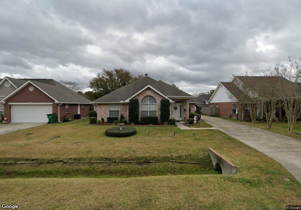
122 Franklin St Luling, LA 70070
Estimated Value: $260,000 - $322,000
Studio
--
Bath
8,050
Sq Ft
$36/Sq Ft
Est. Value
About This Home
This home is located at 122 Franklin St, Luling, LA 70070 and is currently estimated at $289,061, approximately $35 per square foot. 122 Franklin St is a home located in St. Charles Parish with nearby schools including Mimosa Park Elementary School, Lakewood Elementary School, and J.B. Martin Middle School.
Ownership History
Date
Name
Owned For
Owner Type
Purchase Details
Closed on
Apr 30, 2013
Sold by
Ashton Plantation Estates Llc
Bought by
Mire Heiki Veronica and Griffin Aaron M
Current Estimated Value
Home Financials for this Owner
Home Financials are based on the most recent Mortgage that was taken out on this home.
Original Mortgage
$58,500
Outstanding Balance
$40,986
Interest Rate
3.61%
Mortgage Type
Future Advance Clause Open End Mortgage
Estimated Equity
$248,075
Create a Home Valuation Report for This Property
The Home Valuation Report is an in-depth analysis detailing your home's value as well as a comparison with similar homes in the area
Home Values in the Area
Average Home Value in this Area
Purchase History
| Date | Buyer | Sale Price | Title Company |
|---|---|---|---|
| Mire Heiki Veronica | $68,900 | Riverview Title |
Source: Public Records
Mortgage History
| Date | Status | Borrower | Loan Amount |
|---|---|---|---|
| Open | Mire Heiki Veronica | $58,500 |
Source: Public Records
Tax History
| Year | Tax Paid | Tax Assessment Tax Assessment Total Assessment is a certain percentage of the fair market value that is determined by local assessors to be the total taxable value of land and additions on the property. | Land | Improvement |
|---|---|---|---|---|
| 2025 | $1,329 | $20,650 | $5,370 | $15,280 |
| 2024 | $1,329 | $20,650 | $5,370 | $15,280 |
| 2023 | $1,350 | $20,650 | $5,370 | $15,280 |
| 2022 | $2,415 | $20,650 | $5,370 | $15,280 |
| 2021 | $2,192 | $18,585 | $4,833 | $13,752 |
| 2020 | $2,440 | $20,650 | $5,370 | $15,280 |
| 2019 | $2,112 | $17,813 | $4,100 | $13,713 |
| 2018 | $2,096 | $17,813 | $4,100 | $13,713 |
| 2017 | $2,094 | $17,813 | $4,100 | $13,713 |
| 2016 | $2,102 | $17,813 | $4,100 | $13,713 |
| 2015 | $1,017 | $16,149 | $3,604 | $12,545 |
| 2014 | $980 | $16,149 | $3,604 | $12,545 |
| 2013 | $983 | $16,149 | $3,604 | $12,545 |
Source: Public Records
Map
Nearby Homes
Your Personal Tour Guide
Ask me questions while you tour the home.