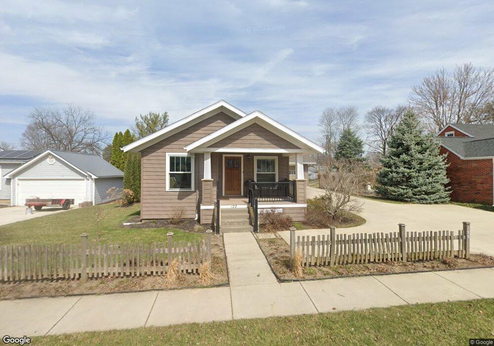
122 Grove St Bluffton, OH 45817
Estimated Value: $156,000 - $232,000
2
Beds
1
Bath
984
Sq Ft
$204/Sq Ft
Est. Value
About This Home
This home is located at 122 Grove St, Bluffton, OH 45817 and is currently estimated at $200,422, approximately $203 per square foot. 122 Grove St is a home located in Allen County with nearby schools including Bluffton Elementary School, Bluffton Middle School, and Bluffton High School.
Ownership History
Date
Name
Owned For
Owner Type
Purchase Details
Closed on
Nov 30, 2010
Sold by
Theis Jonathan L and Theis Bethany G
Bought by
Suter Robert W and Suter Linda F
Current Estimated Value
Home Financials for this Owner
Home Financials are based on the most recent Mortgage that was taken out on this home.
Original Mortgage
$75,905
Outstanding Balance
$1,694
Interest Rate
4.19%
Mortgage Type
New Conventional
Estimated Equity
$198,728
Purchase Details
Closed on
Sep 23, 1999
Sold by
Neiswander Evan
Bought by
Bledsoe Rae
Home Financials for this Owner
Home Financials are based on the most recent Mortgage that was taken out on this home.
Original Mortgage
$59,000
Interest Rate
8.21%
Mortgage Type
New Conventional
Purchase Details
Closed on
Sep 18, 1986
Bought by
Neiswander Evan D
Create a Home Valuation Report for This Property
The Home Valuation Report is an in-depth analysis detailing your home's value as well as a comparison with similar homes in the area
Home Values in the Area
Average Home Value in this Area
Purchase History
| Date | Buyer | Sale Price | Title Company |
|---|---|---|---|
| Suter Robert W | $79,900 | Attorney | |
| Bledsoe Rae | $64,000 | -- | |
| Neiswander Evan D | $14,000 | -- |
Source: Public Records
Mortgage History
| Date | Status | Borrower | Loan Amount |
|---|---|---|---|
| Open | Suter Robert W | $75,905 | |
| Closed | Bledsoe Rae | $59,000 |
Source: Public Records
Tax History Compared to Growth
Tax History
| Year | Tax Paid | Tax Assessment Tax Assessment Total Assessment is a certain percentage of the fair market value that is determined by local assessors to be the total taxable value of land and additions on the property. | Land | Improvement |
|---|---|---|---|---|
| 2024 | $1,323 | $49,880 | $11,690 | $38,190 |
| 2023 | $1,155 | $41,550 | $9,730 | $31,820 |
| 2022 | $1,180 | $41,550 | $9,730 | $31,820 |
| 2021 | $1,188 | $41,550 | $9,730 | $31,820 |
| 2020 | $1,069 | $35,420 | $9,310 | $26,110 |
| 2019 | $1,069 | $35,420 | $9,310 | $26,110 |
| 2018 | $1,074 | $35,420 | $9,310 | $26,110 |
| 2017 | $899 | $31,080 | $9,310 | $21,770 |
| 2016 | $844 | $29,370 | $8,610 | $20,760 |
| 2015 | $801 | $29,370 | $8,610 | $20,760 |
| 2014 | $801 | $27,830 | $8,370 | $19,460 |
| 2013 | $737 | $27,830 | $8,370 | $19,460 |
Source: Public Records
Map
Nearby Homes
- 135 Grove St
- 217 Grove St
- 222 Grove St
- 212 S Lawn Ave
- 430 S Jackson St
- 0 State Route 103
- 513 S Jackson St
- 136 N Spring St
- 303 Parkview Dr
- 305 Parkview Dr
- 301 Parkview Dr
- 307 Parkview Dr
- 222 N Lawn Ave
- 0 Ohio 103
- 0 Columbus Grove-Bluffton Rd
- 313 Parkview Dr
- 182 Sunset Dr
- 315 Parkview Dr
- 317 Parkview Dr
- 319 Parkview Dr
- 126 Grove St
- 120 Grove St
- 230 S Jackson St
- 225 S Lawn Ave
- 224 S Jackson St
- 217 S Lawn Ave
- 217 S Lawn Ave
- 125 Grove St
- 140 Grove St
- 218 S Jackson St
- 215 S Lawn Ave
- 306 S Jackson St
- 212 S Jackson St
- 207 S Lawn Ave
- 114 Grove St
- 240 S Lawn Ave
- 246 S Lawn Ave
- 232 S Lawn Ave
- 213 S Jackson St
- 252 S Lawn Ave