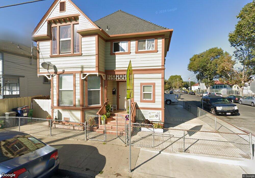
122 Marchant St Unit A Watsonville, CA 95076
Estimated Value: $685,586 - $936,000
--
Bed
--
Bath
1,868
Sq Ft
$442/Sq Ft
Est. Value
About This Home
This home is located at 122 Marchant St Unit A, Watsonville, CA 95076 and is currently estimated at $826,147, approximately $442 per square foot. 122 Marchant St Unit A is a home located in Santa Cruz County with nearby schools including E.A. Hall Middle School, Watsonville High School, and Linscott Charter School.
Ownership History
Date
Name
Owned For
Owner Type
Purchase Details
Closed on
Dec 22, 2010
Sold by
Careaga Alicia and The Elisa Carrera 2004 Revocab
Bought by
Rocha Felipe and Rocha Patricia
Current Estimated Value
Home Financials for this Owner
Home Financials are based on the most recent Mortgage that was taken out on this home.
Original Mortgage
$265,000
Outstanding Balance
$176,146
Interest Rate
4.34%
Mortgage Type
Seller Take Back
Estimated Equity
$650,001
Purchase Details
Closed on
Jan 8, 2004
Sold by
Carrera Elisa
Bought by
Carrera Elisa and Carrera Elisa Carrera
Create a Home Valuation Report for This Property
The Home Valuation Report is an in-depth analysis detailing your home's value as well as a comparison with similar homes in the area
Home Values in the Area
Average Home Value in this Area
Purchase History
| Date | Buyer | Sale Price | Title Company |
|---|---|---|---|
| Rocha Felipe | $315,000 | Chicago Title Company | |
| Carrera Elisa | -- | -- |
Source: Public Records
Mortgage History
| Date | Status | Borrower | Loan Amount |
|---|---|---|---|
| Open | Rocha Felipe | $265,000 |
Source: Public Records
Tax History Compared to Growth
Tax History
| Year | Tax Paid | Tax Assessment Tax Assessment Total Assessment is a certain percentage of the fair market value that is determined by local assessors to be the total taxable value of land and additions on the property. | Land | Improvement |
|---|---|---|---|---|
| 2025 | $5,027 | $403,572 | $242,143 | $161,429 |
| 2023 | $4,946 | $387,900 | $232,740 | $155,160 |
| 2022 | $4,849 | $380,295 | $228,177 | $152,118 |
| 2021 | $4,431 | $372,838 | $223,703 | $149,135 |
| 2020 | $4,367 | $369,015 | $221,409 | $147,606 |
| 2019 | $4,289 | $361,779 | $217,067 | $144,712 |
| 2018 | $4,179 | $354,685 | $212,811 | $141,874 |
| 2017 | $4,142 | $347,731 | $208,640 | $139,091 |
| 2016 | $4,032 | $340,913 | $204,549 | $136,364 |
| 2015 | $4,017 | $335,792 | $201,476 | $134,316 |
| 2014 | $3,930 | $329,214 | $197,529 | $131,685 |
Source: Public Records
Map
Nearby Homes
- 128 Maple Ave
- 124 E Riverside Dr
- 234 Maple Ave
- 101 W Front St Unit 6
- 30 W Lake Ave
- 30 Riverside Rd
- 441 Center St
- 219 2nd St
- 514 Argos Cir
- 105 Palm Ave
- 932 Lincoln St
- 3 Gonzales St
- 630 California St
- 67 Roosevelt St
- 401 Spruce Cir
- 110 Crespi Cir Unit 110
- 708 Hill Ave
- 145 Alma St
- 443 Tuttle Ave
- 759 Bronte Ave