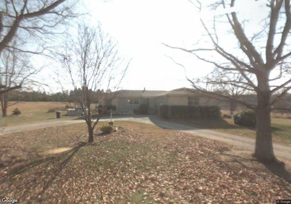
122 Michael Dr Stokesdale, NC 27357
Estimated Value: $247,000
--
Bed
--
Bath
1,848
Sq Ft
$134/Sq Ft
Est. Value
About This Home
This home is located at 122 Michael Dr, Stokesdale, NC 27357 and is currently priced at $247,000, approximately $133 per square foot. 122 Michael Dr is a home located in Rockingham County with nearby schools including Bethany Elementary School, Rockingham County Middle School, and Rockingham County High School.
Ownership History
Date
Name
Owned For
Owner Type
Purchase Details
Closed on
Oct 3, 2024
Sold by
Lamb & Peeples Builders Inc and Lamb And Peeples Builders Inc
Bought by
Franklin Benjamin Charles and Franklin Mary E
Current Estimated Value
Home Financials for this Owner
Home Financials are based on the most recent Mortgage that was taken out on this home.
Original Mortgage
$364,900
Outstanding Balance
$361,064
Interest Rate
6.35%
Mortgage Type
VA
Purchase Details
Closed on
Dec 12, 2023
Sold by
Mcdaniel Marsha M
Bought by
Lamb & Peeples Builders Inc
Create a Home Valuation Report for This Property
The Home Valuation Report is an in-depth analysis detailing your home's value as well as a comparison with similar homes in the area
Purchase History
| Date | Buyer | Sale Price | Title Company |
|---|---|---|---|
| Franklin Benjamin Charles | $365,000 | None Listed On Document | |
| Lamb & Peeples Builders Inc | $30,000 | None Listed On Document |
Source: Public Records
Mortgage History
| Date | Status | Borrower | Loan Amount |
|---|---|---|---|
| Open | Franklin Benjamin Charles | $364,900 |
Source: Public Records
Tax History
| Year | Tax Paid | Tax Assessment Tax Assessment Total Assessment is a certain percentage of the fair market value that is determined by local assessors to be the total taxable value of land and additions on the property. | Land | Improvement |
|---|---|---|---|---|
| 2023 | $1,334 | $167,758 | $30,406 | $137,352 |
| 2022 | $667 | $167,758 | $30,406 | $137,352 |
| 2021 | $1,334 | $167,758 | $30,406 | $137,352 |
| 2020 | $667 | $167,758 | $30,406 | $137,352 |
| 2019 | $667 | $167,758 | $30,406 | $137,352 |
| 2018 | $633 | $159,037 | $36,973 | $122,064 |
| 2017 | $1,266 | $159,037 | $36,973 | $122,064 |
Source: Public Records
Map
Nearby Homes
- 8606 Polar Bear Ct
- 8607 Lemur Ln
- 5604 Penguin Dr
- 5602 Penguin Dr
- 5600 Penguin Dr
- 8605 Lemur Ln
- 5503 Penguin Dr
- 8602 Lemur Ln
- 8603 Lemur Ln
- 5506 Penguin Dr
- 8601 Lemur Ln
- 5504 Penguin Dr
- 8505 Lemur Ln
- 8504 Lemur Ln
- 168 Pepper Tree Rd
- 165 Pepper Tree Rd
- 111 Black Willow Rd
- 112 Black Willow Rd
- 174 Pepper Tree Rd
- 352 Willowbrooke Way
- 117 Fox Haven Rd
- 143 Michael Dr
- 145 Fox Haven Ln
- 211 Farrar Store Rd
- 101 Farrar Store Rd
- 155 Michael Dr
- 170 Fox Haven Ln
- 220 Farrar Store Rd
- 201 Fox Haven Ln
- 243 Farrar Store Rd
- 184 Fox Haven Ln
- 133 Fridd Ln
- 221 Fox Haven Ln
- Lot 5 Highway 65
- Lot 3 Highway 65
- 404 Us 220 Hwy
- 220 Fox Haven Ln
- 283 Farrar Store Rd
- 280 Farrar Store Rd
- 187 Ogburn Mill Rd
Your Personal Tour Guide
Ask me questions while you tour the home.