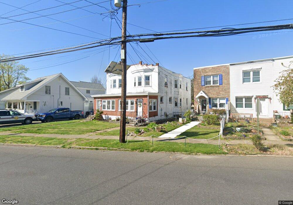
122 N Forklanding Rd Maple Shade, NJ 08052
Estimated Value: $241,000 - $285,212
--
Bed
--
Bath
1,450
Sq Ft
$187/Sq Ft
Est. Value
About This Home
This home is located at 122 N Forklanding Rd, Maple Shade, NJ 08052 and is currently estimated at $271,303, approximately $187 per square foot. 122 N Forklanding Rd is a home located in Burlington County with nearby schools including Ralph J Steinhauer Elementary School, Maude M. Wilkins Elementary School, and Howard R Yocum School.
Ownership History
Date
Name
Owned For
Owner Type
Purchase Details
Closed on
Jul 30, 2003
Sold by
Hambrecht Patricia A
Bought by
Conley Steffanie
Current Estimated Value
Home Financials for this Owner
Home Financials are based on the most recent Mortgage that was taken out on this home.
Original Mortgage
$117,000
Outstanding Balance
$51,701
Interest Rate
6.02%
Mortgage Type
Purchase Money Mortgage
Estimated Equity
$219,602
Purchase Details
Closed on
Oct 29, 1997
Sold by
Campbell Michael J and Campbell Bonnie C
Bought by
Frye Ronald A
Home Financials for this Owner
Home Financials are based on the most recent Mortgage that was taken out on this home.
Original Mortgage
$65,700
Interest Rate
7.17%
Create a Home Valuation Report for This Property
The Home Valuation Report is an in-depth analysis detailing your home's value as well as a comparison with similar homes in the area
Home Values in the Area
Average Home Value in this Area
Purchase History
| Date | Buyer | Sale Price | Title Company |
|---|---|---|---|
| Conley Steffanie | $117,000 | Congress Title Corp | |
| Frye Ronald A | $73,000 | -- |
Source: Public Records
Mortgage History
| Date | Status | Borrower | Loan Amount |
|---|---|---|---|
| Open | Conley Steffanie | $117,000 | |
| Previous Owner | Frye Ronald A | $65,700 |
Source: Public Records
Tax History Compared to Growth
Tax History
| Year | Tax Paid | Tax Assessment Tax Assessment Total Assessment is a certain percentage of the fair market value that is determined by local assessors to be the total taxable value of land and additions on the property. | Land | Improvement |
|---|---|---|---|---|
| 2025 | $5,049 | $133,000 | $38,300 | $94,700 |
| 2024 | $4,902 | $133,000 | $38,300 | $94,700 |
| 2023 | $4,902 | $133,000 | $38,300 | $94,700 |
| 2022 | $4,827 | $133,000 | $38,300 | $94,700 |
| 2021 | $4,780 | $133,000 | $38,300 | $94,700 |
| 2020 | $4,793 | $133,000 | $38,300 | $94,700 |
| 2019 | $4,618 | $133,000 | $38,300 | $94,700 |
| 2018 | $4,538 | $133,000 | $38,300 | $94,700 |
| 2017 | $4,485 | $133,000 | $38,300 | $94,700 |
| 2016 | $4,418 | $133,000 | $38,300 | $94,700 |
| 2015 | $4,323 | $133,000 | $38,300 | $94,700 |
| 2014 | $4,191 | $133,000 | $38,300 | $94,700 |
Source: Public Records
Map
Nearby Homes
- 29 W Broadway
- 48 N Terrace Ave
- 301 N Coles Ave
- 22 Theodore Ave
- 26 N Poplar Ave
- 57 S Terrace Ave
- 480 W Front St
- 104 E Laurelton Ave
- 2 Gainor Ave
- 4 W Germantown Ave
- 112 S Maple Ave
- 12 Collins Ln
- 19 Farnsworth Ave
- 19 S Chestnut Ave
- 52 S Fellowship Rd
- 120 E Center Ave
- 5 Paul Rd
- 8515 Bryn Mawr Ave
- 410 S Forklanding Rd
- 702 E Main St
- 124 N Forklanding Rd
- 120 N Forklanding Rd
- 126 N Forklanding Rd
- 128 N Forklanding Rd
- 116 N Forklanding Rd
- 10 W Linwood Ave
- 112 N Forklanding Rd
- 14 W Linwood Ave
- 200 N Forklanding Rd
- 17 W Broadway
- 108 N Forklanding Rd
- 203 N Forklanding Rd
- 21 W Broadway
- 123 N Forklanding Rd
- 18 W Linwood Ave
- 119 N Forklanding Rd
- 117 N Forklanding Rd
- 15 W Linwood Ave
- 207 N Forklanding Rd
- 25 W Broadway