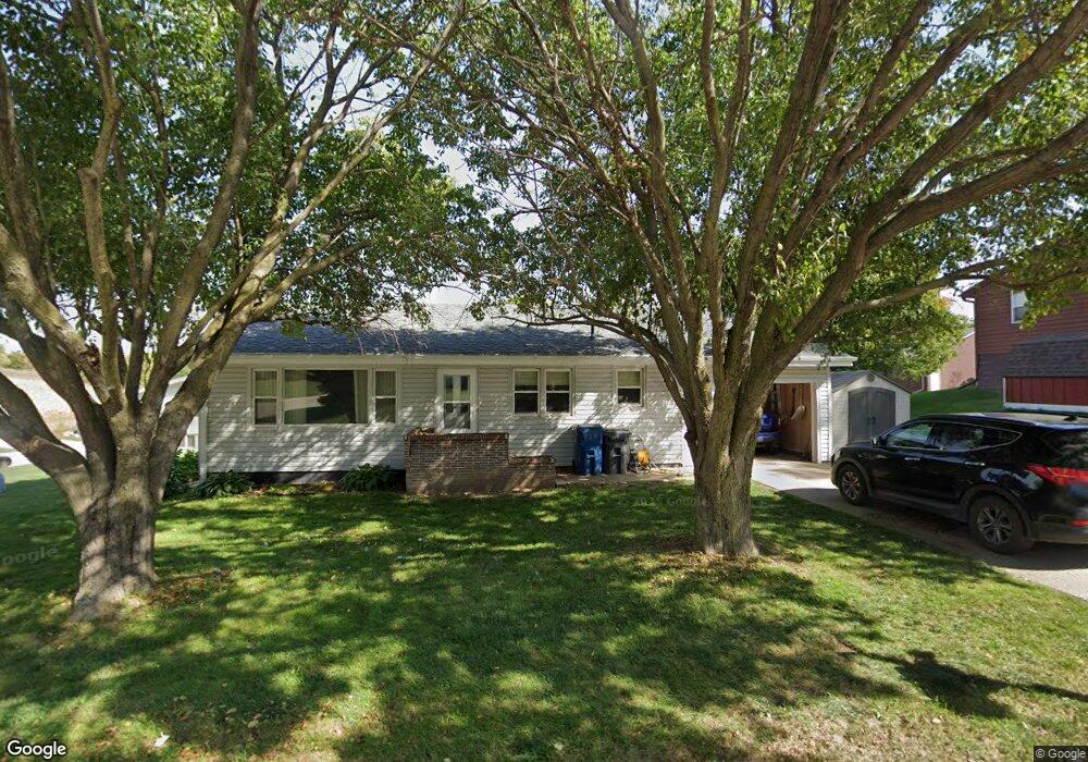
122 N Pine Ave Hinton, IA 51024
Estimated Value: $186,000 - $233,000
2
Beds
2
Baths
936
Sq Ft
$231/Sq Ft
Est. Value
About This Home
This home is located at 122 N Pine Ave, Hinton, IA 51024 and is currently estimated at $216,326, approximately $231 per square foot. 122 N Pine Ave is a home located in Plymouth County with nearby schools including Hinton Elementary School, Hinton Intermediate School, and Hinton High School.
Ownership History
Date
Name
Owned For
Owner Type
Purchase Details
Closed on
Feb 10, 2015
Sold by
Schroeder Daniel A and Schroeder Nancy S
Bought by
Yates Shayne D
Current Estimated Value
Home Financials for this Owner
Home Financials are based on the most recent Mortgage that was taken out on this home.
Original Mortgage
$71,960
Outstanding Balance
$54,750
Interest Rate
3.66%
Mortgage Type
New Conventional
Estimated Equity
$161,576
Create a Home Valuation Report for This Property
The Home Valuation Report is an in-depth analysis detailing your home's value as well as a comparison with similar homes in the area
Home Values in the Area
Average Home Value in this Area
Purchase History
| Date | Buyer | Sale Price | Title Company |
|---|---|---|---|
| Yates Shayne D | $90,000 | None Available |
Source: Public Records
Mortgage History
| Date | Status | Borrower | Loan Amount |
|---|---|---|---|
| Open | Yates Shayne D | $71,960 |
Source: Public Records
Tax History Compared to Growth
Tax History
| Year | Tax Paid | Tax Assessment Tax Assessment Total Assessment is a certain percentage of the fair market value that is determined by local assessors to be the total taxable value of land and additions on the property. | Land | Improvement |
|---|---|---|---|---|
| 2025 | $2,562 | $191,210 | $37,600 | $153,610 |
| 2024 | $2,266 | $179,400 | $37,600 | $141,800 |
| 2023 | $2,334 | $158,290 | $23,720 | $134,570 |
| 2022 | $2,330 | $128,010 | $23,720 | $104,290 |
| 2021 | $2,042 | $128,010 | $23,720 | $104,290 |
| 2020 | $2,042 | $121,380 | $23,720 | $97,660 |
| 2019 | -- | $121,380 | $23,720 | $97,660 |
| 2018 | -- | $113,310 | $23,720 | $89,590 |
| 2017 | -- | $91,000 | $0 | $0 |
| 2016 | -- | $91,000 | $0 | $0 |
| 2015 | -- | $83,310 | $0 | $0 |
| 2014 | -- | $0 | $0 | $0 |
Source: Public Records
Map
Nearby Homes
- 217 Pine Ave
- LOT 13 Blackhawk Ridge
- LOT 18 Blackhawk Ridge
- LOT 35 Blackhawk Ridge
- LOT 25 Blackhawk Ridge
- LOT 26 Blackhawk Ridge
- Lot 19 Tucker Hill Drive - Replat
- 209 E Main St
- 854 Springbrook Dr
- 525 Titan Rd
- Lot 9 Titan Rd
- Lot 8 Titan Rd
- Lot 4 Titan Rd
- Lot 6 Titan Rd
- Lot 7 Titan Rd
- Lot 5 Titan Rd
- TBD Tucker Hill Dr
- 1215 Blackhawk Ct
- 1219 Blackhawk Ct
- LOT 17 Tucker Hill Dr - Replat
- 121 N Prospect St
- 112 N Pine Ave
- 119 N Pine Ave
- 115 N Prospect St
- 306 W Cedar St
- 315 W Cedar St
- 405 W Cedar St
- 111 N Pine Ave
- 207 Pine St
- 311 W Cedar St
- 311 W Main St
- 207 Pine Ave
- 315 W Main St
- 214 N Pine Ave
- 122 N Prospect St
- 211 Pine St
- 417 W Cedar St
- 405 W Main St
- 416 W Cedar St
- 116 N Prospect St