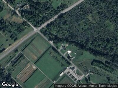
122 Nursery Rd Howard, PA 16841
Howard NeighborhoodEstimated Value: $229,000 - $292,000
3
Beds
2
Baths
1,956
Sq Ft
$133/Sq Ft
Est. Value
About This Home
This home is located at 122 Nursery Rd, Howard, PA 16841 and is currently estimated at $260,407, approximately $133 per square foot. 122 Nursery Rd is a home located in Centre County with nearby schools including Bald Eagle Area Junior/Senior High School.
Ownership History
Date
Name
Owned For
Owner Type
Purchase Details
Closed on
Aug 14, 2019
Sold by
Deitz Scot A and Deitz Ashley J
Bought by
Deitz Ashley J and Granite Jr Michael F
Current Estimated Value
Home Financials for this Owner
Home Financials are based on the most recent Mortgage that was taken out on this home.
Original Mortgage
$193,100
Interest Rate
3.8%
Mortgage Type
Commercial
Purchase Details
Closed on
Jul 8, 2009
Sold by
Deitz Scot A and Deitz Teal D
Bought by
Deitz Scot A and Deitz Ashley J
Create a Home Valuation Report for This Property
The Home Valuation Report is an in-depth analysis detailing your home's value as well as a comparison with similar homes in the area
Home Values in the Area
Average Home Value in this Area
Purchase History
| Date | Buyer | Sale Price | Title Company |
|---|---|---|---|
| Deitz Ashley J | $65,346 | None Available | |
| Deitz Scot A | -- | None Available |
Source: Public Records
Mortgage History
| Date | Status | Borrower | Loan Amount |
|---|---|---|---|
| Open | Deitz Ashley J | $197,000 | |
| Closed | Deitz Ashley J | $193,100 | |
| Previous Owner | Deitz Scot A | $75,000 |
Source: Public Records
Tax History Compared to Growth
Tax History
| Year | Tax Paid | Tax Assessment Tax Assessment Total Assessment is a certain percentage of the fair market value that is determined by local assessors to be the total taxable value of land and additions on the property. | Land | Improvement |
|---|---|---|---|---|
| 2025 | $4,266 | $59,425 | $7,625 | $51,800 |
| 2024 | $4,267 | $59,425 | $7,625 | $51,800 |
| 2023 | $4,267 | $59,425 | $7,625 | $51,800 |
| 2022 | $4,149 | $59,425 | $7,625 | $51,800 |
| 2021 | $4,090 | $59,425 | $7,625 | $51,800 |
| 2020 | $2,294 | $33,340 | $7,625 | $25,715 |
| 2019 | $1,420 | $33,340 | $7,625 | $25,715 |
| 2018 | $2,211 | $33,340 | $7,625 | $25,715 |
| 2017 | $2,149 | $33,340 | $7,625 | $25,715 |
| 2016 | $969 | $33,340 | $7,625 | $25,715 |
| 2015 | $969 | $33,340 | $7,625 | $25,715 |
| 2014 | $969 | $33,340 | $7,625 | $25,715 |
Source: Public Records
Map
Nearby Homes
- LOT 2 W Dowdy Hole Rd
- LOT 1 W Dowdy Hole Rd
- On Shay Ln
- 181 Hogan Ln
- 145 Grove St
- 131 W Main St
- 133 Black St
- 333 Walnut St
- 380 Walnut St
- 382 Walnut St
- 402 Walnut St
- Lot Off Hunter Ridge Rd
- 311 Lyonstown Rd
- 4170 Jacksonville Rd
- 0 Richner Hollow Rd
- 128 Brandy Ct
- 285 Benner Rd
- 188 Sunset Dr
- 150 Landon Dr
- 1156 Zion Ridge Ave
