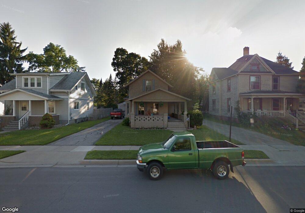
122 S Mckenzie St Adrian, MI 49221
Estimated Value: $143,000 - $159,000
3
Beds
2
Baths
1,300
Sq Ft
$114/Sq Ft
Est. Value
About This Home
This home is located at 122 S Mckenzie St, Adrian, MI 49221 and is currently estimated at $148,661, approximately $114 per square foot. 122 S Mckenzie St is a home located in Lenawee County with nearby schools including Adrian High School, Berean Baptist Academy, and Trenton Hills Learning Center.
Ownership History
Date
Name
Owned For
Owner Type
Purchase Details
Closed on
Aug 17, 2011
Sold by
Fannie Mae
Bought by
Harbour Portfolio Vii
Current Estimated Value
Purchase Details
Closed on
Jan 14, 2011
Sold by
Thomas Dustin Lee
Bought by
Ballantyne Michael and Smith Melissa Sue
Purchase Details
Closed on
Aug 13, 2010
Sold by
Nationstar Mortgage Llc
Bought by
Fannie Mae
Purchase Details
Closed on
Aug 12, 2010
Sold by
Ballantyne Michael and Smith Melissa Sue
Bought by
Nationstar Mortgage Llc
Create a Home Valuation Report for This Property
The Home Valuation Report is an in-depth analysis detailing your home's value as well as a comparison with similar homes in the area
Home Values in the Area
Average Home Value in this Area
Purchase History
| Date | Buyer | Sale Price | Title Company |
|---|---|---|---|
| Harbour Portfolio Vii | -- | None Available | |
| Ballantyne Michael | -- | None Available | |
| Fannie Mae | -- | None Available | |
| Nationstar Mortgage Llc | $102,724 | None Available |
Source: Public Records
Tax History
| Year | Tax Paid | Tax Assessment Tax Assessment Total Assessment is a certain percentage of the fair market value that is determined by local assessors to be the total taxable value of land and additions on the property. | Land | Improvement |
|---|---|---|---|---|
| 2025 | $2,968 | $57,800 | $0 | $0 |
| 2024 | $22 | $54,400 | $0 | $0 |
| 2023 | $2,827 | $50,500 | $0 | $0 |
| 2022 | $4,834 | $47,400 | $0 | $0 |
| 2021 | $2,441 | $43,800 | $0 | $0 |
| 2020 | $2,458 | $40,800 | $0 | $0 |
| 2019 | $113,579 | $39,000 | $0 | $0 |
| 2018 | $2,339 | $44,541 | $0 | $0 |
| 2017 | $2,295 | $37,132 | $0 | $0 |
| 2016 | $2,684 | $38,719 | $0 | $0 |
| 2014 | -- | $34,100 | $0 | $0 |
Source: Public Records
Map
Nearby Homes
- 914 W Maumee St
- 146 Budlong St
- 155 S Scott St
- 705 College Ave
- 143 Park St
- 169 Park St
- 176 S Scott St
- 1006 College Ave
- 703 Company St
- 313 Rice St
- 227 Greenly St
- 404 S Mckenzie St
- 333 Greenly St
- 1144 W Maumee St
- 1139 College Ave
- 306 Summer St
- 228 W Church St
- 1060 Scottdale Dr
- 1230 Madison Dr
- 559 Northwestern Dr
- 122 S Mckenzie St Unit MCKENZIE
- 118 S Mckenzie St S
- 128 S Mckenzie St
- 132 S Mckenzie St
- 116 S Mckenzie St Unit 116 1/2 S McKenzie
- 116 S Mckenzie St
- 116 S Mckenzie St Unit 116 1/2 S McKenzie S
- 112 S Mckenzie St
- 136 S Mckenzie St
- 3 Maumee Ct
- 123 S Mckenzie St
- 123 S Mckenzie St Unit MCKENZIE
- 4 Maumee Ct
- 115 S Mckenzie St
- 823 W Maumee St
- 142 S Mckenzie St
- 5 Maumee Ct
- 127 S Mckenzie St
- 783 W Maumee St
- 827 W Maumee St
Your Personal Tour Guide
Ask me questions while you tour the home.