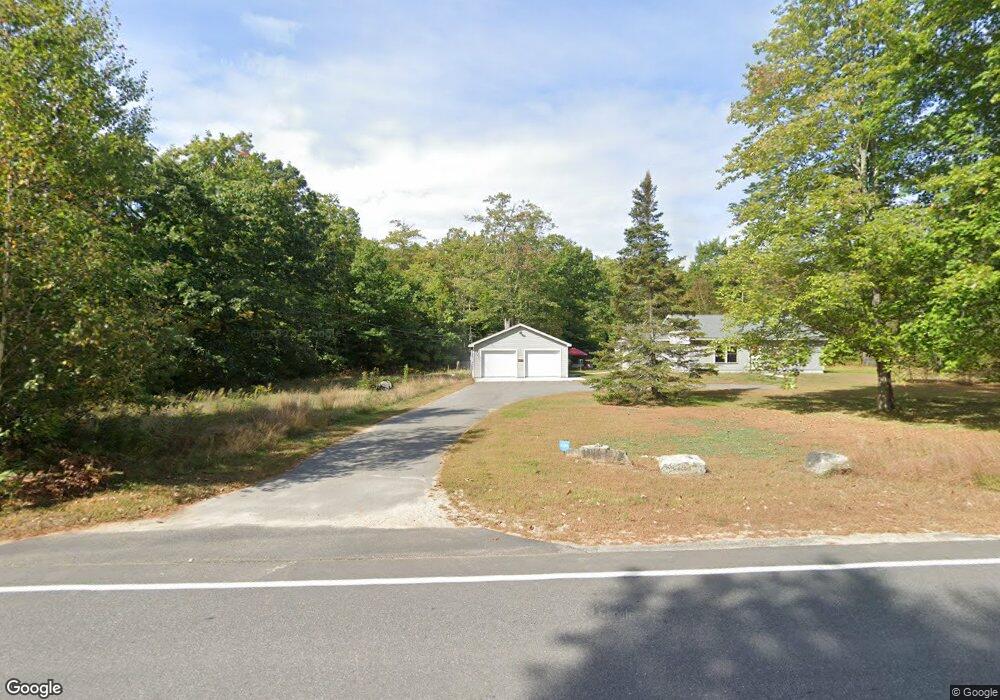
122 Sabbathday Rd New Gloucester, ME 04260
Estimated Value: $155,000 - $485,000
--
Bed
--
Bath
732
Sq Ft
$367/Sq Ft
Est. Value
About This Home
This home is located at 122 Sabbathday Rd, New Gloucester, ME 04260 and is currently estimated at $268,413, approximately $366 per square foot. 122 Sabbathday Rd is a home located in Cumberland County with nearby schools including Gray-New Gloucester High School and Fiddlehead School of Arts & Science.
Ownership History
Date
Name
Owned For
Owner Type
Purchase Details
Closed on
Aug 22, 2014
Sold by
Flanders James and Flanders Samantha
Bought by
Lauritsen & Son Inc
Current Estimated Value
Purchase Details
Closed on
Jul 13, 2010
Sold by
Merrill Francis M
Bought by
Flanders Darrell M
Purchase Details
Closed on
Apr 16, 2009
Sold by
Brady Michael T
Bought by
Merrill Francis M
Home Financials for this Owner
Home Financials are based on the most recent Mortgage that was taken out on this home.
Original Mortgage
$27,000
Interest Rate
5.02%
Mortgage Type
Unknown
Purchase Details
Closed on
Dec 8, 2005
Sold by
Flanders Samantha J and Flanders James D
Bought by
Flanders Darrell M
Create a Home Valuation Report for This Property
The Home Valuation Report is an in-depth analysis detailing your home's value as well as a comparison with similar homes in the area
Home Values in the Area
Average Home Value in this Area
Purchase History
| Date | Buyer | Sale Price | Title Company |
|---|---|---|---|
| Lauritsen & Son Inc | -- | -- | |
| Flanders Darrell M | -- | -- | |
| Merrill Francis M | -- | -- | |
| Flanders Darrell M | -- | -- |
Source: Public Records
Mortgage History
| Date | Status | Borrower | Loan Amount |
|---|---|---|---|
| Previous Owner | Merrill Francis M | $27,000 |
Source: Public Records
Tax History Compared to Growth
Tax History
| Year | Tax Paid | Tax Assessment Tax Assessment Total Assessment is a certain percentage of the fair market value that is determined by local assessors to be the total taxable value of land and additions on the property. | Land | Improvement |
|---|---|---|---|---|
| 2025 | $1,078 | $69,672 | $59,000 | $10,672 |
| 2024 | $1,037 | $69,672 | $59,000 | $10,672 |
| 2023 | $996 | $69,672 | $59,000 | $10,672 |
| 2022 | $961 | $69,672 | $59,000 | $10,672 |
| 2021 | $961 | $69,672 | $59,000 | $10,672 |
| 2020 | $951 | $69,672 | $59,000 | $10,672 |
| 2019 | $1,438 | $85,100 | $61,400 | $23,700 |
| 2018 | $1,345 | $85,100 | $61,400 | $23,700 |
| 2017 | $1,328 | $85,100 | $61,400 | $23,700 |
| 2016 | $1,251 | $85,100 | $61,400 | $23,700 |
| 2015 | $1,247 | $85,100 | $61,400 | $23,700 |
| 2014 | $1,234 | $85,100 | $61,400 | $23,700 |
| 2013 | $1,145 | $85,100 | $61,400 | $23,700 |
Source: Public Records
Map
Nearby Homes
- TBD Targett Rd
- 423 Sabbathday Rd
- 14 Golden Way
- 343 Shaker Rd
- 271 Bennett Rd
- 24 Swamp Rd
- 22 Shaw Rd
- 00 N Shore Rd
- 4 Chelsey Ln
- 15 May Meadow Dr
- 74 May Meadow Dr
- 155 & 151 Gloucester Hill Rd
- 160 Gloucester Hill Rd
- 13 Mill Brook Rd Unit A
- 21 Westwood Rd
- 0 Mayall
- 10 Cobbs Bridge Rd
- 164 Intervale Rd
- 157 Egypt Rd
- M011-006 Westwood Rd
- 120 Sabbathday Rd
- 119 Sabbathday Rd
- 118 Sabbathday Rd
- 136 Sabbathday Rd
- 148 Sabbathday Rd
- 160 Sabbathday Rd
- 107 Sabbathday Rd
- 165 Sabbathday Rd
- 166 Sabbathday Rd
- 20 Krystle Ln
- 104 Sabbathday Rd
- 143 Sabbathday Rd
- 167 Sabbathday Rd
- 174 Sabbathday Rd
- 27 Krystle Ln
- 170 Sabbathday Rd
- 11 Krystle Ln
- 163 Sabbathday Rd
- 175 Sabbathday Rd
- 177 Shaker