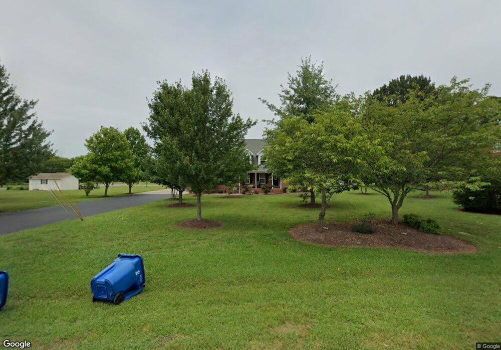
122 Silverstone Dr Murfreesboro, TN 37130
Estimated Value: $444,000 - $554,000
--
Bed
3
Baths
2,867
Sq Ft
$180/Sq Ft
Est. Value
About This Home
This home is located at 122 Silverstone Dr, Murfreesboro, TN 37130 and is currently estimated at $516,613, approximately $180 per square foot. 122 Silverstone Dr is a home located in Rutherford County with nearby schools including Lascassas Elementary School, Oakland Middle School, and Oakland High School.
Ownership History
Date
Name
Owned For
Owner Type
Purchase Details
Closed on
Jun 21, 2005
Sold by
Centex Home Equity Co
Bought by
Anderson Charles W and Anderson Tiffan
Current Estimated Value
Purchase Details
Closed on
Dec 29, 2004
Sold by
Anthony Collins
Bought by
Centex Home Equity Co
Purchase Details
Closed on
Dec 4, 1998
Sold by
Ray Thompson William
Bought by
Anthony Collins
Home Financials for this Owner
Home Financials are based on the most recent Mortgage that was taken out on this home.
Original Mortgage
$126,650
Interest Rate
6.9%
Mortgage Type
Purchase Money Mortgage
Create a Home Valuation Report for This Property
The Home Valuation Report is an in-depth analysis detailing your home's value as well as a comparison with similar homes in the area
Home Values in the Area
Average Home Value in this Area
Purchase History
| Date | Buyer | Sale Price | Title Company |
|---|---|---|---|
| Anderson Charles W | $165,000 | -- | |
| Centex Home Equity Co | $157,806 | -- | |
| Anthony Collins | $149,000 | -- |
Source: Public Records
Mortgage History
| Date | Status | Borrower | Loan Amount |
|---|---|---|---|
| Previous Owner | Anthony Collins | $126,650 | |
| Previous Owner | Anthony Collins | $14,900 |
Source: Public Records
Tax History Compared to Growth
Tax History
| Year | Tax Paid | Tax Assessment Tax Assessment Total Assessment is a certain percentage of the fair market value that is determined by local assessors to be the total taxable value of land and additions on the property. | Land | Improvement |
|---|---|---|---|---|
| 2025 | $1,968 | $104,900 | $15,125 | $89,775 |
| 2024 | $1,968 | $104,900 | $15,125 | $89,775 |
| 2023 | $1,951 | $104,000 | $15,125 | $88,875 |
| 2022 | $1,681 | $104,000 | $15,125 | $88,875 |
| 2021 | $1,632 | $73,550 | $13,750 | $59,800 |
| 2020 | $1,632 | $73,550 | $13,750 | $59,800 |
| 2019 | $1,632 | $73,550 | $13,750 | $59,800 |
| 2018 | $1,544 | $73,550 | $0 | $0 |
| 2017 | $1,500 | $55,975 | $0 | $0 |
| 2016 | $1,500 | $55,975 | $0 | $0 |
| 2015 | $1,500 | $55,975 | $0 | $0 |
| 2014 | $1,392 | $55,975 | $0 | $0 |
| 2013 | -- | $54,800 | $0 | $0 |
Source: Public Records
Map
Nearby Homes
- 1553 N Side Dr
- 3354 Eslin Ct
- 2521 Pebblecreek Ln
- 3358 Eslin Ct
- 3368 Eslin Ct
- 3372 Eslin Ct
- 2333 Laurelstone Dr
- 1168 Gardendale Dr
- 2514 Sandstone Cir
- 3410 Dench Dr
- 1105 Essem Dr
- Edinburgh Plan at Arbors at Compton - Reserve Collection
- Monarch Plan at Arbors at Compton - Reserve Collection
- Davenport Plan at Arbors at Compton - Reserve Collection
- Hawthorne Plan at Arbors at Compton - Reserve Collection
- Choral Plan at Arbors at Compton - Symphony Collection
- Alpine Plan at Arbors at Compton - Symphony Collection
- Winston Plan at Arbors at Compton - Symphony Collection
- Laurel Plan at Arbors at Compton - Reserve Collection
- Chestnut Plan at Arbors at Compton - Reserve Collection
- 118 Silverstone Dr
- 136 Silverstone Dr
- 150 Silverstone Dr
- 114 Silverstone Dr
- 125 Silverstone Dr
- 121 Silverstone Dr
- 117 Silverstone Dr
- 129 Silverstone Dr
- 2983 Lascassas Pike
- 147 Silverstone Dr
- 113 Silverstone Dr
- 145 Silverstone Dr
- 133 Silverstone Dr
- 154 Silverstone Dr
- 137 Silverstone Dr
- 109 Silverstone Dr
- 141 Silverstone Dr
- 106 Silverstone Dr
- 153 Silverstone Dr
- 2989 Lascassas Hwy