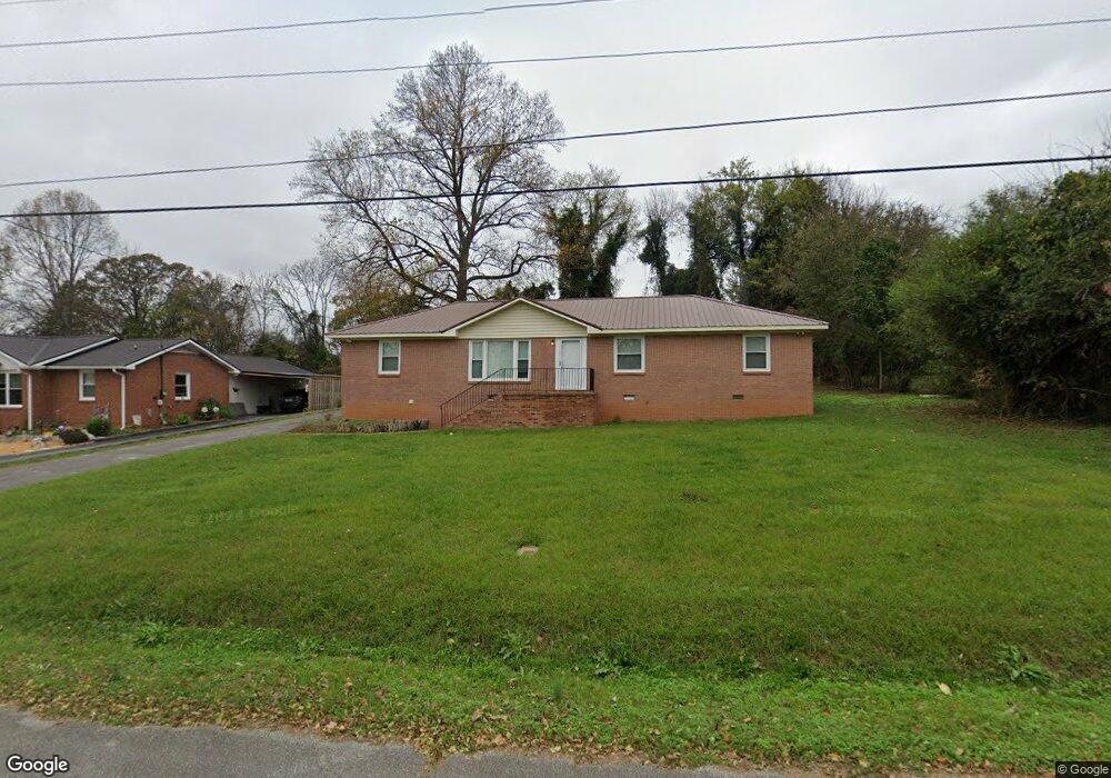
122 Spring Hill Dr Winchester, TN 37398
Estimated Value: $217,645 - $269,000
--
Bed
2
Baths
1,638
Sq Ft
$155/Sq Ft
Est. Value
About This Home
This home is located at 122 Spring Hill Dr, Winchester, TN 37398 and is currently estimated at $254,411, approximately $155 per square foot. 122 Spring Hill Dr is a home located in Franklin County with nearby schools including North Middle School, Franklin County High School, and Winchester Christian Academy.
Ownership History
Date
Name
Owned For
Owner Type
Purchase Details
Closed on
Apr 18, 1997
Sold by
Wiggins David L
Bought by
Franklin County Adult Acit
Current Estimated Value
Home Financials for this Owner
Home Financials are based on the most recent Mortgage that was taken out on this home.
Original Mortgage
$92,800
Interest Rate
7.95%
Purchase Details
Closed on
May 26, 1993
Bought by
Wiggins David L
Purchase Details
Closed on
Feb 15, 1993
Bought by
Hughes Joan B
Purchase Details
Closed on
Jun 18, 1991
Bought by
Evans Johnny H and Evans Marla B
Purchase Details
Closed on
May 7, 1987
Bought by
Mccallie Daniel A and Mccallie Tina M
Purchase Details
Closed on
Jun 4, 1986
Purchase Details
Closed on
Apr 30, 1976
Create a Home Valuation Report for This Property
The Home Valuation Report is an in-depth analysis detailing your home's value as well as a comparison with similar homes in the area
Home Values in the Area
Average Home Value in this Area
Purchase History
| Date | Buyer | Sale Price | Title Company |
|---|---|---|---|
| Franklin County Adult Acit | $70,000 | -- | |
| Wiggins David L | $55,000 | -- | |
| Hughes Joan B | $52,000 | -- | |
| Evans Johnny H | $40,000 | -- | |
| Mccallie Daniel A | -- | -- | |
| -- | -- | -- | |
| -- | -- | -- |
Source: Public Records
Mortgage History
| Date | Status | Borrower | Loan Amount |
|---|---|---|---|
| Closed | Not Available | $92,800 |
Source: Public Records
Tax History Compared to Growth
Tax History
| Year | Tax Paid | Tax Assessment Tax Assessment Total Assessment is a certain percentage of the fair market value that is determined by local assessors to be the total taxable value of land and additions on the property. | Land | Improvement |
|---|---|---|---|---|
| 2024 | $1,137 | $44,200 | $6,250 | $37,950 |
| 2023 | $1,137 | $44,200 | $6,250 | $37,950 |
| 2022 | $1,114 | $44,200 | $6,250 | $37,950 |
| 2021 | $629 | $44,200 | $6,250 | $37,950 |
| 2020 | $868 | $24,575 | $4,050 | $20,525 |
| 2019 | $868 | $24,575 | $4,050 | $20,525 |
| 2018 | $818 | $24,575 | $4,050 | $20,525 |
| 2017 | $818 | $24,575 | $4,050 | $20,525 |
| 2016 | $775 | $23,275 | $4,050 | $19,225 |
| 2015 | $761 | $23,275 | $4,050 | $19,225 |
| 2014 | $761 | $23,276 | $0 | $0 |
Source: Public Records
Map
Nearby Homes
- 0 Spring Hill Dr
- 103 Lisa Cir
- 1108 N Jefferson St
- 136 Bel Aire Dr
- 60 Sharp Cir
- 510 N Porter St
- 120 Dogwood Ln
- 111 Barefoot Way
- 124 Barefoot Way
- 114 11th Ave NW
- 0 N Porter St
- 0 Sharp Springs Rd Unit RTC2980057
- 74 Summerlake Ct
- 0 Summerlake Ct Unit RTC2936678
- 0 Summerlake Ct Unit RTC2936679
- 0 Summerlake Ct Unit RTC2936676
- 0 Summerlake Ct Unit RTC2936675
- 0 Summerlake Ct Unit RTC2936677
- 0 Summerlake Ct Unit RTC2936673
- 0 Summerlake Ct Unit RTC2936674
- 120 Spring Hill Dr
- 124 Spring Hill Dr
- 126 Spring Hill Dr
- 118 Spring Hill Dr
- 123 Spring Hill Dr
- 125 Spring Hill Dr
- 121 Spring Hill Dr
- 116 Spring Hill Dr
- 119 Spring Hill Dr
- 150 Brandi Cir
- 117 Spring Hill Dr
- 114 Spring Hill Dr
- 129 Spring Hill Dr
- 130 Spring Hill Dr
- 115 Spring Hill Dr
- 170 Brandi Cir
- 140 Brandi Cir
- 112 Spring Hill Dr
- 131 Spring Hill Dr
- 113 Spring Hill Dr