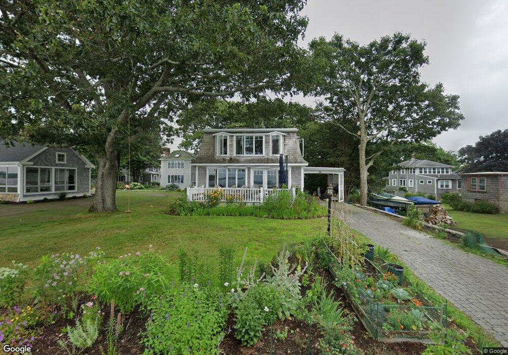
122 Tahanto Rd Pocasset, MA 02559
Pocasset NeighborhoodEstimated Value: $1,071,000 - $1,371,000
3
Beds
3
Baths
1,976
Sq Ft
$638/Sq Ft
Est. Value
About This Home
This home is located at 122 Tahanto Rd, Pocasset, MA 02559 and is currently estimated at $1,260,662, approximately $637 per square foot. 122 Tahanto Rd is a home located in Barnstable County with nearby schools including Bourne High School, Cadence Academy Preschool - Bourne, and St Margaret Regional School.
Ownership History
Date
Name
Owned For
Owner Type
Purchase Details
Closed on
Oct 1, 2007
Sold by
Duffy Jeanne M
Bought by
Curtin Elizabeth F and Curtin William A
Current Estimated Value
Home Financials for this Owner
Home Financials are based on the most recent Mortgage that was taken out on this home.
Original Mortgage
$417,000
Interest Rate
6.65%
Mortgage Type
Purchase Money Mortgage
Create a Home Valuation Report for This Property
The Home Valuation Report is an in-depth analysis detailing your home's value as well as a comparison with similar homes in the area
Home Values in the Area
Average Home Value in this Area
Purchase History
| Date | Buyer | Sale Price | Title Company |
|---|---|---|---|
| Curtin Elizabeth F | $700,000 | -- | |
| Curtin Elizabeth F | $700,000 | -- |
Source: Public Records
Mortgage History
| Date | Status | Borrower | Loan Amount |
|---|---|---|---|
| Open | Curtin Elizabeth F | $417,000 | |
| Closed | Curtin Elizabeth F | $417,000 |
Source: Public Records
Tax History Compared to Growth
Tax History
| Year | Tax Paid | Tax Assessment Tax Assessment Total Assessment is a certain percentage of the fair market value that is determined by local assessors to be the total taxable value of land and additions on the property. | Land | Improvement |
|---|---|---|---|---|
| 2025 | $8,498 | $1,088,100 | $682,800 | $405,300 |
| 2024 | $8,249 | $1,028,600 | $650,300 | $378,300 |
| 2023 | $8,019 | $910,200 | $575,500 | $334,700 |
| 2022 | $7,819 | $774,900 | $509,300 | $265,600 |
| 2021 | $8,719 | $809,600 | $567,800 | $241,800 |
| 2020 | $1,824 | $793,800 | $562,400 | $231,400 |
| 2019 | $7,119 | $677,400 | $459,100 | $218,300 |
| 2018 | $6,682 | $634,000 | $437,300 | $196,700 |
| 2017 | $1,811 | $625,500 | $433,200 | $192,300 |
| 2016 | $6,309 | $621,000 | $433,200 | $187,800 |
| 2015 | $4,944 | $491,000 | $303,200 | $187,800 |
Source: Public Records
Map
Nearby Homes
- 126 Tahanto Rd
- 126 Tahanto Rd Unit 1
- 19 Weetamoe Rd
- 114 Tahanto Rd
- 15 Weetamoe Rd
- 9 Weetamoe Rd
- 27 Weetamoe Rd
- 110 Tahanto Rd
- 134 Tahanto Rd
- 3 Weetamoe Rd
- 138 Tahanto Rd
- 142 Tahanto Rd
- 106 Tahanto Rd
- 10 Weetamoe Rd
- 102 Tahanto Rd
- 6 Weetamoe Rd
- 98 Tahanto Rd
- 18 Weetamoe Rd
- 92 Tahanto Rd
- 59 Pocahontas Rd