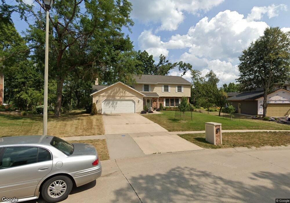
122 Tomahawk Trail SE Cedar Rapids, IA 52403
Estimated Value: $390,546 - $426,000
4
Beds
3
Baths
2,838
Sq Ft
$145/Sq Ft
Est. Value
About This Home
This home is located at 122 Tomahawk Trail SE, Cedar Rapids, IA 52403 and is currently estimated at $411,887, approximately $145 per square foot. 122 Tomahawk Trail SE is a home located in Linn County with nearby schools including Summit Elementary School, Erskine Elementary School, and McKinley STEAM Academy.
Ownership History
Date
Name
Owned For
Owner Type
Purchase Details
Closed on
Jan 29, 2002
Sold by
Alfredson Richard D and Yost Alfredson Sandra L
Bought by
Berg Thomas J and Berg Ann Marie
Current Estimated Value
Home Financials for this Owner
Home Financials are based on the most recent Mortgage that was taken out on this home.
Original Mortgage
$208,000
Outstanding Balance
$85,249
Interest Rate
7.23%
Estimated Equity
$326,638
Purchase Details
Closed on
May 30, 2001
Sold by
Stocking William K and Stocking Cynthia J
Bought by
Alfredson Richard D and Yost Alfredson Sandra L
Home Financials for this Owner
Home Financials are based on the most recent Mortgage that was taken out on this home.
Original Mortgage
$190,000
Interest Rate
7.18%
Create a Home Valuation Report for This Property
The Home Valuation Report is an in-depth analysis detailing your home's value as well as a comparison with similar homes in the area
Home Values in the Area
Average Home Value in this Area
Purchase History
| Date | Buyer | Sale Price | Title Company |
|---|---|---|---|
| Berg Thomas J | $259,500 | -- | |
| Alfredson Richard D | $252,000 | -- |
Source: Public Records
Mortgage History
| Date | Status | Borrower | Loan Amount |
|---|---|---|---|
| Open | Berg Thomas J | $208,000 | |
| Previous Owner | Alfredson Richard D | $190,000 | |
| Closed | Berg Thomas J | $39,000 |
Source: Public Records
Tax History Compared to Growth
Tax History
| Year | Tax Paid | Tax Assessment Tax Assessment Total Assessment is a certain percentage of the fair market value that is determined by local assessors to be the total taxable value of land and additions on the property. | Land | Improvement |
|---|---|---|---|---|
| 2025 | $6,294 | $415,900 | $64,600 | $351,300 |
| 2024 | $6,438 | $413,600 | $64,600 | $349,000 |
| 2023 | $6,438 | $366,100 | $64,600 | $301,500 |
| 2022 | $5,806 | $314,100 | $50,600 | $263,500 |
| 2021 | $5,982 | $289,200 | $50,600 | $238,600 |
| 2020 | $5,982 | $279,700 | $45,000 | $234,700 |
| 2019 | $5,852 | $280,000 | $45,000 | $235,000 |
| 2018 | $5,686 | $280,000 | $45,000 | $235,000 |
| 2017 | $5,677 | $272,100 | $45,000 | $227,100 |
| 2016 | $5,677 | $267,100 | $45,000 | $222,100 |
| 2015 | $5,851 | $275,003 | $44,965 | $230,038 |
| 2014 | $5,666 | $273,005 | $44,965 | $228,040 |
| 2013 | $5,500 | $273,005 | $44,965 | $228,040 |
Source: Public Records
Map
Nearby Homes
- 3618 Kegler Ct SE
- 237 34th St SE
- 380 Indiandale Rd SE
- 3830 Skylark Ln SE
- 415 35th St SE
- 4725 Green Valley Dr SE
- 2227 Kestrel Dr SE
- 2403 Kestrel Dr SE
- 2416 Kestrel Dr SE
- 2226 Kestrel Dr SE
- 3112 Peregrine Ct SE
- 2306 Kestrel Dr SE
- 2420 Kestrel Dr SE
- 2409 Kestrel Dr SE
- 2421 Kestrel Dr SE
- 2221 Kestrel Dr SE
- 2319 Kestrel Dr SE
- 2415 Kestrel Dr SE
- 2325 Kestrel Dr SE
- 2312 Kestrel Dr SE
- 126 Tomahawk Trail SE
- 118 Tomahawk Trail SE
- 121 Tomahawk Trail SE
- 131 Tahoe Ct SE
- 114 Tomahawk Trail SE
- 130 Tomahawk Trail SE
- 111 Tomahawk Trail SE
- 3820 Tahoe Ln SE
- 110 Tomahawk Trail SE
- 132 Tahoe Ct SE
- 131 Tomahawk Trail SE
- 107 Tomahawk Trail SE
- 106 Tomahawk Trail SE
- 136 Tomahawk Trail SE
- 135 Tomahawk Trail SE
- 103 Tomahawk Trail SE
- 3813 Tahoe Ln SE
- 134 Tahoe Ct SE
- 3817 Tahoe Ln SE
- 136 Tahoe Ct SE