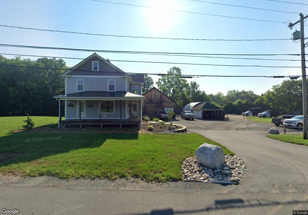
122 West St West Hatfield, MA 01088
Estimated Value: $371,000 - $458,000
5
Beds
2
Baths
2,746
Sq Ft
$158/Sq Ft
Est. Value
About This Home
This home is located at 122 West St, West Hatfield, MA 01088 and is currently estimated at $433,040, approximately $157 per square foot. 122 West St is a home located in Hampshire County with nearby schools including Browerville Elementary School, Brooklyn Center Middle School, and The Montessori School of Northampton.
Ownership History
Date
Name
Owned For
Owner Type
Purchase Details
Closed on
May 18, 2016
Sold by
Mistarka Ronald
Bought by
Jaescke Timothy E
Current Estimated Value
Home Financials for this Owner
Home Financials are based on the most recent Mortgage that was taken out on this home.
Original Mortgage
$212,000
Outstanding Balance
$168,381
Interest Rate
3.59%
Mortgage Type
New Conventional
Estimated Equity
$264,659
Purchase Details
Closed on
Jun 3, 2014
Sold by
Mistarka Ronald
Bought by
First Tennessee Bank
Purchase Details
Closed on
May 25, 2004
Sold by
Zapka Christine and Andros Dorothy
Bought by
Est Zapka Susan and Mistarka Ronald
Home Financials for this Owner
Home Financials are based on the most recent Mortgage that was taken out on this home.
Original Mortgage
$175,000
Interest Rate
5.75%
Mortgage Type
Purchase Money Mortgage
Create a Home Valuation Report for This Property
The Home Valuation Report is an in-depth analysis detailing your home's value as well as a comparison with similar homes in the area
Home Values in the Area
Average Home Value in this Area
Purchase History
| Date | Buyer | Sale Price | Title Company |
|---|---|---|---|
| Jaescke Timothy E | $265,000 | -- | |
| First Tennessee Bank | -- | -- | |
| Est Zapka Susan | $180,000 | -- |
Source: Public Records
Mortgage History
| Date | Status | Borrower | Loan Amount |
|---|---|---|---|
| Open | Jaescke Timothy E | $212,000 | |
| Previous Owner | Est Zapka Susan | $175,000 |
Source: Public Records
Tax History Compared to Growth
Tax History
| Year | Tax Paid | Tax Assessment Tax Assessment Total Assessment is a certain percentage of the fair market value that is determined by local assessors to be the total taxable value of land and additions on the property. | Land | Improvement |
|---|---|---|---|---|
| 2025 | $5,381 | $388,800 | $132,800 | $256,000 |
| 2024 | $5,262 | $343,700 | $113,900 | $229,800 |
| 2023 | $4,399 | $326,300 | $108,500 | $217,800 |
| 2022 | $4,086 | $298,900 | $97,300 | $201,600 |
| 2021 | $4,021 | $283,400 | $88,300 | $195,100 |
| 2020 | $3,834 | $283,400 | $88,300 | $195,100 |
| 2019 | $3,660 | $263,500 | $92,000 | $171,500 |
| 2018 | $3,573 | $263,100 | $91,900 | $171,200 |
| 2017 | $3,587 | $271,300 | $91,900 | $179,400 |
| 2016 | $3,551 | $269,400 | $91,900 | $177,500 |
| 2015 | $3,381 | $256,700 | $84,400 | $172,300 |
| 2014 | $3,195 | $252,200 | $79,900 | $172,300 |
Source: Public Records
Map
Nearby Homes
- 121 West St
- 0 Pantry Rd Unit 73430264
- 34 Gore Ave
- 2B Linseed Rd
- 0 Straits Rd
- 21 Dwight St
- 147 Pantry Rd
- 12 Dwight St
- 151 Pantry Rd
- 18 Elm St
- 106 Elm St
- 43 Laurel Park Unit 43
- 66 Laurel Park Unit 66
- 320 West St
- 0 Old Stage Rd Unit 73394977
- 93 Laurel Park Unit 93
- LOT D Mountain Rd
- 58 Main St Unit 4
- 58 Main St Unit 3
- 136 Main St
- 130 West St
- 112 West St
- 134 West St
- 117 West St
- 129 West St
- 140 West St
- 108 West St
- 140 Chestnut St
- 144 West St
- 133 Chestnut St
- 104 West St
- 148 West St
- 138 Chestnut St
- 141 West St Unit 16
- 139 West St Unit 11
- 139 West St Unit 4
- 139 West St Unit 17
- 139 West St Unit 14
- 139 West St Unit 16
- 139 West St Unit 13