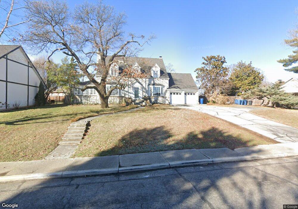
1220 Crest Dr Joplin, MO 64801
Roanoke NeighborhoodEstimated Value: $296,210 - $365,000
3
Beds
4
Baths
3,394
Sq Ft
$97/Sq Ft
Est. Value
About This Home
This home is located at 1220 Crest Dr, Joplin, MO 64801 and is currently estimated at $327,803, approximately $96 per square foot. 1220 Crest Dr is a home located in Jasper County with nearby schools including North Middle School, Joplin High School, and St. Peter's Middle School.
Ownership History
Date
Name
Owned For
Owner Type
Purchase Details
Closed on
Nov 17, 2020
Sold by
Greninger Kelli A
Bought by
Greninger Paul A
Current Estimated Value
Purchase Details
Closed on
Aug 4, 2020
Sold by
Blair Benjamib B and Blair Robin D
Bought by
Grenninger Paul A and Greninger Grace E
Home Financials for this Owner
Home Financials are based on the most recent Mortgage that was taken out on this home.
Original Mortgage
$235,125
Interest Rate
3%
Mortgage Type
New Conventional
Purchase Details
Closed on
Jul 28, 2014
Sold by
Wyman Jane B
Bought by
Blair Benjamin B and Blair Robin D
Home Financials for this Owner
Home Financials are based on the most recent Mortgage that was taken out on this home.
Original Mortgage
$184,000
Interest Rate
4.23%
Mortgage Type
New Conventional
Create a Home Valuation Report for This Property
The Home Valuation Report is an in-depth analysis detailing your home's value as well as a comparison with similar homes in the area
Home Values in the Area
Average Home Value in this Area
Purchase History
| Date | Buyer | Sale Price | Title Company |
|---|---|---|---|
| Greninger Paul A | -- | None Available | |
| Grenninger Paul A | -- | None Available | |
| Blair Benjamin B | -- | None Available |
Source: Public Records
Mortgage History
| Date | Status | Borrower | Loan Amount |
|---|---|---|---|
| Previous Owner | Grenninger Paul A | $235,125 | |
| Previous Owner | Blair Benjamin B | $184,000 |
Source: Public Records
Tax History
| Year | Tax Paid | Tax Assessment Tax Assessment Total Assessment is a certain percentage of the fair market value that is determined by local assessors to be the total taxable value of land and additions on the property. | Land | Improvement |
|---|---|---|---|---|
| 2025 | $1,603 | $39,180 | $3,740 | $35,440 |
| 2024 | $1,602 | $34,710 | $3,740 | $30,970 |
| 2023 | $1,602 | $34,710 | $3,740 | $30,970 |
| 2022 | $1,563 | $33,980 | $3,740 | $30,240 |
| 2021 | $1,553 | $33,980 | $3,740 | $30,240 |
| 2020 | $1,467 | $31,410 | $3,740 | $27,670 |
| 2019 | $1,470 | $31,410 | $3,740 | $27,670 |
| 2018 | $1,443 | $30,950 | $0 | $0 |
| 2017 | $1,448 | $30,950 | $0 | $0 |
| 2016 | $1,414 | $30,630 | $0 | $0 |
| 2015 | -- | $30,630 | $0 | $0 |
| 2014 | -- | $30,250 | $0 | $0 |
Source: Public Records
Map
Nearby Homes
- 1232 Bramar Dr
- 639 W Jaccard Place
- 1005 N Moffet Ave
- 802 Hampton Place
- 1324 Fairmont Dr
- 1025 Northridge Rd
- 728 N Pearl Ave
- 624 N Sergeant Ave
- 634 N Byers Ave
- 1302 Cambridge St
- 528 N Sergeant Ave
- 602 N Byers Ave
- 530 N Pearl Ave
- 114 W F St
- 531 N Wall Ave
- Lot 60-62 N Joplin Ave
- 432 N Joplin Ave
- 319 N Moffet Ave
- 301 N Connor Ave Unit 305
- 416 N Joplin Ave
- 1200 Crest Dr
- 1234 Crest Dr
- 901 W Kensington Rd
- 1221 Crest Dr
- 1227 Crest Dr
- 1240 Crest Dr
- 1021 N Jackson Ave
- 911 W Kensington Rd
- 1030 N Sergeant Ave
- 1019 N Jackson Ave
- 1235 Crest Dr
- 1250 Crest Dr
- 1015 N Jackson Ave
- 1022 N Sergeant Ave
- 1231 Crest Dr
- 1202 Bramar Dr
- 915 W Kensington Rd Unit 1
- 920 W Kensington Rd
- 657 W Jaccard Place
- 1245 Crest Dr
Your Personal Tour Guide
Ask me questions while you tour the home.