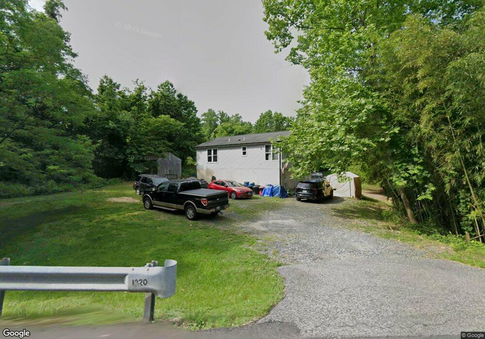
1220 E Chesapeake Beach Rd Owings, MD 20736
Estimated Value: $291,078 - $442,000
Studio
--
Bath
864
Sq Ft
$410/Sq Ft
Est. Value
About This Home
This home is located at 1220 E Chesapeake Beach Rd, Owings, MD 20736 and is currently estimated at $354,520, approximately $410 per square foot. 1220 E Chesapeake Beach Rd is a home located in Calvert County with nearby schools including Windy Hill Elementary School, Windy Hill Middle School, and Northern High School.
Ownership History
Date
Name
Owned For
Owner Type
Purchase Details
Closed on
Jul 26, 1983
Sold by
Wilson Luckett H and Wilson William C
Bought by
Thomas Isaac G and Thomas Jestine
Current Estimated Value
Home Financials for this Owner
Home Financials are based on the most recent Mortgage that was taken out on this home.
Original Mortgage
$46,400
Interest Rate
13.58%
Purchase Details
Closed on
Jun 8, 1983
Sold by
Argenta June and Eileen Buffalini
Bought by
Wilson Luckett H and Wilson William C
Home Financials for this Owner
Home Financials are based on the most recent Mortgage that was taken out on this home.
Original Mortgage
$46,400
Interest Rate
13.58%
Create a Home Valuation Report for This Property
The Home Valuation Report is an in-depth analysis detailing your home's value as well as a comparison with similar homes in the area
Home Values in the Area
Average Home Value in this Area
Purchase History
| Date | Buyer | Sale Price | Title Company |
|---|---|---|---|
| Thomas Isaac G | $58,100 | -- | |
| Wilson Luckett H | $4,500 | -- |
Source: Public Records
Mortgage History
| Date | Status | Borrower | Loan Amount |
|---|---|---|---|
| Closed | Thomas Isaac G | $46,400 |
Source: Public Records
Tax History
| Year | Tax Paid | Tax Assessment Tax Assessment Total Assessment is a certain percentage of the fair market value that is determined by local assessors to be the total taxable value of land and additions on the property. | Land | Improvement |
|---|---|---|---|---|
| 2025 | $2,970 | $254,700 | $143,000 | $111,700 |
| 2024 | $2,855 | $244,467 | $0 | $0 |
| 2023 | $2,648 | $234,233 | $0 | $0 |
| 2022 | $2,538 | $224,000 | $143,000 | $81,000 |
| 2021 | $2,501 | $221,967 | $0 | $0 |
| 2020 | $2,501 | $219,933 | $0 | $0 |
| 2019 | $2,488 | $217,900 | $143,000 | $74,900 |
| 2018 | $2,446 | $215,200 | $0 | $0 |
| 2017 | $2,447 | $212,500 | $0 | $0 |
| 2016 | -- | $209,800 | $0 | $0 |
| 2015 | $2,282 | $209,800 | $0 | $0 |
| 2014 | $2,282 | $209,800 | $0 | $0 |
Source: Public Records
Map
Nearby Homes
- 8819 Lafayette Dr
- 8741 Paris Pines Ct
- 9015 Woodland Way N
- 750 Woodland Way
- 890 Stevens Rd
- 8200 Frances Ln
- 2128 Horace Ward Rd
- 9618 Ridge View Dr
- 300 Owings Hill Ct
- 8531 Solomons Island Rd
- 9550 N Side Dr
- 2535 Richfield Ln
- 2637 Richfield Ln
- 9947 Boyds Turn Rd
- 2425 Woodland Ct
- 8199 Woodland Ln
- 8187 Deer Chase Ln
- 5 Cross Point Dr
- 270 Skinners Turn Rd
- 2401 Green Leaf Terrace
- 1232 E Mount Harmony Rd
- 1240 E Mount Harmony Rd
- 8802 Donalds Way
- 1150 Old Paris Rd
- 1260 E Mount Harmony Rd
- 1235 E Mount Harmony Rd
- 1110 E Mount Harmony Rd
- 8806 Donalds Way
- 1165 Old Paris Rd
- 8654 Stevens Rd
- 8812 Donalds Way
- 985 Cat Bird Ln
- 8806 Lafayette Dr
- 8808 Lafayette Dr
- 1100 E Mount Harmony Rd
- 928 Cat Bird Ln
- 988 Cat Bird Ln
- 8619 Cat Bird Ln
- 975 Cat Bird Ln
- 8810 Lafayette Dr
Your Personal Tour Guide
Ask me questions while you tour the home.