Estimated Value: $112,000 - $177,000
3
Beds
1
Bath
1,196
Sq Ft
$110/Sq Ft
Est. Value
About This Home
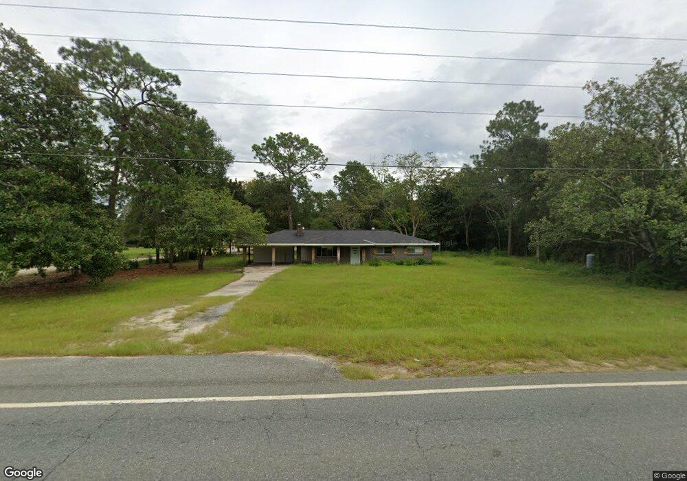
This home is located at 1220 Lanes Bridge Rd, Jesup, GA 31545 and is currently estimated at $131,260, approximately $109 per square foot. 1220 Lanes Bridge Rd is a home located in Wayne County with nearby schools including Martha Rawls Smith Elementary School, Arthur Williams Middle School, and Wayne County High School.
Ownership History
Date
Name
Owned For
Owner Type
Purchase Details
Closed on
Oct 31, 2017
Bought by
Rio Enterprises Llc
Current Estimated Value
Purchase Details
Closed on
Aug 1, 2017
Sold by
Wireman Curtis L
Bought by
Jpmorgan Chase Bank National A
Purchase Details
Closed on
Feb 1, 2011
Sold by
Poppell James W
Bought by
Primesouth Bank
Purchase Details
Closed on
Dec 7, 2010
Sold by
Poppell James W
Bought by
Primesouth Bank
Purchase Details
Closed on
Oct 1, 2003
Sold by
Carter Olin H
Bought by
Poppell James W
Purchase Details
Closed on
Jun 1, 2001
Bought by
Carter Olin H
Create a Home Valuation Report for This Property
The Home Valuation Report is an in-depth analysis detailing your home's value as well as a comparison with similar homes in the area
Home Values in the Area
Average Home Value in this Area
Purchase History
| Date | Buyer | Sale Price | Title Company |
|---|---|---|---|
| Rio Enterprises Llc | $48,750 | -- | |
| Jpmorgan Chase Bank National A | -- | -- | |
| Primesouth Bank | -- | -- | |
| Primesouth Bank | -- | -- | |
| Poppell James W | $15,800 | -- | |
| Carter Olin H | -- | -- |
Source: Public Records
Tax History Compared to Growth
Tax History
| Year | Tax Paid | Tax Assessment Tax Assessment Total Assessment is a certain percentage of the fair market value that is determined by local assessors to be the total taxable value of land and additions on the property. | Land | Improvement |
|---|---|---|---|---|
| 2024 | $959 | $36,211 | $2,400 | $33,811 |
| 2023 | $914 | $30,450 | $813 | $29,637 |
| 2022 | $728 | $23,138 | $818 | $22,320 |
| 2021 | $780 | $23,138 | $818 | $22,320 |
| 2020 | $807 | $23,138 | $818 | $22,320 |
| 2019 | $831 | $23,138 | $818 | $22,320 |
| 2018 | $831 | $23,138 | $818 | $22,320 |
| 2017 | $716 | $23,138 | $818 | $22,320 |
| 2016 | $692 | $23,138 | $818 | $22,320 |
| 2014 | $694 | $23,138 | $818 | $22,320 |
| 2013 | -- | $23,137 | $817 | $22,320 |
Source: Public Records
Map
Nearby Homes
- 308 Cowboy Rd
- 120 Womack Rd Unit 1.4 ACRES
- 440 Oak Island Estates Rd
- na Georgia 169
- 1 Spring Grove Rd
- 71 Cruz Rd
- 15 Paris Dr
- 695 Lanes Bridge Rd
- 177 Bunion Rd
- 368 Whispering Pines Rd
- 10235 Lanes Bridge Rd
- 1276 Spring Grove Rd
- 000 Hamburg St
- 705 S 11th St
- 155 Persimmon St
- 75 Woodlawn Dr
- 100 Morgan Dr
- 196 Pine Ridge Rd
- 0000 N Fourth St
- 0 N Fourth St Unit 159403
- 24 Carter St
- 1195 Lanes Bridge Rd
- 35 Carter St
- 1181 Lanes Bridge Rd
- 1251 Lanes Bridge Rd
- 1170 Lanes Bridge Rd
- 1294 Lanes Bridge Rd
- 1171 Lanes Bridge Rd
- 80 Carter St
- 120 Carter St
- 1133 Lanes Bridge Rd
- 1116 Lanes Bridge Rd
- 1311 Lanes Bridge Rd
- 1275 Lanes Bridge Rd
- 200 Carter St
- 61 Delaware Rd
- 169 Carter St
- 339 Spring Grove Rd
- 319 Spring Grove Rd
- 1343 Lanes Bridge Rd