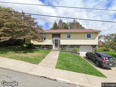
1220 Lloyd St Scranton, PA 18508
Tripp's Park NeighborhoodEstimated Value: $136,495 - $253,000
--
Bed
--
Bath
--
Sq Ft
0.34
Acres
About This Home
This home is located at 1220 Lloyd St, Scranton, PA 18508 and is currently estimated at $206,624. 1220 Lloyd St is a home located in Lackawanna County with nearby schools including Neil Armstrong Elementary School, South Scranton Intermediate, and West Scranton High School.
Ownership History
Date
Name
Owned For
Owner Type
Purchase Details
Closed on
Jan 31, 2020
Sold by
Knott Charles J and Knott Donna M
Bought by
Knott Ryan
Current Estimated Value
Home Financials for this Owner
Home Financials are based on the most recent Mortgage that was taken out on this home.
Original Mortgage
$94,500
Outstanding Balance
$84,706
Interest Rate
3.7%
Mortgage Type
Seller Take Back
Estimated Equity
$125,022
Purchase Details
Closed on
Jan 30, 2020
Sold by
Knott Charles J and Estate Of Loretta C Knott
Bought by
Knott Charles J and Knott Donna M
Home Financials for this Owner
Home Financials are based on the most recent Mortgage that was taken out on this home.
Original Mortgage
$94,500
Outstanding Balance
$84,706
Interest Rate
3.7%
Mortgage Type
Seller Take Back
Estimated Equity
$125,022
Purchase Details
Closed on
Aug 9, 1977
Bought by
Knott Charles J and Knott Loretta
Create a Home Valuation Report for This Property
The Home Valuation Report is an in-depth analysis detailing your home's value as well as a comparison with similar homes in the area
Home Values in the Area
Average Home Value in this Area
Purchase History
| Date | Buyer | Sale Price | Title Company |
|---|---|---|---|
| Knott Ryan | $94,500 | None Available | |
| Knott Charles J | -- | None Available | |
| Knott Charles J | $5,700 | -- |
Source: Public Records
Mortgage History
| Date | Status | Borrower | Loan Amount |
|---|---|---|---|
| Open | Knott Ryan | $94,500 |
Source: Public Records
Tax History Compared to Growth
Tax History
| Year | Tax Paid | Tax Assessment Tax Assessment Total Assessment is a certain percentage of the fair market value that is determined by local assessors to be the total taxable value of land and additions on the property. | Land | Improvement |
|---|---|---|---|---|
| 2025 | $5,025 | $15,000 | $3,400 | $11,600 |
| 2024 | $4,605 | $15,000 | $3,400 | $11,600 |
| 2023 | $4,605 | $15,000 | $3,400 | $11,600 |
| 2022 | $4,505 | $15,000 | $3,400 | $11,600 |
| 2021 | $4,505 | $15,000 | $3,400 | $11,600 |
| 2020 | $4,424 | $15,000 | $3,400 | $11,600 |
| 2019 | $4,165 | $15,000 | $3,400 | $11,600 |
| 2018 | $4,165 | $15,000 | $3,400 | $11,600 |
| 2017 | $4,095 | $15,000 | $3,400 | $11,600 |
| 2016 | $1,377 | $15,000 | $3,400 | $11,600 |
| 2015 | $3,221 | $15,000 | $3,400 | $11,600 |
| 2014 | -- | $17,000 | $4,000 | $13,000 |
Source: Public Records
Map
Nearby Homes
- 1515 Euclid Ave
- 1528 Hawthorne St
- 1010 Sterling St
- 0 Philo St Unit GSBSC4763
- 116 Little Spike Way Unit L 40
- 1707 Hawthorne St
- 942 Mount Vernon Ave Unit L 61 62
- 103 Kelly Way
- 801 Philo St
- 623 Court St
- 612 Philo St
- 10 Hawk Place
- 1408 Short Ave
- 1206 Blair Ave Unit Rear
- 1502 Church Ave
- 620 Foster St
- 829 N Sumner Ave
- 1103 Albright Ave
- 1035 Albright Ave
- 1408 Oram St
- 1220 Lloyd St
- 1224 Lloyd St
- 1214 Lloyd St
- 1214 Lloyd St Unit L 7 & 8
- 1213 Court St
- 1215 Court St Unit L16
- Lot 112 Euclid Ave
- Lot 122 Euclid Ave
- Lot 105 Euclid Ave
- 1211 Court St
- 1221 Lloyd St
- 1208 Lloyd St
- 1213 Lloyd St
- 1209 Court St
- 1100 N Sumner Ave Unit BLK
- 1217 Court St
- 1209 Lloyd St
- 1219 Court St
- 1207 Court St
- 1105 N Sumner Ave