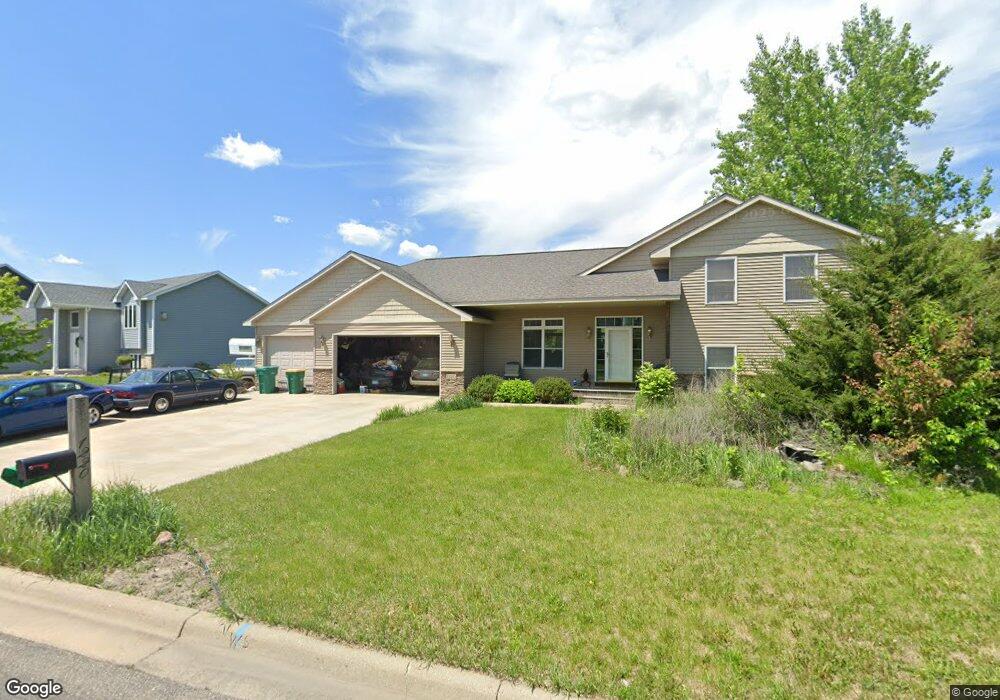
1220 Pheasant Ct Belle Plaine, MN 56011
Estimated Value: $387,000 - $414,000
4
Beds
3
Baths
1,450
Sq Ft
$275/Sq Ft
Est. Value
About This Home
This home is located at 1220 Pheasant Ct, Belle Plaine, MN 56011 and is currently estimated at $398,523, approximately $274 per square foot. 1220 Pheasant Ct is a home located in Scott County with nearby schools including Chatfield Elementary School, Oak Crest Elementary School, and Belle Plaine Junior/Senior High School.
Ownership History
Date
Name
Owned For
Owner Type
Purchase Details
Closed on
Jun 28, 2011
Sold by
Federal National Mortgage Association
Bought by
Thompson Steve D and Thompson Colleen H
Current Estimated Value
Purchase Details
Closed on
May 29, 2007
Sold by
Sprague Dean J
Bought by
Boeckman Paul and Boeckman Mary
Purchase Details
Closed on
Jan 19, 2007
Sold by
Farmers Development Inc
Bought by
Sprague Dean J and Aspen Remodelers
Create a Home Valuation Report for This Property
The Home Valuation Report is an in-depth analysis detailing your home's value as well as a comparison with similar homes in the area
Home Values in the Area
Average Home Value in this Area
Purchase History
We collect this data history from publicly available records. To have your information removed, we recommend requesting removal directly through your county’s website.
| Date | Buyer | Sale Price | Title Company |
|---|---|---|---|
| Thompson Steve D | -- | -- | |
| Boeckman Paul | $279,000 | -- | |
| Sprague Dean J | $65,000 | -- |
Source: Public Records
Tax History
| Year | Tax Paid | Tax Assessment Tax Assessment Total Assessment is a certain percentage of the fair market value that is determined by local assessors to be the total taxable value of land and additions on the property. | Land | Improvement |
|---|---|---|---|---|
| 2026 | $6,164 | $405,200 | $93,500 | $311,700 |
| 2025 | $6,164 | $407,200 | $91,100 | $316,100 |
| 2024 | $5,630 | $408,800 | $91,100 | $317,700 |
| 2023 | $5,354 | $376,300 | $78,800 | $297,500 |
| 2022 | $4,960 | $377,900 | $78,800 | $299,100 |
| 2021 | $4,288 | $312,800 | $63,500 | $249,300 |
| 2020 | $4,284 | $282,800 | $53,500 | $229,300 |
| 2019 | $3,992 | $279,300 | $50,000 | $229,300 |
| 2018 | $4,082 | $0 | $0 | $0 |
| 2016 | $3,668 | $0 | $0 | $0 |
| 2014 | -- | $0 | $0 | $0 |
Source: Public Records
Map
Nearby Homes
- 924 Mallard Ln
- Lot 3 Blk 2 Mallard Ln
- Lot 11 Blk 2 Mallard Ln
- Lot 10 Blk 2 Mallard Ln
- Lot 2 Blk 2 Mallard Ln
- Lot 9 Blk 2 Mallard Ln
- Lot 12 Blk 2 Mallard Ln
- Lot 1 Blk 2 Mallard Ln
- Lot 4 Blk 1 Mallard Ln
- 929 Farmers Ridge Trail
- Lot 2 Blk 1 Farmers Ridge Trail
- Lot 1 Blk 1 Farmers Ridge Trail
- 956 Farmers Ridge Trail
- Lot 4 Blk 2 Clearview Ct
- Lot 7 Blk 2 Clearview Ct
- 1117 Clearview Ct
- Lot 1 Blk 2 Clearview Ct
- Lot 5 Blk 2 Clearview Ct
- Lot 6 Blk 2 Clearview Ct
- Lot 2 Blk 2 Clearview Ct
- 1212 Pheasant Ct
- 924 924 Mallard Ln
- 1225 Pheasant Ct
- 1221 Pheasant Ct
- 1208 Pheasant Ct
- 1217 Pheasant Ct
- 925 Mallard Ln
- 952 Mallard Ln
- 1204 Pheasant Ct
- 1300 Dove Ct
- 1213 Pheasant Ct
- 1276 Ridge Ln
- 1209 Pheasant Ct
- Lot 13 Blk 2 Mallard Ln
- Lot 5 Blk 1 Mallard Ln
- Lot 3 Blk 1 Mallard Ln
- Lot 2 Blk 1 Mallard Ln
- Lot 1 Blk 1 Mallard Ln
- 1272 Ridge Ln
- 956 Mallard Ln
Your Personal Tour Guide
Ask me questions while you tour the home.