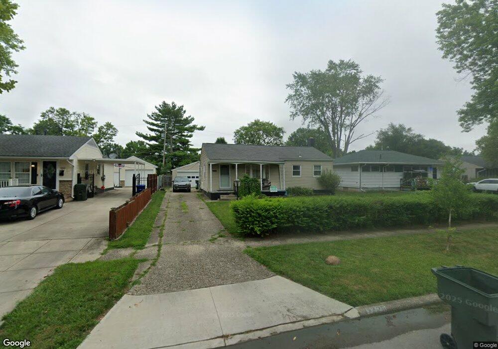
1220 Simpson Dr Columbus, OH 43227
Shady Lane NeighborhoodEstimated Value: $179,000 - $209,000
3
Beds
1
Bath
912
Sq Ft
$210/Sq Ft
Est. Value
About This Home
This home is located at 1220 Simpson Dr, Columbus, OH 43227 and is currently estimated at $191,376, approximately $209 per square foot. 1220 Simpson Dr is a home located in Franklin County with nearby schools including Shady Lane Elementary School, Sherwood Middle School, and Walnut Ridge High School.
Ownership History
Date
Name
Owned For
Owner Type
Purchase Details
Closed on
Jan 20, 2015
Sold by
Haner Shane R and Haner Elizabeth
Bought by
Haner Shane R and Haner Elizabeth
Current Estimated Value
Home Financials for this Owner
Home Financials are based on the most recent Mortgage that was taken out on this home.
Original Mortgage
$53,600
Outstanding Balance
$17,408
Interest Rate
3.82%
Mortgage Type
New Conventional
Estimated Equity
$173,968
Purchase Details
Closed on
Aug 18, 2003
Sold by
Argood Madonna J and Argood Madonna
Bought by
Haner Shane R
Home Financials for this Owner
Home Financials are based on the most recent Mortgage that was taken out on this home.
Original Mortgage
$80,910
Interest Rate
5.69%
Mortgage Type
Purchase Money Mortgage
Create a Home Valuation Report for This Property
The Home Valuation Report is an in-depth analysis detailing your home's value as well as a comparison with similar homes in the area
Home Values in the Area
Average Home Value in this Area
Purchase History
| Date | Buyer | Sale Price | Title Company |
|---|---|---|---|
| Haner Shane R | -- | Nationallink | |
| Haner Shane R | $89,900 | -- |
Source: Public Records
Mortgage History
| Date | Status | Borrower | Loan Amount |
|---|---|---|---|
| Open | Haner Shane R | $53,600 | |
| Closed | Haner Shane R | $80,910 |
Source: Public Records
Tax History
| Year | Tax Paid | Tax Assessment Tax Assessment Total Assessment is a certain percentage of the fair market value that is determined by local assessors to be the total taxable value of land and additions on the property. | Land | Improvement |
|---|---|---|---|---|
| 2025 | $2,739 | $61,040 | $16,800 | $44,240 |
| 2024 | $2,739 | $61,040 | $16,800 | $44,240 |
| 2023 | $2,704 | $61,040 | $16,800 | $44,240 |
| 2022 | $1,528 | $29,470 | $6,300 | $23,170 |
| 2021 | $1,531 | $29,470 | $6,300 | $23,170 |
| 2020 | $1,484 | $28,530 | $6,300 | $22,230 |
| 2019 | $1,366 | $22,510 | $5,040 | $17,470 |
| 2018 | $1,349 | $22,510 | $5,040 | $17,470 |
| 2017 | $1,365 | $22,510 | $5,040 | $17,470 |
| 2016 | $1,471 | $22,200 | $4,940 | $17,260 |
| 2015 | $1,335 | $22,200 | $4,940 | $17,260 |
| 2014 | $1,338 | $22,200 | $4,940 | $17,260 |
| 2013 | $776 | $26,110 | $5,810 | $20,300 |
Source: Public Records
Map
Nearby Homes
- 1243 Simpson Dr
- 1229 Simpson Dr
- 1284 Thurston Dr
- 1193 Marble Dr
- 1281 Maetzel Dr
- 4467 Grimsby Rd
- 1356 Harlow Rd
- 1085 S Hamilton Rd
- 4472 Aragon Ave
- 1260 Country Club Rd
- 1301 Bernhard Rd
- 4677 E Livingston Ave
- 4859 Folger Dr
- 1612 Simpson Dr
- 1607 Baxter Dr
- 1639 Shady Lane Rd
- 4701 Janis Dr
- 1492 Burlington Ave
- 1469 Burlington Ave
- 4991 Justin Rd
- 1228 Simpson Dr
- 1212 Simpson Dr
- 1206 Simpson Dr
- 1236 Simpson Dr
- 4619 Boynton Place
- 1221 Simpson Dr
- 1244 Simpson Dr
- 1198 Simpson Dr
- 4620 Boynton Place
- 1213 Simpson Dr
- 1237 Simpson Dr
- 1205 Simpson Dr
- 4623 Boynton Place
- 1250 Simpson Dr
- 1190 Simpson Dr
- 4626 Boynton Place
- 1199 Simpson Dr
- 4603 Ludington Rd
- 1251 Simpson Dr
- 4611 Ludington Rd
Your Personal Tour Guide
Ask me questions while you tour the home.