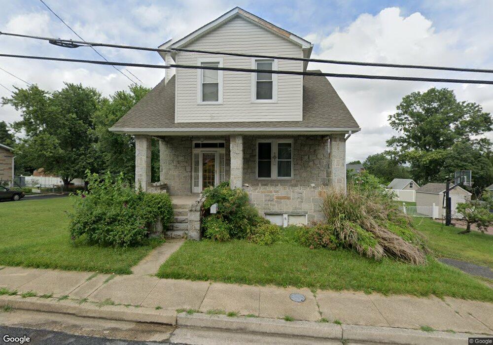
1220 Stevens Ave Halethorpe, MD 21227
Estimated Value: $358,000 - $422,000
--
Bed
3
Baths
1,697
Sq Ft
$224/Sq Ft
Est. Value
About This Home
This home is located at 1220 Stevens Ave, Halethorpe, MD 21227 and is currently estimated at $379,481, approximately $223 per square foot. 1220 Stevens Ave is a home located in Baltimore County with nearby schools including Arbutus Elementary School, Arbutus Middle School, and Lansdowne High School.
Ownership History
Date
Name
Owned For
Owner Type
Purchase Details
Closed on
Jan 14, 2003
Sold by
Secretary Of Veterans Affairs
Bought by
Leonard Ronald and Leonard Theresa
Current Estimated Value
Purchase Details
Closed on
Jun 3, 2002
Sold by
Miller David P
Bought by
Secretary Of Veterans Affairs
Purchase Details
Closed on
Mar 26, 2001
Sold by
Miller David P
Bought by
Miller David P and Miller Anna R
Purchase Details
Closed on
Jan 20, 1999
Sold by
Miller David P
Bought by
Miller David P and Miller Anna R
Purchase Details
Closed on
May 20, 1996
Sold by
Brake Charles Q
Bought by
Miller David P
Create a Home Valuation Report for This Property
The Home Valuation Report is an in-depth analysis detailing your home's value as well as a comparison with similar homes in the area
Home Values in the Area
Average Home Value in this Area
Purchase History
| Date | Buyer | Sale Price | Title Company |
|---|---|---|---|
| Leonard Ronald | $117,590 | -- | |
| Secretary Of Veterans Affairs | $119,857 | -- | |
| Miller David P | -- | -- | |
| Miller David P | -- | -- | |
| Miller David P | $117,900 | -- |
Source: Public Records
Tax History Compared to Growth
Tax History
| Year | Tax Paid | Tax Assessment Tax Assessment Total Assessment is a certain percentage of the fair market value that is determined by local assessors to be the total taxable value of land and additions on the property. | Land | Improvement |
|---|---|---|---|---|
| 2025 | $3,375 | $266,633 | -- | -- |
| 2024 | $3,375 | $240,800 | $76,600 | $164,200 |
| 2023 | $3,320 | $235,733 | $0 | $0 |
| 2022 | $3,374 | $230,667 | $0 | $0 |
| 2021 | $3,093 | $225,600 | $57,800 | $167,800 |
| 2020 | $3,093 | $222,000 | $0 | $0 |
| 2019 | $3,026 | $218,400 | $0 | $0 |
| 2018 | $3,088 | $214,800 | $57,800 | $157,000 |
| 2017 | $2,756 | $204,067 | $0 | $0 |
| 2016 | $3,039 | $193,333 | $0 | $0 |
| 2015 | $3,039 | $182,600 | $0 | $0 |
| 2014 | $3,039 | $182,600 | $0 | $0 |
Source: Public Records
Map
Nearby Homes
- 1242 Vogt Ave
- 1201 Poplar Ave
- 1209 Locust Ave
- 5502 Osage Ave
- 1309 Linden Ave
- 1263 Birch Ave
- 1312 Poplar Ave
- 1326 Stevens Ave
- 1328 Maple Ave
- 1029 Regina Dr
- 5523 Council St
- 1416 Sulphur Spring Rd
- 1229 Leeds Terrace
- 5207 Arbutus Ave
- 957 Circle Dr
- 5522 Ashbourne Rd
- 4821 Carmella Dr
- 5530 Willys Ave
- 5215 Benson Ave
- 5536 Gayland Rd
- 1222 Stevens Ave
- 1224 Stevens Ave
- 1216 Stevens Ave
- 1219 Linden Ave
- 1221 Linden Ave
- 1223 Stevens Ave
- 1221 Stevens Ave
- 1215 Linden Ave
- 1217 Linden Ave
- 1225 Stevens Ave
- 1214 Stevens Ave
- 1217 Stevens Ave
- 1226 Stevens Ave
- 1227 Stevens Ave
- 1215 Stevens Ave
- 1211 Linden Ave
- 1225 Linden Ave
- 1212 Stevens Ave
- 1228 Stevens Ave
- 1229 Stevens Ave