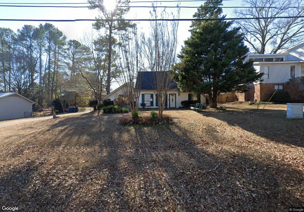
1220 Thompson Rd Alabaster, AL 35007
Estimated Value: $256,000 - $298,000
--
Bed
1
Bath
1,768
Sq Ft
$152/Sq Ft
Est. Value
About This Home
This home is located at 1220 Thompson Rd, Alabaster, AL 35007 and is currently estimated at $268,999, approximately $152 per square foot. 1220 Thompson Rd is a home located in Shelby County with nearby schools including Thompson Intermediate School, Thompson Middle School, and Thompson High School.
Ownership History
Date
Name
Owned For
Owner Type
Purchase Details
Closed on
Jul 7, 2023
Sold by
Pritchard Joseph Loyal
Bought by
Pritchard Phillip Joel and Pritchard Loretta Jo
Current Estimated Value
Purchase Details
Closed on
May 30, 2003
Sold by
Foster Kent Wade and Foster Chrisjonna Rene
Bought by
Pritchard Joseph Loyal and Pritchard Mary Jo
Home Financials for this Owner
Home Financials are based on the most recent Mortgage that was taken out on this home.
Original Mortgage
$102,825
Interest Rate
5.56%
Mortgage Type
Unknown
Create a Home Valuation Report for This Property
The Home Valuation Report is an in-depth analysis detailing your home's value as well as a comparison with similar homes in the area
Home Values in the Area
Average Home Value in this Area
Purchase History
| Date | Buyer | Sale Price | Title Company |
|---|---|---|---|
| Pritchard Phillip Joel | -- | None Listed On Document | |
| Pritchard Joseph Loyal | $103,500 | -- |
Source: Public Records
Mortgage History
| Date | Status | Borrower | Loan Amount |
|---|---|---|---|
| Previous Owner | Pritchard Joseph Loyal | $92,000 | |
| Previous Owner | Pritchard Joseph Loyal | $102,825 | |
| Previous Owner | Foster Ii Kent Wade | $83,395 |
Source: Public Records
Tax History Compared to Growth
Tax History
| Year | Tax Paid | Tax Assessment Tax Assessment Total Assessment is a certain percentage of the fair market value that is determined by local assessors to be the total taxable value of land and additions on the property. | Land | Improvement |
|---|---|---|---|---|
| 2024 | $2,353 | $43,580 | $0 | $0 |
| 2023 | $2,187 | $40,500 | $0 | $0 |
| 2022 | $0 | $18,400 | $0 | $0 |
| 2021 | $0 | $15,600 | $0 | $0 |
| 2020 | $0 | $14,780 | $0 | $0 |
| 2019 | $0 | $14,100 | $0 | $0 |
| 2017 | $0 | $11,140 | $0 | $0 |
| 2015 | -- | $10,660 | $0 | $0 |
| 2014 | -- | $10,420 | $0 | $0 |
Source: Public Records
Map
Nearby Homes
- 1520 Tropical Cir
- 204 Shalimar Cir
- 149 Park Place Ln
- 192 Kentwood Dr
- 104 Camden Cir
- 921 10th St SW
- 113 Palm Dr
- 101 Bermuda Lake Dr
- 121 Sterling Gate Dr
- 217 Kensington Ln
- 218 Buck Creek Cir
- 316 Sterling Manor Cir Unit 15
- 280 Cedar Grove Pkwy Unit 34
- 1036 7th Ave SW
- 521 13th St SW Unit 521
- 549 Ramsgate Dr
- 309 Cedar Grove Ct
- 1166 Eagle Dr
- 35 Bart Cir
- 226 Lake Forest Way
- 1220 Thompson Rd
- 1226 Thompson Rd
- 1224 Southwind Dr
- 1220 Caribbean Cir
- 1168 Caribbean Cir
- 1226 Southwind Dr
- 1157 Thompson Rd
- 6126 Caribbean Cir
- 1162 Caribbean Cir
- 154 Ashford Way
- 150 Ashford Way
- 158 Ashford Way
- 148 Ashford Way
- 1156 Caribbean Cir
- 162 Ashford Way
- 1321 Southwind Dr
- 1321 Southwind Dr Unit 1
- 1151 Thompson Rd
- 1221 Tahiti Ln
- 1227 Caribbean Cir
