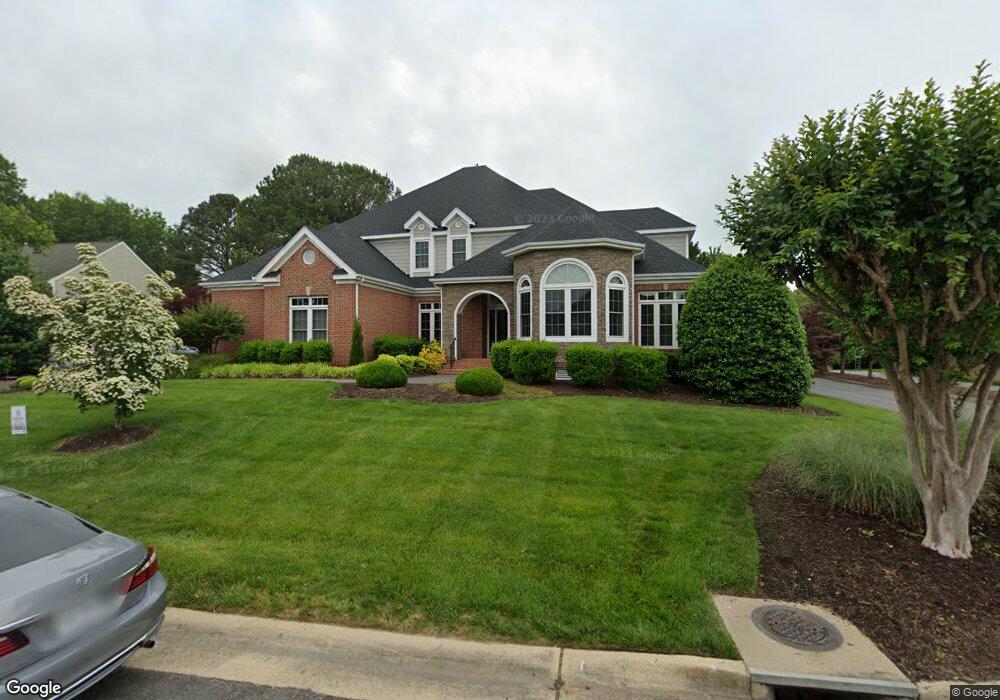
12200 Malham Way Glen Allen, VA 23059
Estimated Value: $742,000 - $875,000
4
Beds
5
Baths
3,583
Sq Ft
$231/Sq Ft
Est. Value
About This Home
This home is located at 12200 Malham Way, Glen Allen, VA 23059 and is currently estimated at $826,602, approximately $230 per square foot. 12200 Malham Way is a home located in Henrico County with nearby schools including Shady Grove Elementary School, Short Pump Middle School, and Deep Run High School.
Ownership History
Date
Name
Owned For
Owner Type
Purchase Details
Closed on
May 8, 2023
Sold by
Goodwin Jack S and Goodwin Mary Ellen
Bought by
Ashman Joseph Edward and Ashman Sarah A
Current Estimated Value
Home Financials for this Owner
Home Financials are based on the most recent Mortgage that was taken out on this home.
Original Mortgage
$394,875
Outstanding Balance
$383,955
Interest Rate
6.42%
Mortgage Type
VA
Estimated Equity
$442,647
Create a Home Valuation Report for This Property
The Home Valuation Report is an in-depth analysis detailing your home's value as well as a comparison with similar homes in the area
Home Values in the Area
Average Home Value in this Area
Purchase History
| Date | Buyer | Sale Price | Title Company |
|---|---|---|---|
| Ashman Joseph Edward | $650,000 | Fidelity National Title |
Source: Public Records
Mortgage History
| Date | Status | Borrower | Loan Amount |
|---|---|---|---|
| Open | Ashman Joseph Edward | $394,875 |
Source: Public Records
Tax History Compared to Growth
Tax History
| Year | Tax Paid | Tax Assessment Tax Assessment Total Assessment is a certain percentage of the fair market value that is determined by local assessors to be the total taxable value of land and additions on the property. | Land | Improvement |
|---|---|---|---|---|
| 2025 | $6,378 | $701,500 | $160,000 | $541,500 |
| 2024 | $6,378 | $701,500 | $160,000 | $541,500 |
| 2023 | $5,963 | $701,500 | $160,000 | $541,500 |
| 2022 | $5,335 | $627,700 | $160,000 | $467,700 |
| 2021 | $4,571 | $535,300 | $140,000 | $395,300 |
| 2020 | $4,657 | $535,300 | $140,000 | $395,300 |
| 2019 | $4,694 | $539,500 | $140,000 | $399,500 |
| 2018 | $4,694 | $539,500 | $140,000 | $399,500 |
| 2017 | $4,694 | $539,500 | $140,000 | $399,500 |
| 2016 | $4,694 | $539,500 | $140,000 | $399,500 |
| 2015 | $4,838 | $556,100 | $140,000 | $416,100 |
| 2014 | $4,838 | $556,100 | $140,000 | $416,100 |
Source: Public Records
Map
Nearby Homes
- 6233 Kershaw Dr
- 6225 Kershaw Dr
- 6209 Winsted Ct
- 12516 Collinstone Ct
- 12012 Layton Dr
- 12009 Club Commons Dr
- 14357 Western Riders Ln
- 6573 Glenshaw Dr
- 5604 Ashton Park Ct
- 12309 Hardwick Ct
- 5707 Stoneacre Ct
- 5835 Shady Hills Way
- 5525 Barnsley Terrace
- 7159 Yare St
- 5824 Ketterley Row
- 12313 Haybrook Ln
- 12024 Stonewick Place
- 7480 Brandiston St
- 10605 Gate House Ct
- 11900 Westcott Ridge Terrace
- 12204 Malham Way
- 12201 Denford Way
- 12205 Denford Way
- 12201 Malham Way
- 6308 Morestead Dr
- 12113 Denford Ct
- 6304 Morestead Dr
- 12208 Malham Way
- 12205 Malham Way
- 12109 Denford Ct
- 12209 Denford Way
- 12108 Drumore Ct
- 12000 Drumore Way
- 12104 Drumore Ct
- 12004 Drumore Way
- 12105 Denford Ct
- 12200 Denford Way
- 12116 Denford Ct
- 12008 Drumore Way
- 12208 Denford Way