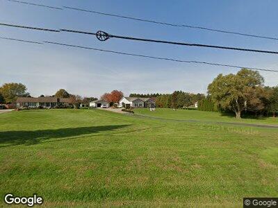
Estimated Value: $213,000 - $322,000
3
Beds
2
Baths
2,134
Sq Ft
$137/Sq Ft
Est. Value
About This Home
This home is located at 12201 State Route 13, Milan, OH 44846 and is currently estimated at $293,139, approximately $137 per square foot. 12201 State Route 13 is a home located in Erie County with nearby schools including Edison Elementary School (Formerly Milan Elementary), Edison Middle School (Formerly Berlin-Milan Middle School), and Edison High School.
Ownership History
Date
Name
Owned For
Owner Type
Purchase Details
Closed on
Jan 10, 2013
Sold by
Camp James W and Camp Diane L
Bought by
Camp James W and Camp Diane L
Current Estimated Value
Purchase Details
Closed on
Oct 22, 1999
Sold by
Zorn Kenneth P
Bought by
Camp James W and Camp Diane L
Home Financials for this Owner
Home Financials are based on the most recent Mortgage that was taken out on this home.
Original Mortgage
$63,000
Interest Rate
6.88%
Mortgage Type
New Conventional
Purchase Details
Closed on
Aug 25, 1995
Sold by
Kluding Mark G
Bought by
Zorn Kenneth P and Zahniser Rae S
Home Financials for this Owner
Home Financials are based on the most recent Mortgage that was taken out on this home.
Original Mortgage
$98,000
Interest Rate
7.43%
Mortgage Type
New Conventional
Create a Home Valuation Report for This Property
The Home Valuation Report is an in-depth analysis detailing your home's value as well as a comparison with similar homes in the area
Home Values in the Area
Average Home Value in this Area
Purchase History
| Date | Buyer | Sale Price | Title Company |
|---|---|---|---|
| Camp James W | -- | None Available | |
| Camp James W | $153,000 | -- | |
| Zorn Kenneth P | $128,000 | -- |
Source: Public Records
Mortgage History
| Date | Status | Borrower | Loan Amount |
|---|---|---|---|
| Closed | Camp James W | $37,271 | |
| Closed | Camp James W | $52,000 | |
| Closed | Camp James W | $63,000 | |
| Previous Owner | Zorn Kenneth P | $98,000 |
Source: Public Records
Tax History Compared to Growth
Tax History
| Year | Tax Paid | Tax Assessment Tax Assessment Total Assessment is a certain percentage of the fair market value that is determined by local assessors to be the total taxable value of land and additions on the property. | Land | Improvement |
|---|---|---|---|---|
| 2024 | $3,214 | $93,790 | $15,090 | $78,700 |
| 2023 | $3,214 | $69,275 | $13,720 | $55,555 |
| 2022 | $2,552 | $69,275 | $13,720 | $55,555 |
| 2021 | $2,537 | $69,280 | $13,720 | $55,560 |
| 2020 | $2,354 | $63,800 | $13,720 | $50,080 |
| 2019 | $2,444 | $63,800 | $13,720 | $50,080 |
| 2018 | $2,568 | $63,800 | $13,720 | $50,080 |
| 2017 | $2,594 | $63,460 | $13,790 | $49,670 |
| 2016 | $2,574 | $63,460 | $13,790 | $49,670 |
| 2015 | $2,534 | $63,460 | $13,790 | $49,670 |
| 2014 | $2,562 | $63,460 | $13,790 | $49,670 |
| 2013 | $2,528 | $63,460 | $13,790 | $49,670 |
Source: Public Records
Map
Nearby Homes
- 26 N Edison Dr
- 25 S Edison Dr
- 79 Ridgeview Cir
- 9807 Church St
- 0 Millwood Lots 1 & 2 Unit 20243149
- 73 Center St
- 128 Center St
- 104 S Edison Dr
- 139 S Edison Dr
- 20 Chippewa Dr
- 0 S Main St
- 13965 Perrin Rd
- 2710 Scheid Rd
- 9920 River Rd
- 4107 State Route 113 E
- 5054 Ohio 601
- 520 Milan Ave Unit 21
- 520 Milan Ave Unit 106
- 520 Milan Ave Unit 172
- 0 Wikel Rd
- 12201 State Route 13
- 12205 State Route 13
- 12111 State Route 13
- 12211 State Route 13
- 12103 State Route 13
- 12202 State Route 13
- 12301 Mudbrook Rd
- 12111 Mudbrook Rd
- 12103 Mudbrook Rd
- 12301 State Route 13
- 11910 Hoover Rd
- 11916 Hoover Rd
- 11902 Hoover Rd
- 1406 Horn Rd
- 11816 Hoover Rd
- 12000 Hoover Rd
- 12307 State Route 13
- 1402 Horn Rd
- 1312 Horn Rd
- 12011 State Route 13
