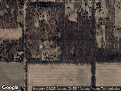
12201 Sutfin Rd Horton, MI 49246
Estimated Value: $363,049 - $592,000
--
Bed
--
Bath
2,100
Sq Ft
$231/Sq Ft
Est. Value
About This Home
This home is located at 12201 Sutfin Rd, Horton, MI 49246 and is currently estimated at $485,262, approximately $231 per square foot. 12201 Sutfin Rd is a home located in Jackson County with nearby schools including Hanover-Horton Elementary School, Hanover-Horton Middle School, and Hanover-Horton High School.
Ownership History
Date
Name
Owned For
Owner Type
Purchase Details
Closed on
Dec 20, 2021
Sold by
Dean Thomas E and Dean Karen Lynn
Bought by
Lowry Kent and Lowry Tahny
Current Estimated Value
Home Financials for this Owner
Home Financials are based on the most recent Mortgage that was taken out on this home.
Original Mortgage
$256,000
Outstanding Balance
$240,860
Interest Rate
2.98%
Mortgage Type
New Conventional
Purchase Details
Closed on
Feb 23, 2006
Sold by
Dean Karen Lynn and Stewart Karen Lynn
Bought by
Dean Thomas E and Dean Karen Lynn
Home Financials for this Owner
Home Financials are based on the most recent Mortgage that was taken out on this home.
Original Mortgage
$90,000
Interest Rate
6.2%
Mortgage Type
Stand Alone Refi Refinance Of Original Loan
Purchase Details
Closed on
Aug 8, 1996
Sold by
Warblow William N and Warblow Joan B
Bought by
Stewart Karen Lynn
Purchase Details
Closed on
Jun 30, 1995
Sold by
Warblow William H and Warblow Joan B
Bought by
Stewart Karen Lynn
Create a Home Valuation Report for This Property
The Home Valuation Report is an in-depth analysis detailing your home's value as well as a comparison with similar homes in the area
Home Values in the Area
Average Home Value in this Area
Purchase History
| Date | Buyer | Sale Price | Title Company |
|---|---|---|---|
| Lowry Kent | $275,000 | American Title | |
| Dean Thomas E | -- | At | |
| Stewart Karen Lynn | $35,000 | -- | |
| Stewart Karen Lynn | -- | -- |
Source: Public Records
Mortgage History
| Date | Status | Borrower | Loan Amount |
|---|---|---|---|
| Open | Lowry Kent | $256,000 | |
| Previous Owner | Dean Thomas E | $90,000 |
Source: Public Records
Tax History Compared to Growth
Tax History
| Year | Tax Paid | Tax Assessment Tax Assessment Total Assessment is a certain percentage of the fair market value that is determined by local assessors to be the total taxable value of land and additions on the property. | Land | Improvement |
|---|---|---|---|---|
| 2024 | $4,399 | $275,600 | $0 | $0 |
| 2022 | $4,094 | $187,400 | $0 | $0 |
| 2021 | $4,109 | $180,500 | $0 | $0 |
| 2020 | $4,275 | $175,000 | $0 | $0 |
| 2019 | $4,157 | $156,900 | $0 | $0 |
| 2018 | $4,065 | $137,600 | $0 | $0 |
| 2017 | $2,966 | $137,300 | $0 | $0 |
| 2016 | $2,119 | $131,000 | $131,000 | $0 |
| 2015 | -- | $124,100 | $124,100 | $0 |
| 2014 | -- | $115,900 | $0 | $0 |
| 2013 | -- | $115,900 | $115,900 | $0 |
Source: Public Records
Map
Nearby Homes
- 11968 Greenbriar Vl Dr
- 11112 Greenview Ct
- 283 Westshore Dr
- 11968 Greenbriar Dr
- 281 Mirror Dr
- Lot 6 & 7 Westshore Dr
- 159 Westshore Dr
- 11752 Baker Rd
- 11799 Greenbriar Dr
- 11437 Highland Hills Dr
- 11715 Baker Rd
- 125 Westshore Dr
- 11767 Greenbriar Dr
- 11477 Highland Hills Dr
- 447 Paradise Ln
- 150 Hollybrook Ct
- 11597 Highland Hills Dr
- V/L Hollybrook Ct
- 192 Eastshore Dr
- 160 Eastshore Dr
- 12201 Sutfin Rd
- 11900 Sutfin Rd
- 12200 Sutfin Rd
- 12000 Sutfin Rd
- 11940 Sutfin Rd
- 11940 Sutfin Rd Unit SUTFIN
- 11953 Sutfin Rd
- 11931 Sutfin Rd
- 11931 Sutfin Rd
- 12220 Sutfin Rd
- 74 Sutfin Rd
- 11921 Sutfin Rd
- 11191 Sutfin Rd
- 11944 Sutfin Rd
- 11936 Sutfin Rd
- 11900 Patch Rd
- 12000 Patch Rd
- Parcel B Sutfin Rd
- Parcel D Sutfin Rd
- Parcel C Sutfin Rd
