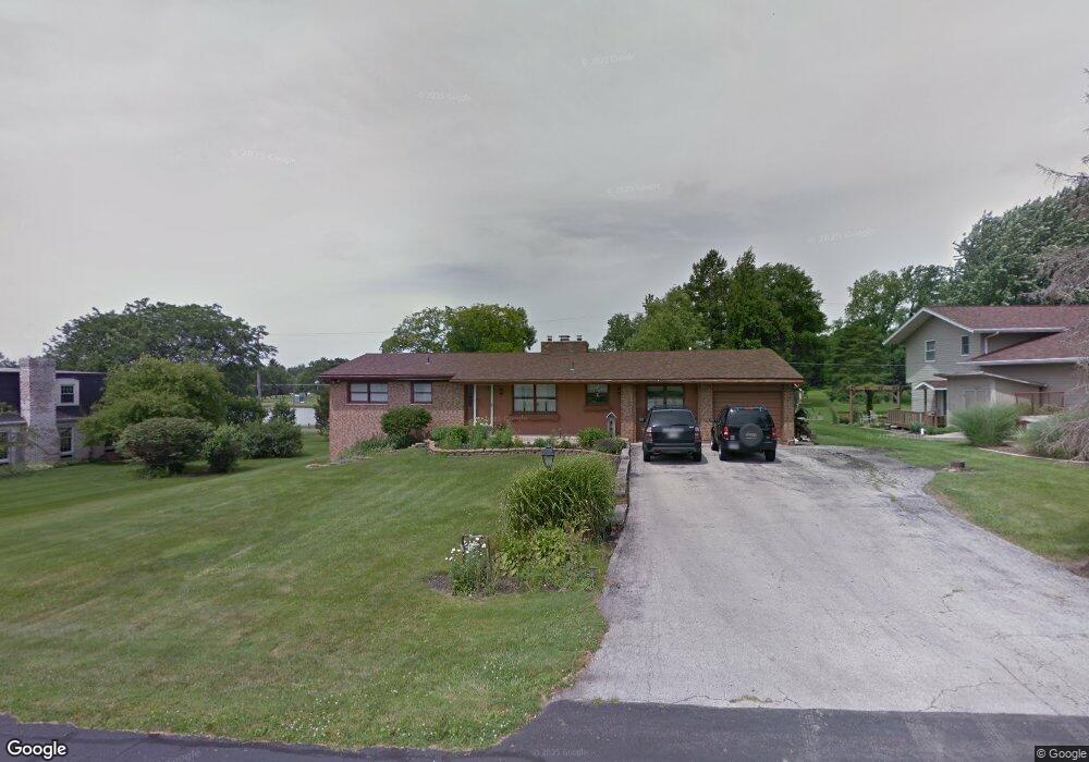
12205 Pamela Dr Kenton, OH 43326
Estimated Value: $235,229 - $317,000
4
Beds
1
Bath
1,876
Sq Ft
$155/Sq Ft
Est. Value
About This Home
This home is located at 12205 Pamela Dr, Kenton, OH 43326 and is currently estimated at $291,557, approximately $155 per square foot. 12205 Pamela Dr is a home located in Hardin County with nearby schools including Kenton Elementary School, Kenton Middle School, and Kenton High School.
Ownership History
Date
Name
Owned For
Owner Type
Purchase Details
Closed on
Feb 14, 2002
Bought by
Price John S and Price Karyn E
Current Estimated Value
Purchase Details
Closed on
Nov 29, 2001
Bought by
Cendant Mobility Financi
Purchase Details
Closed on
May 28, 1999
Bought by
Cubilla Carmelo and Cubilla Jayne
Purchase Details
Closed on
May 16, 1996
Bought by
Mills Daniel F and Mills Bridget
Purchase Details
Closed on
Jan 30, 1991
Purchase Details
Closed on
Jul 6, 1988
Create a Home Valuation Report for This Property
The Home Valuation Report is an in-depth analysis detailing your home's value as well as a comparison with similar homes in the area
Home Values in the Area
Average Home Value in this Area
Purchase History
| Date | Buyer | Sale Price | Title Company |
|---|---|---|---|
| Price John S | $109,900 | -- | |
| Cendant Mobility Financi | $126,900 | -- | |
| Cubilla Carmelo | $124,500 | -- | |
| Mills Daniel F | $93,000 | -- | |
| -- | $80,000 | -- | |
| -- | $62,500 | -- |
Source: Public Records
Tax History Compared to Growth
Tax History
| Year | Tax Paid | Tax Assessment Tax Assessment Total Assessment is a certain percentage of the fair market value that is determined by local assessors to be the total taxable value of land and additions on the property. | Land | Improvement |
|---|---|---|---|---|
| 2024 | $2,489 | $59,020 | $9,920 | $49,100 |
| 2023 | $2,489 | $59,020 | $9,920 | $49,100 |
| 2022 | $2,414 | $53,280 | $4,860 | $48,420 |
| 2021 | $2,423 | $53,280 | $4,860 | $48,420 |
| 2020 | $2,094 | $53,280 | $4,860 | $48,420 |
| 2019 | $1,630 | $43,080 | $4,630 | $38,450 |
| 2018 | $1,751 | $43,080 | $4,630 | $38,450 |
| 2017 | $1,607 | $43,080 | $4,630 | $38,450 |
| 2016 | $1,704 | $45,140 | $4,540 | $40,600 |
| 2015 | $1,574 | $45,140 | $4,540 | $40,600 |
| 2014 | $2,014 | $45,140 | $4,540 | $40,600 |
| 2013 | $1,802 | $48,770 | $4,540 | $44,230 |
Source: Public Records
Map
Nearby Homes
- 11896 Parklane Dr
- 920 Cooper St
- 115 Scioto St
- 1 C Ct
- 79 Broadway St
- 39 Grape St
- 530 E Franklin St
- 510 Decatur St
- 513 E Franklin St
- 508 Decatur St
- 13450 State Route 292
- 509 E Carrol St
- 324 Stone Hedge Ln Unit 324
- 121 S High St
- 104 Oak Ln Unit 15
- 0 N Barron St
- 639 S Main St
- 503 Jennings St
- 727 S Detroit St
- 0 Gilmore St
- 12193 Pamela Dr
- 12173 Pamela Dr
- 12235 Pamela Dr
- 12694 Deborah Dr
- 12180 Pamela Dr
- 12674 Deborah Dr
- 12160 Pamela Dr
- 12270 Pamela Dr
- 12257 Pamela Dr
- 12146 Pamela Dr
- 12656 Deborah Dr
- 12129 Pamela Dr
- 12306 Pamela Dr
- 12641 Deborah Dr
- 16326 County Road 144
- 12287 Pamela Dr
- 12624 Deborah Dr
- 12107 Pamela Dr
- 12324 Pamela Dr