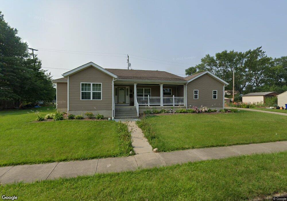
12207 Brookfield Ave Cleveland, OH 44135
Bellaire-Puritas NeighborhoodEstimated Value: $208,000 - $324,994
4
Beds
3
Baths
2,822
Sq Ft
$88/Sq Ft
Est. Value
About This Home
This home is located at 12207 Brookfield Ave, Cleveland, OH 44135 and is currently estimated at $246,999, approximately $87 per square foot. 12207 Brookfield Ave is a home with nearby schools including Artemus Ward School, Almira Academy, and Benjamin Franklin.
Ownership History
Date
Name
Owned For
Owner Type
Purchase Details
Closed on
Jun 8, 2020
Sold by
Hill Robert A and Rogers Rebba Veronica
Bought by
Hill Robert A and Rogers Reba Veronica
Current Estimated Value
Home Financials for this Owner
Home Financials are based on the most recent Mortgage that was taken out on this home.
Original Mortgage
$202,610
Outstanding Balance
$179,598
Interest Rate
3.2%
Mortgage Type
VA
Estimated Equity
$67,401
Purchase Details
Closed on
Jul 16, 2016
Sold by
Hill Robert A
Bought by
Hill Robert A
Home Financials for this Owner
Home Financials are based on the most recent Mortgage that was taken out on this home.
Original Mortgage
$232,259
Interest Rate
3.54%
Mortgage Type
VA
Purchase Details
Closed on
Oct 12, 2006
Sold by
Estate Of Mary H Parson
Bought by
Parson Willie
Create a Home Valuation Report for This Property
The Home Valuation Report is an in-depth analysis detailing your home's value as well as a comparison with similar homes in the area
Home Values in the Area
Average Home Value in this Area
Purchase History
| Date | Buyer | Sale Price | Title Company |
|---|---|---|---|
| Hill Robert A | -- | Netco Title | |
| Hill Robert A | -- | Silk Abstract Company | |
| Parson Willie | -- | None Available |
Source: Public Records
Mortgage History
| Date | Status | Borrower | Loan Amount |
|---|---|---|---|
| Open | Hill Robert A | $202,610 | |
| Closed | Hill Robert A | $232,259 |
Source: Public Records
Tax History Compared to Growth
Tax History
| Year | Tax Paid | Tax Assessment Tax Assessment Total Assessment is a certain percentage of the fair market value that is determined by local assessors to be the total taxable value of land and additions on the property. | Land | Improvement |
|---|---|---|---|---|
| 2024 | $1,340 | $98,070 | $20,440 | $77,630 |
| 2023 | $669 | $8,820 | $8,820 | $0 |
| 2022 | $665 | $133,735 | $8,820 | $124,915 |
| 2021 | $658 | $133,740 | $8,820 | $124,920 |
| 2020 | $603 | $6,830 | $6,830 | $0 |
| 2019 | $559 | $19,500 | $19,500 | $0 |
| 2018 | $535 | $6,830 | $6,830 | $0 |
| 2017 | $512 | $6,060 | $6,060 | $0 |
Source: Public Records
Map
Nearby Homes
- 12312 Guardian Blvd
- 11913 Matherson Ave
- 11808 Leeila Ave
- 12400 Saint John Ave
- 12508 Sobieski Ave
- 12510 Summerland Ave
- 12605 Brooklawn Ave
- 12510 Grimsby Ave
- 4059 W 130th St
- 12620 Grimsby Ave
- 11909 Mortimer Ave
- 3958 W 130th St
- 11813 Kensington Ave
- 3818 Highland Rd
- 13206 Liberty Ave
- 11804 Kensington Ave
- 13209 Liberty Ave
- 13301 Courtland Ave
- 3753 W 117th St
- 13313 Highlandview Ave
- 12211 Brookfield Ave
- 12111 Brookfield Ave
- 12206 Guardian Blvd
- 12215 Brookfield Ave
- 12210 Guardian Blvd
- 12202 Brookfield Ave
- 12118 Brookfield Ave
- 12206 Brookfield Ave
- 12110 Brookfield Ave
- 12024 Bellaire Rd
- 12301 Brookfield Ave
- 12214 Guardian Blvd
- 12210 Brookfield Ave
- 12300 Guardian Blvd
- 12104 Brookfield Ave
- 12305 Brookfield Ave
- 12304 Guardian Blvd
- 12205 Emery Ave
- 12309 Brookfield Ave
- 12201 Emery Ave