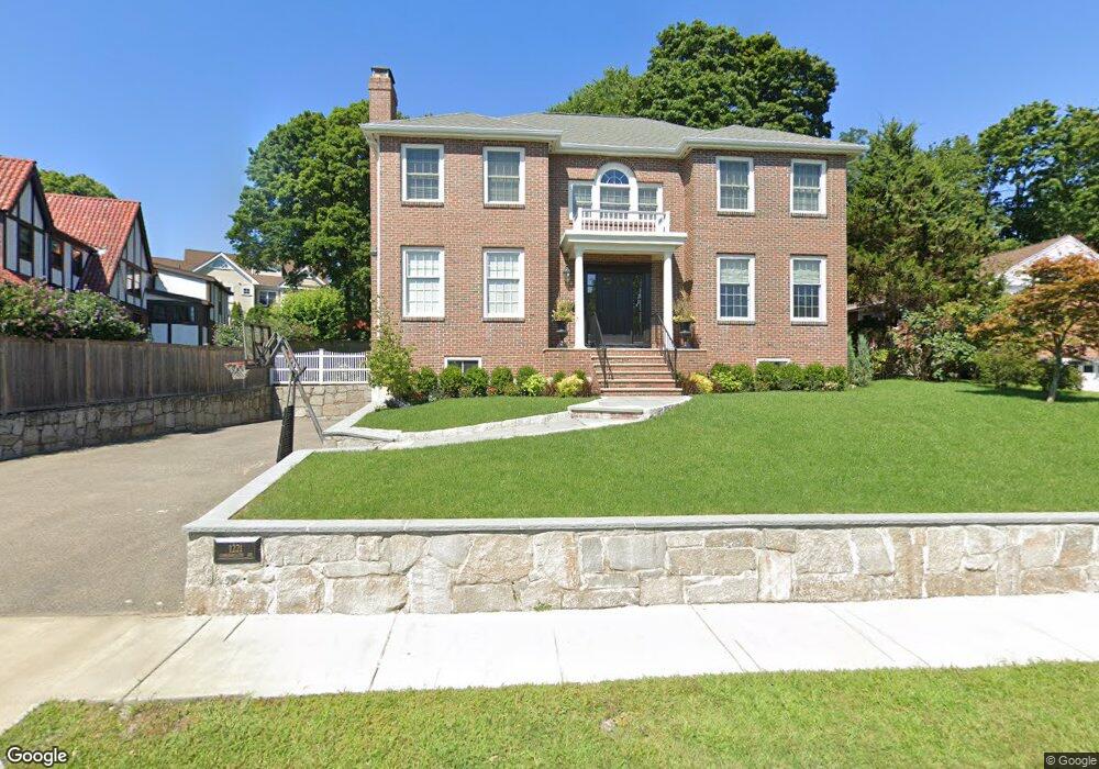
1221 Commonwealth Ave West Newton, MA 02465
West Newton NeighborhoodEstimated Value: $2,634,000 - $3,084,000
5
Beds
6
Baths
4,119
Sq Ft
$694/Sq Ft
Est. Value
About This Home
This home is located at 1221 Commonwealth Ave, West Newton, MA 02465 and is currently estimated at $2,857,627, approximately $693 per square foot. 1221 Commonwealth Ave is a home located in Middlesex County with nearby schools including Peirce Elementary School, F.A. Day Middle School, and Newton North High School.
Ownership History
Date
Name
Owned For
Owner Type
Purchase Details
Closed on
Feb 24, 2017
Sold by
Shale Rodman K and Shale Susan J
Bought by
201 Rodman K Shale Ret
Current Estimated Value
Purchase Details
Closed on
Jun 22, 1995
Sold by
Montepare John W and Fabrizio Donald P
Bought by
Shale Rodman K and Shale Susan J
Home Financials for this Owner
Home Financials are based on the most recent Mortgage that was taken out on this home.
Original Mortgage
$370,000
Interest Rate
7.82%
Mortgage Type
Purchase Money Mortgage
Create a Home Valuation Report for This Property
The Home Valuation Report is an in-depth analysis detailing your home's value as well as a comparison with similar homes in the area
Home Values in the Area
Average Home Value in this Area
Purchase History
| Date | Buyer | Sale Price | Title Company |
|---|---|---|---|
| 201 Rodman K Shale Ret | -- | -- | |
| Shale Rodman K | $620,000 | -- |
Source: Public Records
Mortgage History
| Date | Status | Borrower | Loan Amount |
|---|---|---|---|
| Previous Owner | Shale Rodman K | $523,750 | |
| Previous Owner | Shale Rodman K | $121,000 | |
| Previous Owner | Shale Rodman K | $370,000 |
Source: Public Records
Tax History Compared to Growth
Tax History
| Year | Tax Paid | Tax Assessment Tax Assessment Total Assessment is a certain percentage of the fair market value that is determined by local assessors to be the total taxable value of land and additions on the property. | Land | Improvement |
|---|---|---|---|---|
| 2025 | $26,412 | $2,695,100 | $1,217,500 | $1,477,600 |
| 2024 | $25,538 | $2,616,600 | $1,182,000 | $1,434,600 |
| 2023 | $24,766 | $2,432,800 | $912,400 | $1,520,400 |
| 2022 | $23,697 | $2,252,600 | $844,800 | $1,407,800 |
| 2021 | $22,866 | $2,125,100 | $797,000 | $1,328,100 |
| 2020 | $22,186 | $2,125,100 | $797,000 | $1,328,100 |
| 2019 | $21,560 | $2,063,200 | $773,800 | $1,289,400 |
| 2018 | $20,822 | $1,924,400 | $703,600 | $1,220,800 |
| 2017 | $20,188 | $1,815,500 | $663,800 | $1,151,700 |
| 2016 | $19,308 | $1,696,700 | $620,400 | $1,076,300 |
| 2015 | $18,410 | $1,585,700 | $579,800 | $1,005,900 |
Source: Public Records
Map
Nearby Homes
- 46 Ellis Rd
- 308 Prince St
- 4 Coyne Rd Unit 4
- 222 Prince St
- 50 Crestwood Rd
- 154 Beaumont Ave
- 61 Lakeview Ave
- 279 Chestnut St
- 249 Highland St
- 443 Chestnut St
- 45 Bonnybrook Rd
- 479 Chestnut St
- 513 Chestnut St
- 15 Allen Ave
- 25 Allen Ave
- 1430 Beacon St
- 1114 Beacon St Unit 106
- 1114 Beacon St Unit 103
- 1114 Beacon St Unit 111
- 1114 Beacon St Unit 109
- 78 Wauwinet Rd
- 1215 Commonwealth Ave
- 54 Ellis Rd
- 62 Ellis Rd
- 70 Wauwinet Rd
- 1245 Commonwealth Ave
- 1245 Commonwealth Ave
- 38 Ellis Rd
- 1230 Commonwealth Ave
- 55 Ellis Rd
- 1234 Commonwealth Ave
- 65 Wauwinet Rd
- 45 Ellis Rd
- 1193 Commonwealth Ave
- 1238 Commonwealth Ave
- 37 Ellis Rd
- 30 Ellis Rd
- 50 Wauwinet Rd
- 55 Wauwinet Rd
- 1181 Commonwealth Ave