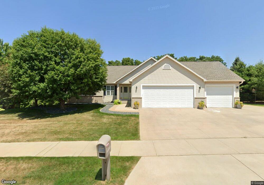
1221 Lone Pine Dr SW Rochester, MN 55902
Estimated Value: $500,000 - $611,000
4
Beds
3
Baths
3,214
Sq Ft
$168/Sq Ft
Est. Value
About This Home
This home is located at 1221 Lone Pine Dr SW, Rochester, MN 55902 and is currently estimated at $539,278, approximately $167 per square foot. 1221 Lone Pine Dr SW is a home located in Olmsted County with nearby schools including Bamber Valley Elementary School, Willow Creek Middle School, and Mayo Senior High School.
Ownership History
Date
Name
Owned For
Owner Type
Purchase Details
Closed on
May 27, 2016
Sold by
Ayers John D and Ayers Donna L
Bought by
Hodny Travis and Hodny Rachael
Current Estimated Value
Home Financials for this Owner
Home Financials are based on the most recent Mortgage that was taken out on this home.
Original Mortgage
$320,100
Outstanding Balance
$255,509
Interest Rate
3.66%
Mortgage Type
New Conventional
Estimated Equity
$283,769
Purchase Details
Closed on
Jul 6, 2006
Sold by
Clemens Brad A and Clemens Laurie
Bought by
Ayers John D and Ayers Donna L
Home Financials for this Owner
Home Financials are based on the most recent Mortgage that was taken out on this home.
Original Mortgage
$311,900
Interest Rate
6.73%
Mortgage Type
New Conventional
Create a Home Valuation Report for This Property
The Home Valuation Report is an in-depth analysis detailing your home's value as well as a comparison with similar homes in the area
Home Values in the Area
Average Home Value in this Area
Purchase History
| Date | Buyer | Sale Price | Title Company |
|---|---|---|---|
| Hodny Travis | $337,000 | Edina Realty Title Inc | |
| Ayers John D | $389,900 | Edina Title Rochester |
Source: Public Records
Mortgage History
| Date | Status | Borrower | Loan Amount |
|---|---|---|---|
| Open | Hodny Travis | $320,100 | |
| Previous Owner | Ayers John D | $311,900 |
Source: Public Records
Tax History Compared to Growth
Tax History
| Year | Tax Paid | Tax Assessment Tax Assessment Total Assessment is a certain percentage of the fair market value that is determined by local assessors to be the total taxable value of land and additions on the property. | Land | Improvement |
|---|---|---|---|---|
| 2024 | $6,484 | $463,100 | $50,000 | $413,100 |
| 2023 | $5,840 | $463,700 | $50,000 | $413,700 |
| 2022 | $5,040 | $425,700 | $50,000 | $375,700 |
| 2021 | $4,746 | $369,800 | $50,000 | $319,800 |
| 2020 | $4,872 | $349,500 | $50,000 | $299,500 |
| 2019 | $4,664 | $344,600 | $50,000 | $294,600 |
| 2018 | $4,462 | $332,600 | $42,000 | $290,600 |
| 2017 | $4,462 | $327,000 | $42,000 | $285,000 |
| 2016 | $4,086 | $304,400 | $40,800 | $263,600 |
| 2015 | $3,650 | $272,200 | $40,300 | $231,900 |
| 2014 | $3,600 | $258,700 | $40,000 | $218,700 |
| 2012 | -- | $263,600 | $40,113 | $223,487 |
Source: Public Records
Map
Nearby Homes
- 5512 Leslie Ln SW
- XXXX 11th Ave SW
- 5182 Southern Ridge Ln SW
- 5274 Southwood Dr SW
- 2304 Britwood Ln SW
- 479 Pointe Ct SW
- 4887 Tee Ct SW
- 2630 Scenic Point Dr SW
- 5044 Schumard Ct SE
- 2674 Scenic Point Dr SW
- 2608 Bentley Dr SW
- 2657 Scenic Point Dr SW
- 2656 Bentley Dr SW
- 2764 Scenic Point Dr SW
- 2720 Bentley Dr SW
- 2732 Bentley Dr SW
- 2901 Bentley Dr SW
- 2917 Bentley Dr SW
- 2909 Bentley Dr SW
- 14 Tyrol Dr SE
- 1229 Lone Pine Dr SW
- 5549 Leslie Ln SW
- 1301 Lone Pine Dr SW
- 1220 Lone Pine Dr SW
- 1228 Lone Pine Dr SW
- 1212 Lone Pine Dr SW
- 1236 Lone Pine Dr SW
- 5543 Leslie Ln SW
- 1204 Lone Pine Dr SW
- 1309 Lone Pine Dr SW
- 5535 Leslie Ln SW
- 1302 Lone Pine Dr SW
- 5554 Leslie Ln SW
- 5548 Leslie Ln SW
- 1310 Lone Pine Dr SW
- 5542 Leslie Ln SW
- 1315 Lone Pine Dr SW
- 5521 Leslie Ln SW
- 1120 Lone Pine Dr SW
- 5515 Leslie Ln SW