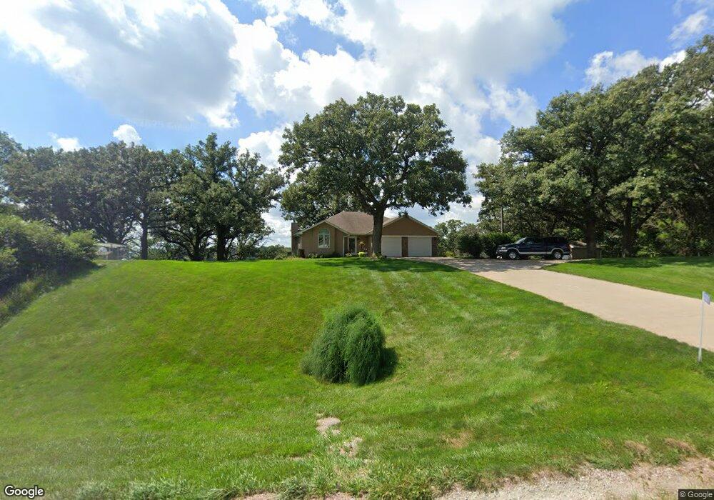
1221 W Highway 37 Dunlap, IA 51529
Estimated Value: $165,000 - $437,000
3
Beds
1
Bath
1,238
Sq Ft
$257/Sq Ft
Est. Value
About This Home
This home is located at 1221 W Highway 37, Dunlap, IA 51529 and is currently estimated at $318,085, approximately $256 per square foot. 1221 W Highway 37 is a home located in Crawford County with nearby schools including Boyer Valley Elementary School and Boyer Valley Middle/High School.
Ownership History
Date
Name
Owned For
Owner Type
Purchase Details
Closed on
Apr 21, 2005
Sold by
Thomas David V and Thomas Geraldine G
Bought by
Losh Donald D and Losh Nora L
Current Estimated Value
Home Financials for this Owner
Home Financials are based on the most recent Mortgage that was taken out on this home.
Original Mortgage
$144,000
Outstanding Balance
$75,608
Interest Rate
6.05%
Mortgage Type
New Conventional
Estimated Equity
$242,477
Create a Home Valuation Report for This Property
The Home Valuation Report is an in-depth analysis detailing your home's value as well as a comparison with similar homes in the area
Home Values in the Area
Average Home Value in this Area
Purchase History
| Date | Buyer | Sale Price | Title Company |
|---|---|---|---|
| Losh Donald D | $180,000 | None Available |
Source: Public Records
Mortgage History
| Date | Status | Borrower | Loan Amount |
|---|---|---|---|
| Open | Losh Donald D | $144,000 |
Source: Public Records
Tax History Compared to Growth
Tax History
| Year | Tax Paid | Tax Assessment Tax Assessment Total Assessment is a certain percentage of the fair market value that is determined by local assessors to be the total taxable value of land and additions on the property. | Land | Improvement |
|---|---|---|---|---|
| 2025 | $3,200 | $284,100 | $35,000 | $249,100 |
| 2024 | $3,200 | $277,720 | $35,000 | $242,720 |
| 2023 | $3,100 | $277,720 | $35,000 | $242,720 |
| 2022 | $3,058 | $233,510 | $35,000 | $198,510 |
| 2021 | $2,956 | $233,510 | $35,000 | $198,510 |
| 2020 | $2,906 | $212,030 | $25,000 | $187,030 |
| 2019 | $2,698 | $193,810 | $15,000 | $178,810 |
| 2018 | $2,660 | $193,810 | $15,000 | $178,810 |
| 2017 | $2,660 | $193,810 | $15,000 | $178,810 |
| 2016 | $2,622 | $182,230 | $0 | $0 |
| 2015 | $2,622 | $166,900 | $0 | $0 |
| 2014 | $2,340 | $166,900 | $0 | $0 |
Source: Public Records
Map
Nearby Homes
- 202 Y St
- 1403 Eaton St
- 32055 Spruce Ave
- 211 Brookview Dr
- 2074 U Ave
- 37 10th St
- 39472 280th St
- 808 Park St
- 907 Harvest Hills Dr
- 102 Bluegrass Ln
- 101 Bluegrass Ln
- 42 6th St
- 106 Bluegrass Ln
- 905 Harvest Hills Dr
- 111 Ridgeline Rd
- 906 Harvest Hills Dr
- 903 Harvest Hills Dr
- 118 Ridgeline Rd
- 904 Harvest Hills Dr
- 1222 W Highway 37
- 1212 W Highway 37
- 1224 W Highway 37
- 1224 Iowa 37
- 1208 W Highway 37
- 1205 W Highway 37
- 1192 W Highway 37
- 1192 W Highway 37
- 1189 Hwy 37
- 1029 Tabor Ave
- 3381 130th St
- 3391 130th St
- 1139 Nelson Hollow
- 1141 W Highway 37
- 3337 130th St
- 3489 340th St
- 3327 130th St
- 1128 Nelson Hollow
- 1131 Nelson Hollow
- 1107 Street