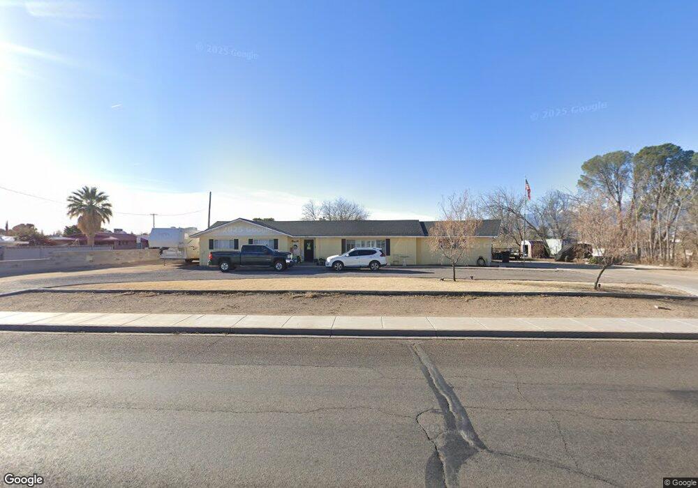
1221 W Relation St Safford, AZ 85546
Estimated Value: $290,838 - $337,000
--
Bed
--
Bath
1,896
Sq Ft
$168/Sq Ft
Est. Value
About This Home
This home is located at 1221 W Relation St, Safford, AZ 85546 and is currently estimated at $319,210, approximately $168 per square foot. 1221 W Relation St is a home located in Graham County with nearby schools including Ruth Powell Elementary School, Dorothy Stinson School, and Lafe Nelson School.
Ownership History
Date
Name
Owned For
Owner Type
Purchase Details
Closed on
May 4, 2020
Sold by
Stauffer Miles Ivery and Stauffer Denise
Bought by
Cochran Jennifer Jacobson and Cochran Mason David
Current Estimated Value
Home Financials for this Owner
Home Financials are based on the most recent Mortgage that was taken out on this home.
Original Mortgage
$196,377
Outstanding Balance
$174,666
Interest Rate
3.5%
Mortgage Type
FHA
Estimated Equity
$144,544
Purchase Details
Closed on
Feb 9, 2010
Sold by
Stauffer James Christian and Stauffer Bailey Low
Bought by
Stauffer Miles Ivery
Create a Home Valuation Report for This Property
The Home Valuation Report is an in-depth analysis detailing your home's value as well as a comparison with similar homes in the area
Home Values in the Area
Average Home Value in this Area
Purchase History
| Date | Buyer | Sale Price | Title Company |
|---|---|---|---|
| Cochran Jennifer Jacobson | $200,000 | Stewart Ttl & Tr Of Phoenix | |
| Stauffer Miles Ivery | -- | Safford Title Agency Inc |
Source: Public Records
Mortgage History
| Date | Status | Borrower | Loan Amount |
|---|---|---|---|
| Open | Cochran Jennifer Jacobson | $196,377 |
Source: Public Records
Tax History Compared to Growth
Tax History
| Year | Tax Paid | Tax Assessment Tax Assessment Total Assessment is a certain percentage of the fair market value that is determined by local assessors to be the total taxable value of land and additions on the property. | Land | Improvement |
|---|---|---|---|---|
| 2026 | $1,166 | -- | -- | -- |
| 2025 | $1,166 | $23,082 | $2,371 | $20,711 |
| 2024 | $1,212 | $21,619 | $2,371 | $19,248 |
| 2023 | $1,212 | $18,210 | $2,186 | $16,024 |
| 2022 | $1,185 | $15,802 | $2,186 | $13,616 |
| 2021 | $1,312 | $0 | $0 | $0 |
| 2020 | $1,262 | $0 | $0 | $0 |
| 2019 | $1,331 | $0 | $0 | $0 |
| 2018 | $1,267 | $0 | $0 | $0 |
| 2017 | $1,131 | $0 | $0 | $0 |
| 2016 | $1,040 | $0 | $0 | $0 |
| 2015 | $950 | $0 | $0 | $0 |
Source: Public Records
Map
Nearby Homes
- 1115 W Relation St
- 1309 S Bingham Place
- 1536 W Cherokee Ln
- 813 W 13th St
- 1101 S 9th Place
- 1227 S 7th Ave
- 1808 Mesa Cir
- 1116 S 6th Ave
- 1544 Stone Willow Dr
- 1906 S Elm Ave
- 860 S Flagstone Way
- 1104 S Central Ave
- 5052 S 20th Ave Unit 141
- 616 W 7th St
- 0 S 20th Ave Unit no 22325261
- 120 Relation St Unit 2
- 115 W 15th St
- 2190 S Mason Way
- 1204 S 1st Ave
- 1017 W Tucson St
- 1206 W Relation St
- 1407 S 12th Ave
- 1315 W Relation St
- 1220 W Relation St
- 1409 S 12th Ave
- 1200 W Relation St
- 1107 W Relation St
- 1264 W Relation St
- 1411 S 12th Ave
- 1120 W Relation St
- 1202 W Relation St
- 1105 W Relation St
- 1319 W Relation St
- 1413 S 12th Ave
- 1292 W Relation St
- 1326 S 11th Ave
- 1502 S 12th Ave
- 1103 W Relation St
- 1320 S 11th Ave
- TBD Relation St