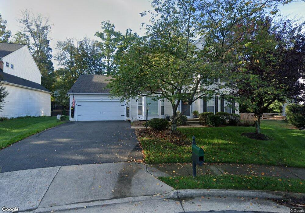
12211 Murdo Ct Bristow, VA 20136
Villages At Saybrooke NeighborhoodEstimated Value: $687,000 - $811,000
4
Beds
3
Baths
2,438
Sq Ft
$302/Sq Ft
Est. Value
About This Home
This home is located at 12211 Murdo Ct, Bristow, VA 20136 and is currently estimated at $736,173, approximately $301 per square foot. 12211 Murdo Ct is a home located in Prince William County with nearby schools including Patriot High School, Cedar Point Elementary School, and E.H. Marsteller Middle School.
Ownership History
Date
Name
Owned For
Owner Type
Purchase Details
Closed on
Jun 15, 2001
Sold by
Martin Leslie D
Bought by
Pierre Rogers Ronald V
Current Estimated Value
Home Financials for this Owner
Home Financials are based on the most recent Mortgage that was taken out on this home.
Original Mortgage
$262,000
Outstanding Balance
$99,874
Interest Rate
7.15%
Estimated Equity
$636,299
Purchase Details
Closed on
May 28, 1999
Sold by
N V R Inc
Bought by
Martin Leslie D
Home Financials for this Owner
Home Financials are based on the most recent Mortgage that was taken out on this home.
Original Mortgage
$204,700
Interest Rate
6.82%
Create a Home Valuation Report for This Property
The Home Valuation Report is an in-depth analysis detailing your home's value as well as a comparison with similar homes in the area
Home Values in the Area
Average Home Value in this Area
Purchase History
| Date | Buyer | Sale Price | Title Company |
|---|---|---|---|
| Pierre Rogers Ronald V | $327,500 | -- | |
| Martin Leslie D | $255,919 | -- |
Source: Public Records
Mortgage History
| Date | Status | Borrower | Loan Amount |
|---|---|---|---|
| Open | Pierre Rogers Ronald V | $262,000 | |
| Previous Owner | Martin Leslie D | $204,700 |
Source: Public Records
Tax History
| Year | Tax Paid | Tax Assessment Tax Assessment Total Assessment is a certain percentage of the fair market value that is determined by local assessors to be the total taxable value of land and additions on the property. | Land | Improvement |
|---|---|---|---|---|
| 2025 | $5,668 | $629,300 | $204,500 | $424,800 |
| 2024 | $5,668 | $569,900 | $194,900 | $375,000 |
| 2023 | $5,601 | $538,300 | $174,900 | $363,400 |
| 2022 | $5,762 | $510,000 | $147,900 | $362,100 |
| 2021 | $5,508 | $450,800 | $129,600 | $321,200 |
| 2020 | $6,445 | $415,800 | $122,200 | $293,600 |
| 2019 | $6,327 | $408,200 | $122,200 | $286,000 |
| 2018 | $4,773 | $395,300 | $116,400 | $278,900 |
| 2017 | $4,784 | $387,400 | $116,400 | $271,000 |
| 2016 | $4,684 | $382,800 | $115,000 | $267,800 |
| 2015 | $4,671 | $378,000 | $115,000 | $263,000 |
| 2014 | $4,671 | $373,600 | $110,600 | $263,000 |
Source: Public Records
Map
Nearby Homes
- 12217 Wheat Mill Loop
- 12203 Aster Rd
- 12172 Aster Rd
- 12151 Drum Salute Place
- 10351 Spring Iris Dr
- 12360 Corncrib Ct
- 12511 Heykens Ln
- 12458 Hadrians Ct
- 12021 Spring Beauty Rd
- 12017 Youngtree Ct
- 10582 Poagues Battery Dr
- 11701 Town Green Rd
- 10615 Bristow Station Dr
- 9822 Maitland Loop
- 11650 Iron Brigade Unit Ave
- 9856 Maitland Loop
- 10410 Kettle Run Rd
- 11747 Alexander Hays Rd
- 9568 Tarvie Cir
- 9653 Innerwick Place
- 12210 Murdo Ct
- 12310 Cold Stream Guard Ct
- 12314 Cold Stream Guard Ct
- 12309 Cold Stream Guard Ct
- 12219 Murdo Ct
- 10132 Middlebrooks Terrace
- 12322 Cold Stream Guard Ct
- 10136 Middlebrooks Terrace
- 10128 Middlebrooks Terrace
- 12214 Murdo Ct
- 12218 Murdo Ct
- 12223 Murdo Ct
- 12318 Cold Stream Guard Ct
- 10099 Tummel Falls Dr
- 10124 Middlebrooks Terrace
- 12326 Cold Stream Guard Ct
- 12311 Cold Stream Guard Ct
- 12222 Murdo Ct
- 10103 Tummel Falls Dr
- 10120 Middlebrooks Terrace
Your Personal Tour Guide
Ask me questions while you tour the home.