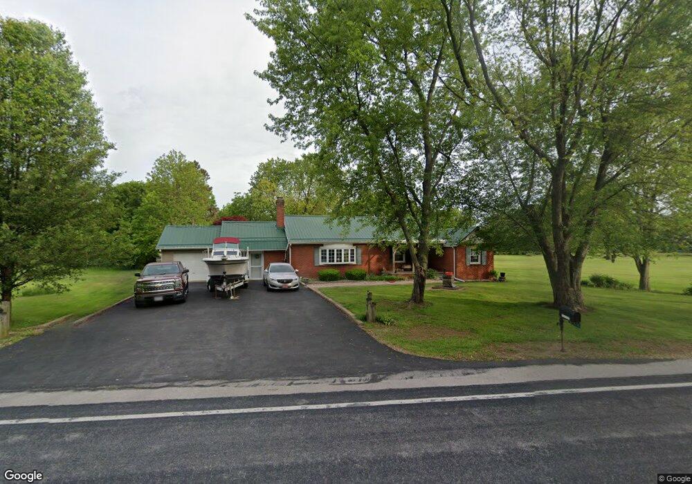
12215 Patten Tract Rd Monroeville, OH 44847
Estimated Value: $153,000 - $211,000
4
Beds
2
Baths
1,554
Sq Ft
$114/Sq Ft
Est. Value
About This Home
This home is located at 12215 Patten Tract Rd, Monroeville, OH 44847 and is currently estimated at $177,926, approximately $114 per square foot. 12215 Patten Tract Rd is a home located in Erie County with nearby schools including Monroeville Elementary School, Monroeville High School, and St Joseph Catholic School.
Ownership History
Date
Name
Owned For
Owner Type
Purchase Details
Closed on
Mar 2, 2023
Sold by
Kennedy Vernon C and Kennedy Kathleen
Bought by
Kennedy Vernon C and Kennedy Kathleen
Current Estimated Value
Purchase Details
Closed on
Jan 1, 1987
Bought by
Kennedy Vernon C and Kennedy Kathleen
Create a Home Valuation Report for This Property
The Home Valuation Report is an in-depth analysis detailing your home's value as well as a comparison with similar homes in the area
Purchase History
| Date | Buyer | Sale Price | Title Company |
|---|---|---|---|
| Kennedy Vernon C | -- | -- | |
| Kennedy Vernon C | -- | -- |
Source: Public Records
Tax History
| Year | Tax Paid | Tax Assessment Tax Assessment Total Assessment is a certain percentage of the fair market value that is determined by local assessors to be the total taxable value of land and additions on the property. | Land | Improvement |
|---|---|---|---|---|
| 2024 | $822 | $42,476 | $8,757 | $33,719 |
| 2023 | $1,246 | $30,862 | $6,632 | $24,230 |
| 2022 | $964 | $30,859 | $6,632 | $24,227 |
| 2021 | $934 | $30,860 | $6,630 | $24,230 |
| 2020 | $760 | $26,240 | $6,630 | $19,610 |
| 2019 | $785 | $26,240 | $6,630 | $19,610 |
| 2018 | $786 | $26,240 | $6,630 | $19,610 |
| 2017 | $757 | $25,680 | $5,840 | $19,840 |
| 2016 | $747 | $25,680 | $5,840 | $19,840 |
| 2015 | $748 | $25,680 | $5,840 | $19,840 |
| 2014 | $652 | $25,680 | $5,840 | $19,840 |
| 2013 | $688 | $25,680 | $5,840 | $19,840 |
Source: Public Records
Map
Nearby Homes
- 12310 Patten Tract Rd
- 4308 River Rd
- 2 Eagle View Dr
- 117 North St
- 101 North St
- 113 North St
- 6012 Mason Rd
- 17 Hollister St
- 9 Herrick Aly
- 40 Monroe St
- 15 Jackson St
- 8109 Hayes Ave
- 7117 Mason Rd
- 1328 Lovers Lane Rd
- 3050 E Main St
- 8802 Mason Rd
- 65 Grassland Cir
- 28 Amber Way
- 144 Sycamore Dr
- 12714 US Highway 250 N
- 12211 Patten Tract Rd
- 12303 Patten Tract Rd
- 12303 Patten Tract Rd
- 12206 Patten Tract Rd
- 12313 Patten Tract Rd
- 12309 Patten Tract Rd
- 12319 Patten Tract Rd
- 12511 Patten Tract
- 11917 Patten Tract Rd
- 11819 Patten Tract Rd
- 12610 Patten Tract Rd
- 5615 Delematre Rd
- 11715 Patten Tract Rd
- 5601 Delematre Rd
- 12718 Patten Tract Rd
- 5425 Delematre Rd
- 5411 Delematre Rd
- 11703 Patten Tract
- 5315 Delematre Rd
- 12815 Patten Tract Rd
Your Personal Tour Guide
Ask me questions while you tour the home.