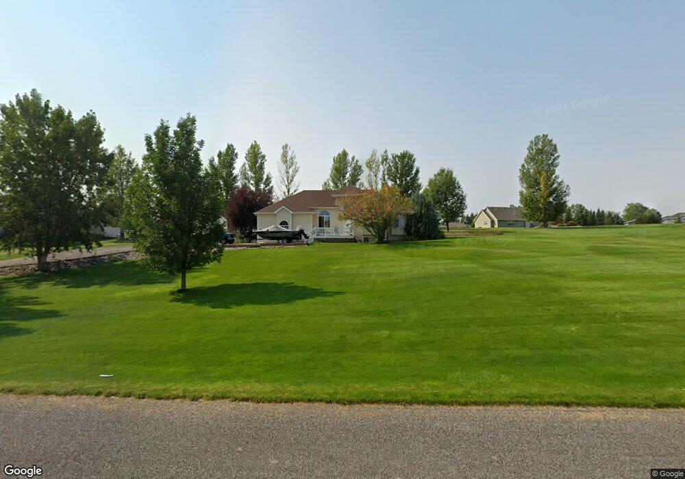
1222 Clarhill Rd Laurel, MT 59044
Estimated Value: $592,000 - $752,000
3
Beds
2
Baths
1,444
Sq Ft
$456/Sq Ft
Est. Value
About This Home
This home is located at 1222 Clarhill Rd, Laurel, MT 59044 and is currently estimated at $657,908, approximately $455 per square foot. 1222 Clarhill Rd is a home located in Yellowstone County with nearby schools including Fred W. Graff School, West School, and Laurel Middle School.
Ownership History
Date
Name
Owned For
Owner Type
Purchase Details
Closed on
Nov 25, 2008
Sold by
Schlegelmilch Donald D
Bought by
Tucker Jeffery A and Tucker Shari R
Current Estimated Value
Home Financials for this Owner
Home Financials are based on the most recent Mortgage that was taken out on this home.
Original Mortgage
$185,000
Outstanding Balance
$123,663
Interest Rate
6.37%
Mortgage Type
Unknown
Estimated Equity
$534,245
Purchase Details
Closed on
Jun 26, 2007
Sold by
Schlegelmilch Marlys K
Bought by
Schlegelmilch Donald D
Create a Home Valuation Report for This Property
The Home Valuation Report is an in-depth analysis detailing your home's value as well as a comparison with similar homes in the area
Home Values in the Area
Average Home Value in this Area
Purchase History
| Date | Buyer | Sale Price | Title Company |
|---|---|---|---|
| Tucker Jeffery A | -- | None Available | |
| Schlegelmilch Donald D | -- | None Available |
Source: Public Records
Mortgage History
| Date | Status | Borrower | Loan Amount |
|---|---|---|---|
| Open | Tucker Jeffery A | $185,000 |
Source: Public Records
Tax History
| Year | Tax Paid | Tax Assessment Tax Assessment Total Assessment is a certain percentage of the fair market value that is determined by local assessors to be the total taxable value of land and additions on the property. | Land | Improvement |
|---|---|---|---|---|
| 2025 | $3,370 | $565,600 | $109,300 | $456,300 |
| 2024 | $3,370 | $479,800 | $85,000 | $394,800 |
| 2023 | $3,369 | $479,800 | $85,000 | $394,800 |
| 2022 | $2,399 | $371,600 | $0 | $0 |
| 2021 | $2,692 | $371,600 | $0 | $0 |
| 2020 | $2,610 | $344,980 | $0 | $0 |
| 2019 | $2,517 | $344,980 | $0 | $0 |
| 2018 | $2,766 | $330,000 | $0 | $0 |
| 2017 | $2,532 | $330,000 | $0 | $0 |
| 2016 | $2,380 | $313,400 | $0 | $0 |
| 2015 | $2,345 | $313,400 | $0 | $0 |
| 2014 | $2,158 | $153,647 | $0 | $0 |
Source: Public Records
Map
Nearby Homes
- 1031 Fir Ave
- 1665 Wild Lupine Ln
- 1108 E 8th St
- 1104 E 8th St
- 1319 Valley Dr
- 809 Pennsylvania Ave
- 1631 Valley Dr
- 605 Date Ave
- 717 E 5th, 506 Alder Ave
- 717 E 5th St
- 601 E 5th St
- 801 E 4th St
- 516 Pennsylvania Ave
- 414 Wyoming Ave
- 1254 W Beartooth Dr
- 1216 W 12th Street Cir
- 110 E 5th St
- 1735 Lobo Dr
- 1627 Brookway Cir
- 1906 Waterwood Dr
- 1238 Clarhill Rd
- 1126 Clarhill Rd
- 1517 Hill Crest Ave
- 1531 Hill Crest Ave
- 1223 Clarhill Rd
- 1505 Hill Crest Ave
- 1547 Hill Crest Ave
- 1308 Clarhill Rd
- 1329 Downy Rd
- 1532 Hill Crest Ave
- 1433 Hill Crest Ave
- 1518 Hill Crest Ave
- 1320 Clarhill Rd
- 1548 Hill Crest Ave
- 1540 Hill Crest Ave
- 1436 Hill Crest Ave
- 1332 Clarhill Rd
- 1405 Downy Rd
- 1402 Downy Rd
- 1422 Hill Crest Ave
Your Personal Tour Guide
Ask me questions while you tour the home.