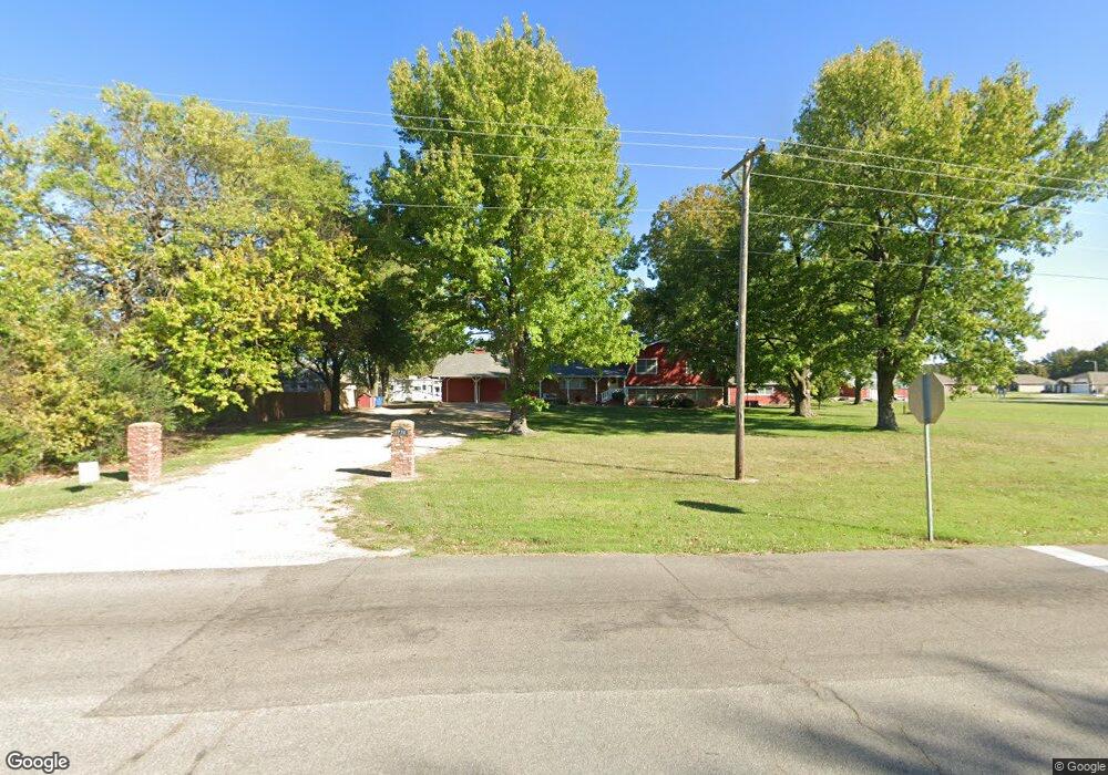
1222 W Par Cir Neosho, MO 64850
Estimated Value: $340,000 - $371,000
4
Beds
2
Baths
2,228
Sq Ft
$160/Sq Ft
Est. Value
About This Home
This home is located at 1222 W Par Cir, Neosho, MO 64850 and is currently estimated at $357,539, approximately $160 per square foot. 1222 W Par Cir is a home located in Newton County with nearby schools including Neosho High School, Ozark Christian Academy, and Neosho Christian Schools.
Ownership History
Date
Name
Owned For
Owner Type
Purchase Details
Closed on
Nov 22, 2024
Sold by
Boyd Jarrod P and Cooley Erin Leigh
Bought by
Crecelius Rebecca and Crecelius Roy
Current Estimated Value
Home Financials for this Owner
Home Financials are based on the most recent Mortgage that was taken out on this home.
Original Mortgage
$342,000
Outstanding Balance
$338,722
Interest Rate
6.32%
Mortgage Type
VA
Estimated Equity
$18,817
Purchase Details
Closed on
Jul 25, 2023
Sold by
Megan D Kivett Llc
Bought by
Boyd Jarrod P
Home Financials for this Owner
Home Financials are based on the most recent Mortgage that was taken out on this home.
Original Mortgage
$160,100
Interest Rate
6.69%
Mortgage Type
New Conventional
Create a Home Valuation Report for This Property
The Home Valuation Report is an in-depth analysis detailing your home's value as well as a comparison with similar homes in the area
Home Values in the Area
Average Home Value in this Area
Purchase History
| Date | Buyer | Sale Price | Title Company |
|---|---|---|---|
| Crecelius Rebecca | -- | None Listed On Document | |
| Crecelius Rebecca | -- | None Listed On Document | |
| Boyd Jarrod P | -- | None Listed On Document |
Source: Public Records
Mortgage History
| Date | Status | Borrower | Loan Amount |
|---|---|---|---|
| Open | Crecelius Rebecca | $342,000 | |
| Closed | Crecelius Rebecca | $342,000 | |
| Previous Owner | Boyd Jarrod P | $160,100 |
Source: Public Records
Tax History Compared to Growth
Tax History
| Year | Tax Paid | Tax Assessment Tax Assessment Total Assessment is a certain percentage of the fair market value that is determined by local assessors to be the total taxable value of land and additions on the property. | Land | Improvement |
|---|---|---|---|---|
| 2024 | $2,348 | $42,770 | -- | -- |
| 2023 | $2,348 | $42,770 | $7,467 | $35,303 |
| 2022 | $2,348 | $39,080 | -- | -- |
| 2021 | $2,144 | $39,080 | $0 | $0 |
| 2020 | $1,420 | $34,900 | $0 | $0 |
| 2019 | $1,737 | $34,900 | $0 | $0 |
Source: Public Records
Map
Nearby Homes
- 2032 Eagle Dr
- 2007 Bogey Ln
- 005 Kodiak Rd
- 2203 Timbercrest Dr
- 1003 Greenbrook Dr
- 11438 Norway Rd
- 1700 Ankney Place
- 000 Kodiak Road & Garrow Blvd
- TBD Kodiak Rd & Garrow Blvd
- 15084 Mm Hwy
- 1214 Linden Terrace
- 32 Acres Nettle Dr
- 1330 Stoneledge Ln
- 006 Kodiak Rd
- 1701 Village Ln
- 2.89 Ac W Daugherty Rd
- 1895 Industrial Dr
- 5.11+/- Acres Industrial Dr
- 1936 Verdant Ave
- 2208 Sunset Cir
- 1220 W Par Cir
- 1218 W Par Cir
- 2029 Eagle Dr
- 1776 Waldo Hatler Memorial Dr
- 1216 W Par Cir
- 2027 Eagle Dr
- 2034 Eagle Dr
- 2030 Eagle Dr
- 2036 Eagle Dr
- 2028 Eagle Dr
- 2025 Eagle Dr
- 2038 Eagle Dr
- 2026 Eagle Dr
- 2040 Eagle Dr
- 1220 E Par Cir
- 1812 Waldo Hatler Memorial Dr
- 2023 Eagle Dr
- 1218 E Par Cir
- 1212 W Par Cir
- 1754 Waldo Hatler Memorial Dr