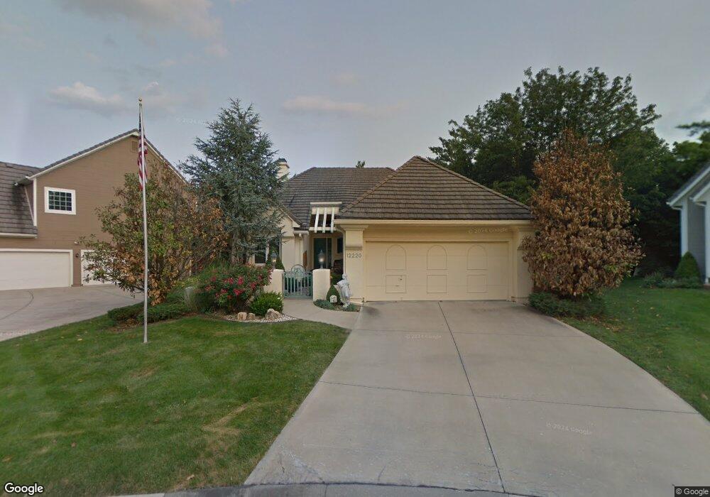
12220 Sagamore Rd Leawood, KS 66209
Estimated Value: $494,000 - $568,000
3
Beds
4
Baths
1,723
Sq Ft
$303/Sq Ft
Est. Value
About This Home
This home is located at 12220 Sagamore Rd, Leawood, KS 66209 and is currently estimated at $521,904, approximately $302 per square foot. 12220 Sagamore Rd is a home located in Johnson County with nearby schools including Leawood Elementary School, Leawood Middle School, and Blue Valley North High School.
Ownership History
Date
Name
Owned For
Owner Type
Purchase Details
Closed on
Nov 15, 2013
Sold by
Haynes Carrol E and Haynes Shirley J
Bought by
Shaw Thomas P and Haynes Kimberly K
Current Estimated Value
Home Financials for this Owner
Home Financials are based on the most recent Mortgage that was taken out on this home.
Original Mortgage
$254,600
Outstanding Balance
$190,244
Interest Rate
4.28%
Mortgage Type
New Conventional
Estimated Equity
$331,660
Purchase Details
Closed on
Nov 22, 2006
Sold by
Batty Alyce
Bought by
Haynes Carroll and Haynes Shirley
Create a Home Valuation Report for This Property
The Home Valuation Report is an in-depth analysis detailing your home's value as well as a comparison with similar homes in the area
Home Values in the Area
Average Home Value in this Area
Purchase History
| Date | Buyer | Sale Price | Title Company |
|---|---|---|---|
| Shaw Thomas P | -- | First American Title | |
| Haynes Carroll | -- | Stewart Title |
Source: Public Records
Mortgage History
| Date | Status | Borrower | Loan Amount |
|---|---|---|---|
| Open | Shaw Thomas P | $254,600 |
Source: Public Records
Tax History Compared to Growth
Tax History
| Year | Tax Paid | Tax Assessment Tax Assessment Total Assessment is a certain percentage of the fair market value that is determined by local assessors to be the total taxable value of land and additions on the property. | Land | Improvement |
|---|---|---|---|---|
| 2024 | $5,643 | $51,140 | $9,862 | $41,278 |
| 2023 | $5,610 | $49,967 | $9,862 | $40,105 |
| 2022 | $5,089 | $44,413 | $9,862 | $34,551 |
| 2021 | $4,940 | $41,055 | $9,862 | $31,193 |
| 2020 | $4,665 | $41,687 | $8,965 | $32,722 |
| 2019 | $4,797 | $38,375 | $8,965 | $29,410 |
| 2018 | $4,566 | $35,892 | $8,148 | $27,744 |
| 2017 | $3,958 | $30,636 | $6,790 | $23,846 |
| 2016 | $3,808 | $29,520 | $5,904 | $23,616 |
| 2015 | $3,811 | $29,187 | $5,904 | $23,283 |
| 2013 | -- | $28,336 | $5,362 | $22,974 |
Source: Public Records
Map
Nearby Homes
- 2213 W 122nd St
- 2200 W 121st St
- 1985 W 123rd Place
- 1013 W Santa fe Trail
- 2401 W 123rd Terrace
- 2405 W 123rd Terrace
- 905 W 122nd Terrace
- 12201 Aberdeen Rd
- 12380 Summit St
- 2313 W 127th St
- 11905 Madison Ave
- 12208 Avila Dr
- 12601 Overbrook Rd
- 12605 Overbrook Rd
- 12500 Overbrook Rd
- 11800 Madison Ave
- 1105 W Santa fe Trail
- 11712 Brookwood Ave
- 11721 Manor Rd
- 12763 Overbrook Rd
- 12222 Sagamore Rd
- 12218 Sagamore Rd
- 12224 Sagamore Rd
- 12216 Sagamore Rd
- 12226 Sagamore Rd
- 12214 Sagamore Rd
- 2016 W 123rd Terrace
- 2020 W 123rd Terrace
- 12213 Sagamore Rd
- 12212 Sagamore Rd
- 12223 Sagamore Rd
- 2012 W 123rd Terrace
- 12228 Sagamore Rd
- 2200 W 123rd Terrace
- 12225 Sagamore Rd
- 2008 W 123rd Terrace
- 2247 W 122nd Terrace
- 12230 Sagamore Rd
- 2017 W 123rd Terrace
- 2245 W 122nd Terrace