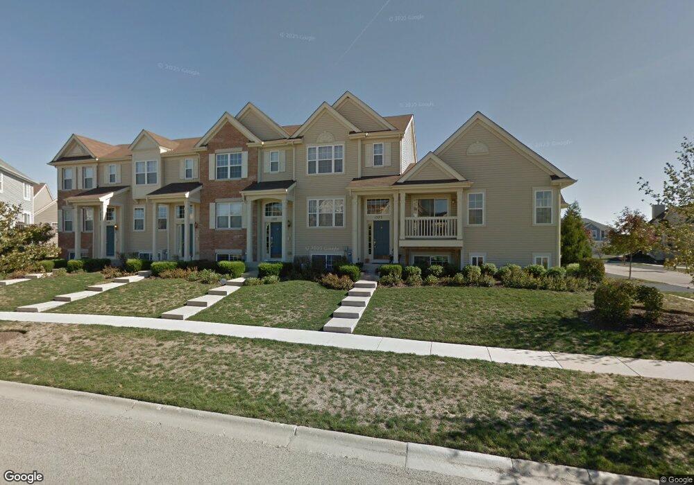
1223 Derry Ln Pingree Grove, IL 60140
Estimated Value: $277,859 - $293,000
3
Beds
3
Baths
1,757
Sq Ft
$163/Sq Ft
Est. Value
About This Home
This home is located at 1223 Derry Ln, Pingree Grove, IL 60140 and is currently estimated at $286,215, approximately $162 per square foot. 1223 Derry Ln is a home located in Kane County with nearby schools including Hampshire Middle School, Hampshire High School, and Cambridge Lakes Charter School.
Ownership History
Date
Name
Owned For
Owner Type
Purchase Details
Closed on
Apr 13, 2010
Sold by
Wells Fargo Bank Na
Bought by
Gunn Michael and Johnson Lucia
Current Estimated Value
Home Financials for this Owner
Home Financials are based on the most recent Mortgage that was taken out on this home.
Original Mortgage
$138,040
Outstanding Balance
$92,484
Interest Rate
5.12%
Mortgage Type
FHA
Estimated Equity
$193,731
Purchase Details
Closed on
Jan 5, 2010
Sold by
The Secretary Of Veterans Affairs
Bought by
Wells Fargo Bank Na
Purchase Details
Closed on
Mar 23, 2009
Sold by
Tylka John J and Fryman Jennifer L
Bought by
The Secretary Of Veteran Affairs
Create a Home Valuation Report for This Property
The Home Valuation Report is an in-depth analysis detailing your home's value as well as a comparison with similar homes in the area
Home Values in the Area
Average Home Value in this Area
Purchase History
| Date | Buyer | Sale Price | Title Company |
|---|---|---|---|
| Gunn Michael | $139,900 | Chicago Title | |
| Wells Fargo Bank Na | -- | Chicago Title | |
| The Secretary Of Veteran Affairs | -- | None Available |
Source: Public Records
Mortgage History
| Date | Status | Borrower | Loan Amount |
|---|---|---|---|
| Open | Gunn Michael | $138,040 |
Source: Public Records
Tax History
| Year | Tax Paid | Tax Assessment Tax Assessment Total Assessment is a certain percentage of the fair market value that is determined by local assessors to be the total taxable value of land and additions on the property. | Land | Improvement |
|---|---|---|---|---|
| 2024 | $5,238 | $70,209 | $14,428 | $55,781 |
| 2023 | $5,090 | $63,492 | $13,048 | $50,444 |
| 2022 | $4,992 | $58,539 | $12,030 | $46,509 |
| 2021 | $4,857 | $55,059 | $11,315 | $43,744 |
| 2020 | $4,767 | $53,653 | $11,026 | $42,627 |
| 2019 | $5,178 | $58,292 | $10,583 | $47,709 |
| 2018 | $5,032 | $54,708 | $9,932 | $44,776 |
| 2017 | $4,937 | $52,098 | $9,458 | $42,640 |
| 2016 | $4,915 | $49,598 | $9,004 | $40,594 |
| 2015 | -- | $46,844 | $8,504 | $38,340 |
| 2014 | -- | $46,844 | $8,504 | $38,340 |
| 2013 | -- | $48,911 | $8,660 | $40,251 |
Source: Public Records
Map
Nearby Homes
- 1260 Derry Ln
- 616 Yorkshire Ln
- 1145 Heritage Ct
- Lot 019 Old Stage Rd
- 1594 Hannah Ln Unit 1112
- 560 Lancaster Dr
- 1639 Rochester Rd
- 1175 Sonoma Ct
- 1433 Lighthouse Ln
- 1600 Bayberry Ln
- 1595 Bayberry Ln
- 1114 Port Royal Rd
- 707 Brighton Dr
- 1838 Southern Cir Unit 1838
- 1720 Bayberry Ln
- 1882 Southern Cir Unit 1882
- 1765 Kelley Ln
- 672 N Falls Cir
- 1655 Windward Dr
- 1664 Ruby Dr
- 1225 Derry Ln
- 1221 Derry Ln
- 1227 Derry Ln
- 1229 Derry Ln
- 1229 Derry Ln Unit 1229
- 928 Emerald Dr
- 926 Emerald Dr
- 930 Emerald Dr
- 924 Emerald Dr
- 922 Emerald Dr
- 1241 Derry Ln
- 920 Emerald Dr
- 1243 Derry Ln
- 951 Emerald Dr
- 1245 Derry Ln
- 1247 Derry Ln
- 961 Emerald Dr
- 963 Emerald Dr
- 953 Emerald Dr
- 965 Emerald Dr
Your Personal Tour Guide
Ask me questions while you tour the home.