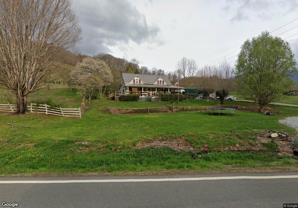
1223 Highway 143 Roan Mountain, TN 37687
Estimated Value: $162,018 - $285,000
3
Beds
1
Bath
1,396
Sq Ft
$158/Sq Ft
Est. Value
About This Home
This home is located at 1223 Highway 143, Roan Mountain, TN 37687 and is currently estimated at $220,255, approximately $157 per square foot. 1223 Highway 143 is a home located in Carter County.
Ownership History
Date
Name
Owned For
Owner Type
Purchase Details
Closed on
May 18, 2007
Sold by
Dyer Brian
Bought by
Wynn Avery B
Current Estimated Value
Purchase Details
Closed on
Oct 10, 2006
Sold by
Dyer Sharion
Bought by
Dyer Brian
Purchase Details
Closed on
Jun 28, 2006
Sold by
Dyer Sharion
Bought by
Carpenter Roger H
Purchase Details
Closed on
Sep 10, 1984
Bought by
Dyer Sharion and Dyer Wilma
Create a Home Valuation Report for This Property
The Home Valuation Report is an in-depth analysis detailing your home's value as well as a comparison with similar homes in the area
Home Values in the Area
Average Home Value in this Area
Purchase History
| Date | Buyer | Sale Price | Title Company |
|---|---|---|---|
| Wynn Avery B | $89,000 | -- | |
| Dyer Brian | $45,000 | -- | |
| Carpenter Roger H | $100,000 | -- | |
| Dyer Sharion | $40,000 | -- |
Source: Public Records
Tax History Compared to Growth
Tax History
| Year | Tax Paid | Tax Assessment Tax Assessment Total Assessment is a certain percentage of the fair market value that is determined by local assessors to be the total taxable value of land and additions on the property. | Land | Improvement |
|---|---|---|---|---|
| 2024 | $643 | $29,475 | $6,875 | $22,600 |
| 2023 | $643 | $29,475 | $0 | $0 |
| 2022 | $598 | $29,475 | $6,875 | $22,600 |
| 2021 | $598 | $29,475 | $6,875 | $22,600 |
| 2020 | $614 | $29,475 | $6,875 | $22,600 |
| 2019 | $614 | $24,850 | $5,475 | $19,375 |
| 2018 | $614 | $24,850 | $5,475 | $19,375 |
| 2017 | $614 | $24,850 | $5,475 | $19,375 |
| 2016 | $609 | $24,850 | $5,475 | $19,375 |
| 2015 | $609 | $24,850 | $5,475 | $19,375 |
| 2014 | $557 | $22,725 | $4,375 | $18,350 |
Source: Public Records
Map
Nearby Homes
- 122 Chase Dr
- 000 Garland Rd
- 410 Eagle Ridge Rd
- 408 Eagle Ridge Rd
- 000 Toms Creek Dr
- 107 Buckner Dr
- 117 Buckner Dr
- 105 Beech Ln
- 427 Cove Creek Rd
- 337 Heaton Creek Rd
- 131 Duck Branch Rd
- 102 Orchard Meadows Lave Ln
- 105 Orchard Meadows Ln
- 119 Seth St
- 122 Orchard Meadows Ln
- 1708 Highway 143
- 000 Sylvan Way
- 190 Roanwood Rd
- Tbd Calusa Spur
- Tbd Log Cabin Ln
- 1223 Highway 143
- 1220 Highway 143
- 1207 Highway 143
- 1212 Highway 143
- 1235 Highway 143
- 101 Burbank Rd
- 103 Herm Barnett Rd
- 107 Burbank Rd
- 0 Little Cove Creek Rd
- 105 Herm Barnett Rd
- 106 Cove Creek Rd
- 109 Burbank Rd
- 111 Burbank Rd
- 129 Burbank Rd
- 118 120 Herm Barnett Rd
- 110 Cove Creek Rd
- 134 Burbank Rd
- 1267 Highway 143
- 135 Burbank Rd
- Tbd Herm Barnett Rd