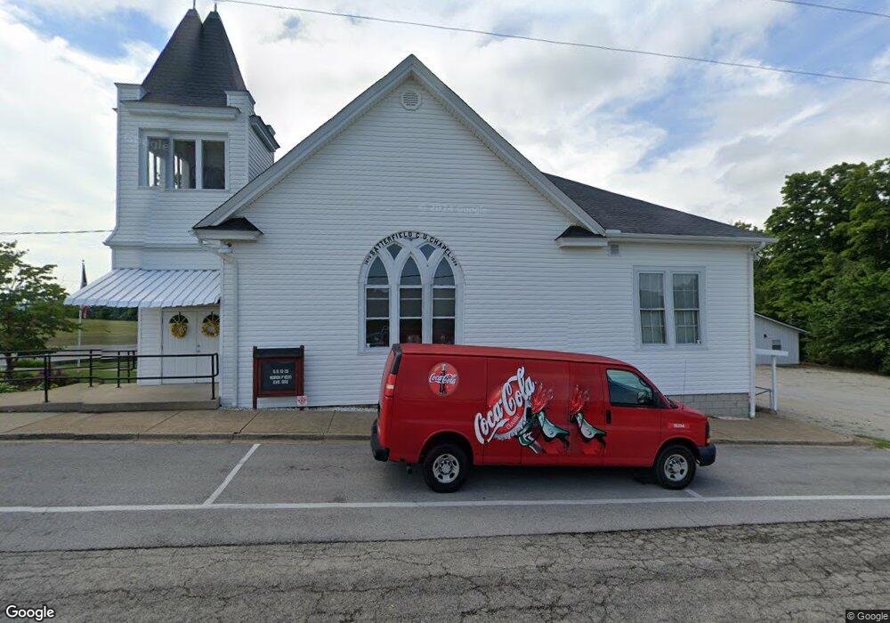
12231 State Route 125 West Union, OH 45693
Estimated Value: $189,000 - $268,000
2
Beds
1
Bath
2,238
Sq Ft
$103/Sq Ft
Est. Value
About This Home
This home is located at 12231 State Route 125, West Union, OH 45693 and is currently estimated at $230,089, approximately $102 per square foot. 12231 State Route 125 is a home located in Adams County with nearby schools including West Union Elementary School and West Union High School.
Ownership History
Date
Name
Owned For
Owner Type
Purchase Details
Closed on
May 5, 2023
Sold by
Johnson Tammy C
Bought by
Hess James E
Current Estimated Value
Purchase Details
Closed on
Jun 26, 2014
Sold by
Armstrong Lafe A and Armstrong Karen I
Bought by
Hess James E and Johnson Tammy C
Home Financials for this Owner
Home Financials are based on the most recent Mortgage that was taken out on this home.
Original Mortgage
$98,188
Interest Rate
3.5%
Mortgage Type
FHA
Purchase Details
Closed on
Oct 15, 2012
Sold by
Taylor Misty Shay and Estate Of Rickie D Palmer
Bought by
The First State Bank Of Adams County and First State Banks
Purchase Details
Closed on
Oct 28, 1997
Bought by
Palmer Rickie D
Create a Home Valuation Report for This Property
The Home Valuation Report is an in-depth analysis detailing your home's value as well as a comparison with similar homes in the area
Home Values in the Area
Average Home Value in this Area
Purchase History
| Date | Buyer | Sale Price | Title Company |
|---|---|---|---|
| Hess James E | $125 | None Listed On Document | |
| Hess James E | $100,000 | None Available | |
| The First State Bank Of Adams County | $107,064 | None Available | |
| Palmer Rickie D | $6,500 | -- |
Source: Public Records
Mortgage History
| Date | Status | Borrower | Loan Amount |
|---|---|---|---|
| Previous Owner | Hess James E | $98,188 |
Source: Public Records
Tax History Compared to Growth
Tax History
| Year | Tax Paid | Tax Assessment Tax Assessment Total Assessment is a certain percentage of the fair market value that is determined by local assessors to be the total taxable value of land and additions on the property. | Land | Improvement |
|---|---|---|---|---|
| 2024 | $846 | $49,840 | $10,150 | $39,690 |
| 2023 | $1,703 | $49,840 | $10,150 | $39,690 |
| 2022 | $1,690 | $42,490 | $7,000 | $35,490 |
| 2021 | $1,561 | $42,490 | $7,000 | $35,490 |
| 2020 | $1,597 | $42,490 | $7,000 | $35,490 |
| 2019 | $1,597 | $42,490 | $7,000 | $35,490 |
| 2018 | $1,396 | $37,870 | $7,000 | $30,870 |
| 2017 | $1,373 | $37,870 | $7,000 | $30,870 |
| 2016 | $1,371 | $37,870 | $7,000 | $30,870 |
| 2015 | $1,379 | $39,420 | $8,370 | $31,050 |
| 2014 | $1,380 | $39,420 | $8,370 | $31,050 |
Source: Public Records
Map
Nearby Homes
- 108 Chirsdon Ln
- 410 Owens Rd
- 1478 Robinson Hollow Rd
- 13465 State Route 41
- 598 Ohio 348
- 1011 Hafer Rd
- 216 Kurt St
- 260 Randy St
- 1064 Hafer Rd
- 120 Randy St
- 292 Larry Baynum Rd
- 405 Lookout View
- 1082 E Walnut St
- 3188 Ohio 125
- 175 Hidden Acres Dr
- 725 E Walnut St
- 917 Logans Ln
- 3460 Logans Ln
- 618 Maple St
- 601 E Main St
- 12231 State Route 125
- 0 Cox Rd Unit 6658
- 12071 State Route 125
- 161 Cox Rd
- 157 Cox Rd
- 12035 State Route 125
- 191 Cox Rd
- 12389 State Route 125
- 12055 State Route 125
- 223 Cox Rd
- 11937 Ohio 125
- 11937 State Route 125
- 259 Cox Rd
- 12494 State Route 125
- 11987 State Route 125
- 11899 State Route 125
- 11875 State Route 125
- 12570 State Route 125
- 4214 Poplar Ridge Rd
- 12575 State Route 125
