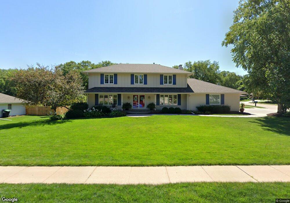
12235 Farnam St Omaha, NE 68154
West Fairacres NeighborhoodEstimated Value: $468,550 - $573,000
5
Beds
4
Baths
3,522
Sq Ft
$147/Sq Ft
Est. Value
About This Home
This home is located at 12235 Farnam St, Omaha, NE 68154 and is currently estimated at $517,888, approximately $147 per square foot. 12235 Farnam St is a home located in Douglas County with nearby schools including Columbian Elementary School, Beveridge Magnet Middle School, and Burke High School.
Ownership History
Date
Name
Owned For
Owner Type
Purchase Details
Closed on
Jul 7, 2009
Sold by
Rosso Larry V and Rosso Penny E
Bought by
Patterson Stephen R and Patterson Dana S
Current Estimated Value
Home Financials for this Owner
Home Financials are based on the most recent Mortgage that was taken out on this home.
Original Mortgage
$205,600
Outstanding Balance
$136,888
Interest Rate
5.71%
Mortgage Type
New Conventional
Estimated Equity
$381,000
Purchase Details
Closed on
Jun 15, 2006
Sold by
Casey Charles
Bought by
Rosso Larry
Create a Home Valuation Report for This Property
The Home Valuation Report is an in-depth analysis detailing your home's value as well as a comparison with similar homes in the area
Home Values in the Area
Average Home Value in this Area
Purchase History
| Date | Buyer | Sale Price | Title Company |
|---|---|---|---|
| Patterson Stephen R | $257,000 | Dakota Title & Escrow | |
| Rosso Larry | $252,000 | -- |
Source: Public Records
Mortgage History
| Date | Status | Borrower | Loan Amount |
|---|---|---|---|
| Open | Patterson Stephen R | $205,600 |
Source: Public Records
Tax History Compared to Growth
Tax History
| Year | Tax Paid | Tax Assessment Tax Assessment Total Assessment is a certain percentage of the fair market value that is determined by local assessors to be the total taxable value of land and additions on the property. | Land | Improvement |
|---|---|---|---|---|
| 2024 | $7,228 | $342,600 | $54,700 | $287,900 |
| 2023 | $7,228 | $342,600 | $54,700 | $287,900 |
| 2022 | $7,034 | $329,500 | $54,700 | $274,800 |
| 2021 | $6,974 | $329,500 | $54,700 | $274,800 |
| 2020 | $7,054 | $329,500 | $54,700 | $274,800 |
| 2019 | $6,438 | $299,800 | $54,700 | $245,100 |
| 2018 | $6,446 | $299,800 | $54,700 | $245,100 |
| 2017 | $6,478 | $299,800 | $54,700 | $245,100 |
| 2016 | $5,807 | $270,600 | $48,700 | $221,900 |
| 2015 | $5,354 | $252,900 | $45,500 | $207,400 |
| 2014 | $5,354 | $252,900 | $45,500 | $207,400 |
Source: Public Records
Map
Nearby Homes
- 12102 Westover Rd
- 12079 Westover Rd
- 12334 Douglas Cir
- 12206 Leavenworth Rd
- 12212 Leavenworth Rd
- 605 S 126th St
- 835 S 120th Ave
- 223 N 127th Plaza
- 836 S 123rd St
- 106 N 117th St
- 12718 Davenport Plaza
- 1231 S 121st Plaza Unit 312
- 912 S 130th St
- 12507 Poppleton Ave
- 821 N 121st St
- 12231 Cuming St
- 618 S 113th Ave
- 922 N 122nd St
- 12714 Woolworth Ave
- 1409 S 127 St
- 317 S 123rd St
- 12225 Farnam St
- 12305 Farnam St
- 12232 Farnam St
- 327 S 123rd St
- 12215 Farnam St
- 12306 Farnam St
- 12306 Farnam St
- 316 S 123rd St
- 12222 Farnam St
- 12315 Farnam St
- 326 S 123rd St
- 337 S 123rd St
- 12212 Farnam St
- 235 S 123rd St
- 12316 Farnam St
- 12205 Farnam St
- 236 S 123rd St
- 315 S 124th Cir
- 305 S 124th Cir