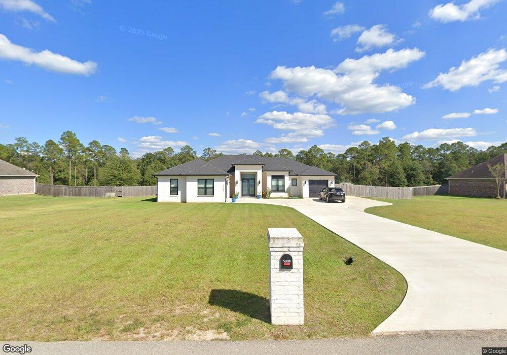
12236 E Pointe Dr Picayune, MS 39466
Estimated Value: $441,000 - $485,150
4
Beds
1
Bath
2,974
Sq Ft
$154/Sq Ft
Est. Value
About This Home
This home is located at 12236 E Pointe Dr, Picayune, MS 39466 and is currently estimated at $459,288, approximately $154 per square foot. 12236 E Pointe Dr is a home with nearby schools including West Hancock Elementary School, Hancock Middle School, and Hancock High School.
Ownership History
Date
Name
Owned For
Owner Type
Purchase Details
Closed on
Apr 21, 2023
Sold by
Hillery Scott J and Hillery Shelby
Bought by
Kennedy Steven M and Kennedy Sabrina Cruz
Current Estimated Value
Home Financials for this Owner
Home Financials are based on the most recent Mortgage that was taken out on this home.
Original Mortgage
$317,000
Outstanding Balance
$306,861
Interest Rate
6.6%
Mortgage Type
New Conventional
Estimated Equity
$152,427
Create a Home Valuation Report for This Property
The Home Valuation Report is an in-depth analysis detailing your home's value as well as a comparison with similar homes in the area
Purchase History
| Date | Buyer | Sale Price | Title Company |
|---|---|---|---|
| Kennedy Steven M | -- | None Listed On Document | |
| Kennedy Steven M | -- | None Listed On Document |
Source: Public Records
Mortgage History
| Date | Status | Borrower | Loan Amount |
|---|---|---|---|
| Open | Kennedy Steven M | $317,000 | |
| Closed | Kennedy Steven M | $317,000 |
Source: Public Records
Tax History
| Year | Tax Paid | Tax Assessment Tax Assessment Total Assessment is a certain percentage of the fair market value that is determined by local assessors to be the total taxable value of land and additions on the property. | Land | Improvement |
|---|---|---|---|---|
| 2025 | $4,508 | $47,337 | $5,534 | $41,803 |
| 2024 | $4,482 | $47,064 | $5,261 | $41,803 |
| 2023 | $2,853 | $29,953 | $3,507 | $26,446 |
| 2022 | $2,624 | $30,699 | $3,507 | $27,192 |
| 2021 | $2,624 | $30,699 | $3,507 | $27,192 |
| 2020 | $2,509 | $28,432 | $3,507 | $24,925 |
| 2019 | $2,441 | $27,745 | $2,820 | $24,925 |
| 2018 | $2,205 | $25,354 | $2,820 | $22,534 |
| 2017 | $196 | $1,980 | $1,980 | $0 |
| 2016 | $191 | $1,980 | $1,980 | $0 |
| 2015 | $181 | $1,980 | $1,980 | $0 |
| 2014 | $177 | $1,980 | $1,980 | $0 |
| 2013 | $171 | $1,980 | $1,980 | $0 |
Source: Public Records
Map
Nearby Homes
- 24094 Rester Rd
- 24327 Rester Rd
- S Leetown and Highway 43
- 0 S Leetown and Highway 43 Hwy Unit 4067215
- 00 N Benville Rd
- 23436 N Benville Rd
- 23280 Leetown Rd
- 0 N Benville Rd Unit 4138082
- 12009 Circle G Ranch Rd
- 26230 Longvue Dr
- 26340 Strickland Rd
- 24100 Autumn Place
- 11084 Road 231
- 11080 Road 231
- 24220 Autumn Ln
- 521 Old Kiln Rd
- 27019 Leetown Rd
- 2670 Long Leaf Dr
- 14014 Lott McCarty Rd
- 27261 Varnado Cutoff Rd
- 24 E Pointe Estates
- 0000 E Pointe Dr
- 12240 E Pointe Dr
- 12230 E Pointe Dr
- 12236 E Pointe Dr
- 19 E Pointe Dr
- 13 E Pointe Dr
- 11 E Pointe Dr
- 8 E Pointe Dr
- 6 E Pointe Dr
- 3 E Pointe Dr
- 2 E Pointe Dr
- 29 E Pointe Dr
- 1 E Pointe Dr
- 31 E Pointe Dr
- 32 E Pointe Dr
- 30 E Pointe Dr
- 28 E Pointe Dr
- 27 E Pointe Dr
- 26 E Pointe Dr
Your Personal Tour Guide
Ask me questions while you tour the home.