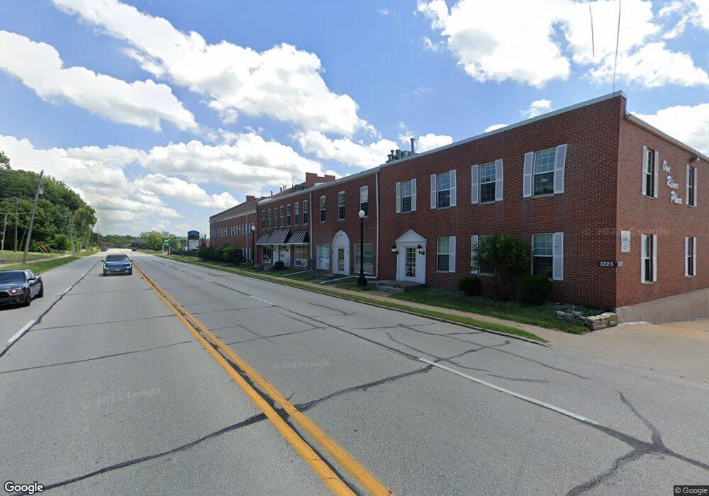
1225 E River Dr Unit 140 Davenport, IA 52803
East End NeighborhoodEstimated Value: $917,479
--
Bed
--
Bath
34,713
Sq Ft
$26/Sq Ft
Est. Value
About This Home
This home is located at 1225 E River Dr Unit 140, Davenport, IA 52803 and is currently estimated at $917,479, approximately $26 per square foot. 1225 E River Dr Unit 140 is a home located in Scott County with nearby schools including Walnut Hill Elementary School, McKinley Elementary School, and Casey County Middle School.
Ownership History
Date
Name
Owned For
Owner Type
Purchase Details
Closed on
Oct 11, 2013
Sold by
Pauli Jeanette M
Bought by
M & M Newell Llc
Current Estimated Value
Home Financials for this Owner
Home Financials are based on the most recent Mortgage that was taken out on this home.
Original Mortgage
$357,403
Outstanding Balance
$266,778
Interest Rate
4.33%
Mortgage Type
Future Advance Clause Open End Mortgage
Estimated Equity
$650,701
Purchase Details
Closed on
Apr 1, 2009
Sold by
J M Pauli Llc
Bought by
Pauli Family Llc
Purchase Details
Closed on
Jun 29, 2006
Sold by
Northwest Bank & Trust Co
Bought by
J M Pauli L L C
Create a Home Valuation Report for This Property
The Home Valuation Report is an in-depth analysis detailing your home's value as well as a comparison with similar homes in the area
Home Values in the Area
Average Home Value in this Area
Purchase History
| Date | Buyer | Sale Price | Title Company |
|---|---|---|---|
| M & M Newell Llc | $563,750 | None Available | |
| Pauli Family Llc | -- | None Available | |
| J M Pauli L L C | -- | None Available |
Source: Public Records
Mortgage History
| Date | Status | Borrower | Loan Amount |
|---|---|---|---|
| Open | M & M Newell Llc | $357,403 |
Source: Public Records
Tax History Compared to Growth
Tax History
| Year | Tax Paid | Tax Assessment Tax Assessment Total Assessment is a certain percentage of the fair market value that is determined by local assessors to be the total taxable value of land and additions on the property. | Land | Improvement |
|---|---|---|---|---|
| 2025 | $38,878 | $1,214,710 | $196,350 | $1,018,360 |
| 2024 | $38,772 | $1,214,710 | $196,350 | $1,018,360 |
| 2023 | $33,262 | $1,214,710 | $196,350 | $1,018,360 |
| 2022 | $32,932 | $1,001,890 | $196,350 | $805,540 |
| 2021 | $32,932 | $1,001,890 | $196,350 | $805,540 |
| 2020 | $31,480 | $1,001,890 | $196,350 | $805,540 |
| 2019 | $29,854 | $929,780 | $196,350 | $733,430 |
| 2018 | $28,264 | $929,780 | $196,350 | $733,430 |
| 2017 | $7,949 | $883,230 | $196,350 | $686,880 |
| 2016 | $18,902 | $624,540 | $0 | $0 |
| 2015 | $18,902 | $624,540 | $0 | $0 |
| 2014 | $20,056 | $649,250 | $0 | $0 |
| 2013 | $23,840 | $0 | $0 | $0 |
| 2012 | -- | $632,360 | $139,200 | $493,160 |
Source: Public Records
Map
Nearby Homes
- 1004 College Ave
- 1012 Bridge Ave
- 1224 E 11th St
- 1102 College Ave
- 1134 Tremont Ave
- 1108 Arlington Ave
- 1220 College Ave
- 616 E 6th St
- 1202 Adams St
- 1233 Eastern Ave
- 1325 Mississippi Ave
- 914 Farnam St
- 603 Leclaire St
- 1501 Bridge Ave
- 430 E 7th St
- 421 E 7th St
- 417 E 6th St
- 1310 Kirkwood Blvd
- 415 E 7th St
- 1215 Farnam St
- 1225 E River Dr
- 1225 E River Dr Unit 212
- 1225 E River Dr Unit 210
- 1225 E River Dr Unit 101
- 1225 E River Dr Unit 205
- 1225 E River Dr Unit 202
- 1225 E River Dr Unit 322
- 1225 E River Dr Unit 320
- 1225 E River Dr Unit 315
- 1225 E River Dr Unit 110
- 1225 E River Dr Unit 303
- 1225 E River Dr Unit 238
- 1225 E River Dr Unit 325
- 1225 E River Dr Unit 302
- 1225 E River Dr Unit 201
- 1225 E River Dr Unit 310
- 1225 E River Dr Unit 130
- 1225 E River Dr Unit 330
- 1225 E River Dr Unit 350
- 1205 E River Dr