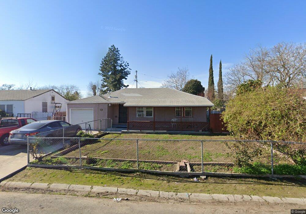
1225 Perry Ave Stockton, CA 95203
Seaport NeighborhoodEstimated Value: $350,000 - $422,000
About This Home
This home is located at 1225 Perry Ave, Stockton, CA 95203 and is currently estimated at $388,016, approximately $251 per square foot. 1225 Perry Ave is a home located in San Joaquin County with nearby schools including Hoover Elementary School, Madison Elementary School, and Flora Arca Mata.
Ownership History
We collect this data history from publicly available records. To have your information removed, we recommend requesting removal directly through your county’s website.
Purchase Details
Home Values in the Area
Average Home Value in this Area
Purchase History
We collect this data history from publicly available records. To have your information removed, we recommend requesting removal directly through your county’s website.
| Date | Buyer | Sale Price | Title Company |
|---|---|---|---|
| $49,000 | Commonwealth Land Title Ins |
Mortgage History
We collect this data history from publicly available records. To have your information removed, we recommend requesting removal directly through your county’s website.
| Date | Status | Borrower | Loan Amount |
|---|---|---|---|
| Open | $80,000 | ||
| Closed | $38,000 |
Tax History
We collect this data history from publicly available records. To have your information removed, we recommend requesting removal directly through your county’s website.
| Year | Tax Paid | Tax Assessment Tax Assessment Total Assessment is a certain percentage of the fair market value that is determined by local assessors to be the total taxable value of land and additions on the property. | Land | Improvement |
|---|---|---|---|---|
| 2025 | $1,501 | $116,453 | $41,985 | $74,468 |
| 2024 | $1,477 | $114,170 | $41,162 | $73,008 |
| 2023 | $1,445 | $111,932 | $40,355 | $71,577 |
| 2022 | $1,413 | $109,738 | $39,564 | $70,174 |
| 2021 | $1,359 | $107,588 | $38,789 | $68,799 |
| 2020 | $1,384 | $106,486 | $38,392 | $68,094 |
| 2019 | $1,379 | $104,399 | $37,640 | $66,759 |
| 2018 | $1,354 | $102,352 | $36,902 | $65,450 |
| 2017 | $1,284 | $100,346 | $36,179 | $64,167 |
| 2016 | $1,218 | $98,378 | $35,469 | $62,909 |
| 2014 | $1,158 | $95,003 | $34,252 | $60,751 |
Map
- 2638 Monte Diablo Ave
- 1215 Kingsley Ave
- 2915 Pixie Dr
- 2635 W Fremont St Unit 9
- 2936 Peachtree Dr Unit 2
- 1331 Pinetree Dr Unit 3
- 1260 Occidental Ave Unit 2
- 2930 Shimizu Dr Unit 2
- 1402 Occidental Ave Unit 4
- 1410 Occidental Ave Unit 2
- 815 King Ave
- 2300 Raymond Ave
- 2433 Canal Dr
- 2136 W Rose St
- 2129 Acacia Ct
- 2204 Canal Dr
- 2080 Lucerne Ave
- 2075 Idaho Ave
- 2206 Idaho Ave
- 2421 Country Club Blvd Unit 6
- 1215 Perry Ave
- 1205 Perry Ave
- 1214 Banner Ave
- 1235 Perry Ave
- 1204 Banner Ave
- 1224 Banner Ave
- 1214 Perry Ave
- 1224 Perry Ave
- 1204 Perry Ave
- 1245 Perry Ave
- 1146 Banner Ave
- 2738 Louis Ct
- 2728 Louis Ct
- 2801 W Rose St
- 2718 Louis Ct
- 2804 W Rose St
- 1244 Perry Ave
- 1136 Banner Ave
- 2748 Pixie Dr
- 2764 Raymond Ave
Ask me questions while you tour the home.