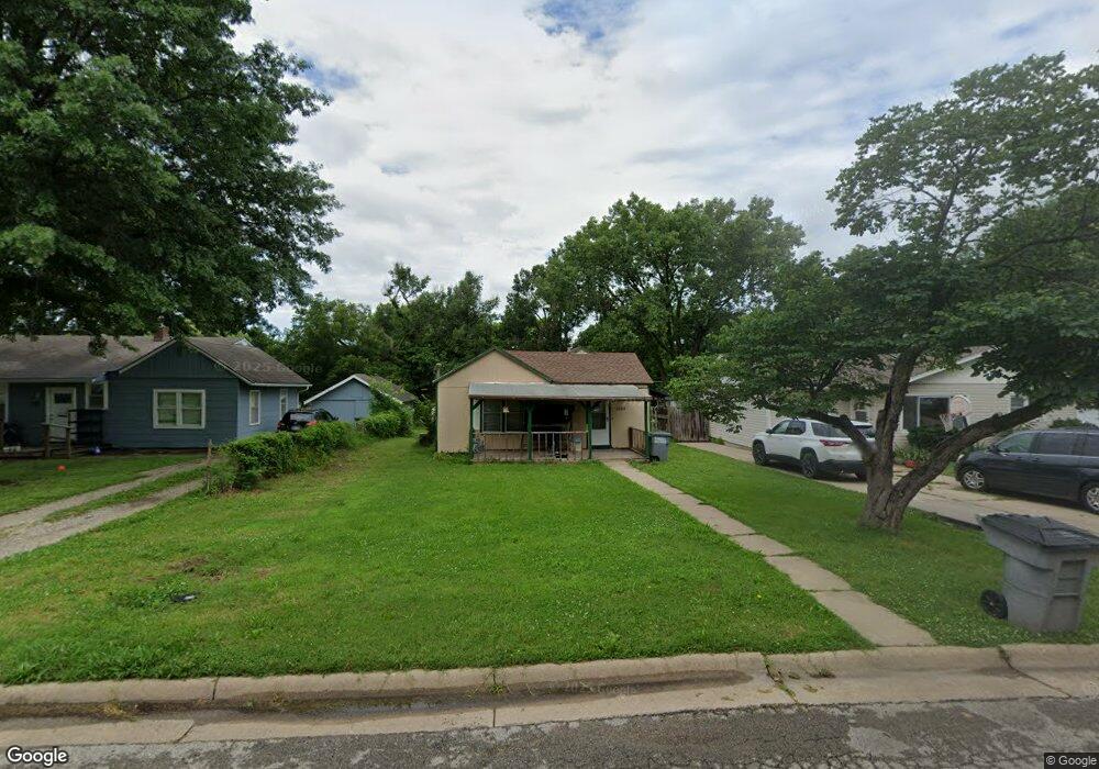
1225 Sunnyslope St Emporia, KS 66801
Estimated Value: $78,434 - $123,000
2
Beds
1
Bath
804
Sq Ft
$132/Sq Ft
Est. Value
About This Home
This home is located at 1225 Sunnyslope St, Emporia, KS 66801 and is currently estimated at $106,109, approximately $131 per square foot. 1225 Sunnyslope St is a home located in Lyon County with nearby schools including Village Elementary School, Emporia Middle School, and Emporia High School.
Ownership History
Date
Name
Owned For
Owner Type
Purchase Details
Closed on
Apr 23, 2025
Sold by
Selby Lyman L Living Trust
Bought by
Guzman Properties Llc
Current Estimated Value
Home Financials for this Owner
Home Financials are based on the most recent Mortgage that was taken out on this home.
Original Mortgage
$94,189
Outstanding Balance
$93,006
Interest Rate
0.67%
Mortgage Type
Construction
Estimated Equity
$13,103
Purchase Details
Closed on
Jan 1, 1988
Bought by
Selby Lyman L Rev Living Trust & Se
Create a Home Valuation Report for This Property
The Home Valuation Report is an in-depth analysis detailing your home's value as well as a comparison with similar homes in the area
Home Values in the Area
Average Home Value in this Area
Purchase History
| Date | Buyer | Sale Price | Title Company |
|---|---|---|---|
| Guzman Properties Llc | $117,736 | -- | |
| Selby Lyman L Rev Living Trust & Se | $13,500 | -- |
Source: Public Records
Mortgage History
| Date | Status | Borrower | Loan Amount |
|---|---|---|---|
| Open | Guzman Properties Llc | $94,189 | |
| Closed | Guzman Properties Llc | $85,329 |
Source: Public Records
Tax History Compared to Growth
Tax History
| Year | Tax Paid | Tax Assessment Tax Assessment Total Assessment is a certain percentage of the fair market value that is determined by local assessors to be the total taxable value of land and additions on the property. | Land | Improvement |
|---|---|---|---|---|
| 2025 | $951 | $6,578 | $1,819 | $4,759 |
| 2024 | $951 | $6,383 | $1,724 | $4,659 |
| 2023 | $889 | $5,853 | $1,659 | $4,194 |
| 2022 | $828 | $5,635 | $1,341 | $4,294 |
| 2021 | $809 | $5,326 | $1,072 | $4,254 |
| 2020 | $549 | $4,818 | $1,021 | $3,797 |
| 2019 | $549 | $3,562 | $868 | $2,694 |
| 2018 | $523 | $3,392 | $868 | $2,524 |
| 2017 | $509 | $3,300 | $868 | $2,432 |
| 2016 | $479 | $3,116 | $868 | $2,248 |
| 2015 | -- | $3,128 | $830 | $2,298 |
| 2014 | -- | $3,374 | $734 | $2,640 |
Source: Public Records
Map
Nearby Homes
- 1035 Grand St
- 1018 Woodland St
- 1614 W 12th Ave
- 1001 Woodland St
- 1344 Prairie Park Ln
- 1428 Prairie St
- 1110 Thompson St
- 1405 Lincoln St
- 916 Garfield St
- 938 Luther St
- 2212 W 15th Ave
- 1222 Tomahawk Rd
- 1225 Presby Dr
- 616 Sherman St
- 634 Lincoln St
- 1304 Chestnut St
- 1327 Lawrence St
- 1242 Lawrence St
- 2302 Diane Ave
- 2043 Schaeffer Way
- 1229 Sunnyslope St
- 1221 Sunnyslope St
- 1233 Sunnyslope St
- 1213 Sunnyslope St
- 1237 Sunnyslope St
- 1230 Woodland St
- 1222 Woodland St
- 1209 Sunnyslope St
- 1241 Sunnyslope St
- 1238 Woodland St
- 1216 Woodland St
- 1801 W 13th Ave
- 1205 Sunnyslope St
- 1240 Woodland St
- 1220 Sunnyslope St
- 1224 Sunnyslope St
- 1206 Sunnyslope St
- 1210 Woodland St
- 1216 Sunnyslope St
- 1228 Sunnyslope St