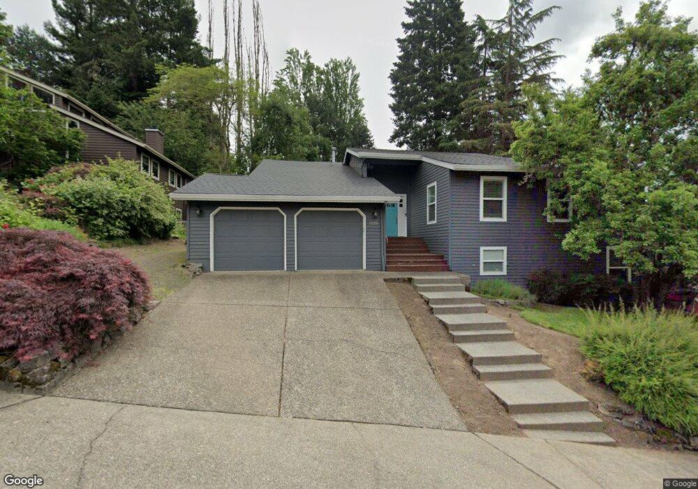
1225 Swiftshore Cir West Linn, OR 97068
Willamette NeighborhoodEstimated Value: $872,000 - $948,000
3
Beds
3
Baths
3,216
Sq Ft
$280/Sq Ft
Est. Value
About This Home
This home is located at 1225 Swiftshore Cir, West Linn, OR 97068 and is currently estimated at $900,709, approximately $280 per square foot. 1225 Swiftshore Cir is a home located in Clackamas County with nearby schools including Willamette Primary School, Athey Creek Middle School, and West Linn High School.
Ownership History
Date
Name
Owned For
Owner Type
Purchase Details
Closed on
Oct 9, 2007
Sold by
Us Bank Na
Bought by
Hart Christopher T and Hart Lenore K
Current Estimated Value
Home Financials for this Owner
Home Financials are based on the most recent Mortgage that was taken out on this home.
Original Mortgage
$344,000
Outstanding Balance
$214,424
Interest Rate
6.27%
Mortgage Type
Purchase Money Mortgage
Estimated Equity
$686,285
Purchase Details
Closed on
Sep 5, 2007
Sold by
Coats Sean E and Coats Carol A
Bought by
Us Bank Na
Home Financials for this Owner
Home Financials are based on the most recent Mortgage that was taken out on this home.
Original Mortgage
$344,000
Outstanding Balance
$214,424
Interest Rate
6.27%
Mortgage Type
Purchase Money Mortgage
Estimated Equity
$686,285
Purchase Details
Closed on
Aug 23, 2007
Sold by
Coats Sean E
Bought by
Coats Carol A
Home Financials for this Owner
Home Financials are based on the most recent Mortgage that was taken out on this home.
Original Mortgage
$344,000
Outstanding Balance
$214,424
Interest Rate
6.27%
Mortgage Type
Purchase Money Mortgage
Estimated Equity
$686,285
Purchase Details
Closed on
Sep 24, 2004
Sold by
Munoz Nicholas J and Munoz Avery B
Bought by
Coats Sean E and Coats Carol A
Home Financials for this Owner
Home Financials are based on the most recent Mortgage that was taken out on this home.
Original Mortgage
$233,750
Interest Rate
5.5%
Mortgage Type
Purchase Money Mortgage
Purchase Details
Closed on
Jul 28, 2003
Sold by
Mcconnell Michael K and Mcconnell Valerie J
Bought by
Munoz Nicholas J and Munoz Avery B
Home Financials for this Owner
Home Financials are based on the most recent Mortgage that was taken out on this home.
Original Mortgage
$228,800
Interest Rate
5.13%
Mortgage Type
Purchase Money Mortgage
Purchase Details
Closed on
Jun 18, 1996
Sold by
Benson James D and Benson Carol E
Bought by
Mcconnell Michael K and Mcconnell Valerie J
Home Financials for this Owner
Home Financials are based on the most recent Mortgage that was taken out on this home.
Original Mortgage
$212,350
Interest Rate
8%
Create a Home Valuation Report for This Property
The Home Valuation Report is an in-depth analysis detailing your home's value as well as a comparison with similar homes in the area
Home Values in the Area
Average Home Value in this Area
Purchase History
| Date | Buyer | Sale Price | Title Company |
|---|---|---|---|
| Hart Christopher T | $430,000 | First American Title Insuran | |
| Us Bank Na | $460,053 | First American Title Insuran | |
| Coats Carol A | -- | Ticor Title Insurance Compan | |
| Coats Sean E | $325,000 | First American | |
| Munoz Nicholas J | $286,000 | First American | |
| Mcconnell Michael K | $235,950 | Transnation Title Insurance |
Source: Public Records
Mortgage History
| Date | Status | Borrower | Loan Amount |
|---|---|---|---|
| Open | Hart Christopher T | $344,000 | |
| Previous Owner | Coats Sean E | $233,750 | |
| Previous Owner | Munoz Nicholas J | $228,800 | |
| Previous Owner | Mcconnell Michael K | $212,350 | |
| Closed | Munoz Nicholas J | $42,900 |
Source: Public Records
Tax History Compared to Growth
Tax History
| Year | Tax Paid | Tax Assessment Tax Assessment Total Assessment is a certain percentage of the fair market value that is determined by local assessors to be the total taxable value of land and additions on the property. | Land | Improvement |
|---|---|---|---|---|
| 2025 | $8,387 | $435,217 | -- | -- |
| 2024 | $8,073 | $422,541 | -- | -- |
| 2023 | $8,073 | $410,234 | $0 | $0 |
| 2022 | $7,620 | $398,286 | $0 | $0 |
| 2021 | $7,234 | $386,686 | $0 | $0 |
| 2020 | $7,283 | $375,424 | $0 | $0 |
| 2019 | $6,945 | $364,490 | $0 | $0 |
| 2018 | $6,635 | $353,874 | $0 | $0 |
| 2017 | $6,283 | $343,567 | $0 | $0 |
| 2016 | $6,119 | $333,560 | $0 | $0 |
| 2015 | $5,675 | $323,845 | $0 | $0 |
| 2014 | $5,416 | $314,413 | $0 | $0 |
Source: Public Records
Map
Nearby Homes
- 25545 Katherine Ct
- 1765 Ostman Rd
- 1694 16th St
- 1690 16th St
- 1721 Dollar St Unit 1721
- 1075 Epperly Way
- 1733 Jamie Cir
- 1931 13th St
- 1160 Blankenship Rd
- 1315 11th St
- 2077 5th Ave
- 812 Wendy Ct
- 2250 River Heights Cir
- 975 Springtree Ln
- 880 Springtree Ln Unit 880
- 850 Springtree Ln Unit 850
- 640 Springtree Ln
- 1101 Ryan Ct
- 1218 9th St Unit Lot 3
- 3565 Summerlinn Dr Unit 64
- 1235 Swiftshore Cir
- 1215 Swiftshore Cir
- 1255 Swiftshore Cir
- 1200 Swiftshore Cir
- 25540 Cheryl Dr
- 1295 Willamette Falls Dr
- 25528 Cheryl Dr Unit 5
- 25528 Cheryl Dr
- 1240 Swiftshore Cir
- 1329 Willamette Falls Dr
- 1190 Swift Shore Cir
- 1275 Swiftshore Cir
- 1190 Swiftshore Cir
- 1190 Swiftshore Dr
- 1275 Willamette Falls Dr
- 1260 Swiftshore Cir
- 25568 Cheryl Dr
- 1170 Swift Shore Cir
- 1195 Swiftshore Cir
- 25470 Swift Shore Dr