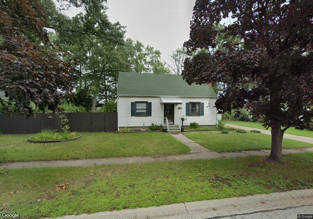
1225 Thomson Ave Port Huron, MI 48060
Estimated Value: $153,000 - $167,000
3
Beds
1
Bath
980
Sq Ft
$164/Sq Ft
Est. Value
About This Home
This home is located at 1225 Thomson Ave, Port Huron, MI 48060 and is currently estimated at $160,498, approximately $163 per square foot. 1225 Thomson Ave is a home located in St. Clair County with nearby schools including Michigamme Elementary School, Central Middle School, and Port Huron High School.
Ownership History
Date
Name
Owned For
Owner Type
Purchase Details
Closed on
Oct 20, 2006
Sold by
Wells Fargo Bank
Bought by
Barton Robert
Current Estimated Value
Home Financials for this Owner
Home Financials are based on the most recent Mortgage that was taken out on this home.
Original Mortgage
$93,900
Outstanding Balance
$56,156
Interest Rate
6.5%
Mortgage Type
New Conventional
Estimated Equity
$104,342
Purchase Details
Closed on
Oct 21, 2005
Sold by
Henry Karina
Bought by
Wells Fargo Bank Na
Purchase Details
Closed on
Dec 22, 2004
Sold by
Kerr Grace G
Bought by
Henry Karina
Home Financials for this Owner
Home Financials are based on the most recent Mortgage that was taken out on this home.
Original Mortgage
$99,000
Interest Rate
7.5%
Mortgage Type
Adjustable Rate Mortgage/ARM
Create a Home Valuation Report for This Property
The Home Valuation Report is an in-depth analysis detailing your home's value as well as a comparison with similar homes in the area
Home Values in the Area
Average Home Value in this Area
Purchase History
| Date | Buyer | Sale Price | Title Company |
|---|---|---|---|
| Barton Robert | $93,900 | E Title Agency | |
| Wells Fargo Bank Na | -- | None Available | |
| Henry Karina | $110,000 | Chirco Title Co |
Source: Public Records
Mortgage History
| Date | Status | Borrower | Loan Amount |
|---|---|---|---|
| Open | Barton Robert | $93,900 | |
| Previous Owner | Henry Karina | $99,000 |
Source: Public Records
Tax History Compared to Growth
Tax History
| Year | Tax Paid | Tax Assessment Tax Assessment Total Assessment is a certain percentage of the fair market value that is determined by local assessors to be the total taxable value of land and additions on the property. | Land | Improvement |
|---|---|---|---|---|
| 2025 | $2,020 | $74,600 | $0 | $0 |
| 2024 | $1,707 | $72,100 | $0 | $0 |
| 2023 | $1,613 | $64,900 | $0 | $0 |
| 2022 | $1,680 | $56,100 | $0 | $0 |
| 2021 | $1,595 | $52,100 | $0 | $0 |
| 2020 | $1,613 | $49,400 | $49,400 | $0 |
| 2019 | $1,584 | $35,400 | $0 | $0 |
| 2018 | $1,549 | $35,400 | $0 | $0 |
| 2017 | $1,332 | $32,200 | $0 | $0 |
| 2016 | $1,136 | $32,200 | $0 | $0 |
| 2015 | $1,075 | $31,100 | $31,100 | $0 |
| 2014 | $1,075 | $30,100 | $30,100 | $0 |
| 2013 | -- | $29,500 | $0 | $0 |
Source: Public Records
Map
Nearby Homes
- 1403 Catherine McAuley Dr
- 2718 Electric Ave
- 2710 Electric Ave
- 2815 Military St
- 2724 Military St
- 2704 Military St
- 1414 Beard St
- 2411 10th St
- 2977 Military St
- 2444 Military St
- 823 Beard St
- 2430 Military St Unit 2434
- 3136 Military St
- 913 Tunnel St
- 730 Jenkinson St
- 1112 Minnie St
- 1127 Minnie St
- 1319 Minnie St
- 9999 Cleveland Ave
- 831 Bancroft St
- 1223 Thomson Ave
- 1217 Thomson Ave
- 2618 13th St
- 2608 13th St
- 1226 Thomson Ave
- 2636 13th St
- 1222 Thomson Ave
- 1222 Thomson Ave
- 2613 13th St
- 2635 13th St
- 2739 Mason Ave
- 2641 13th St
- 2761 Mason Ave
- 2609 Electric Ave
- 1317 Thomson Ave
- 2746 Mason Ave
- 2752 Mason Ave
- 1320 Thomson Ave Unit 1322
- 2647 13th St
- 2700 Mason Ave