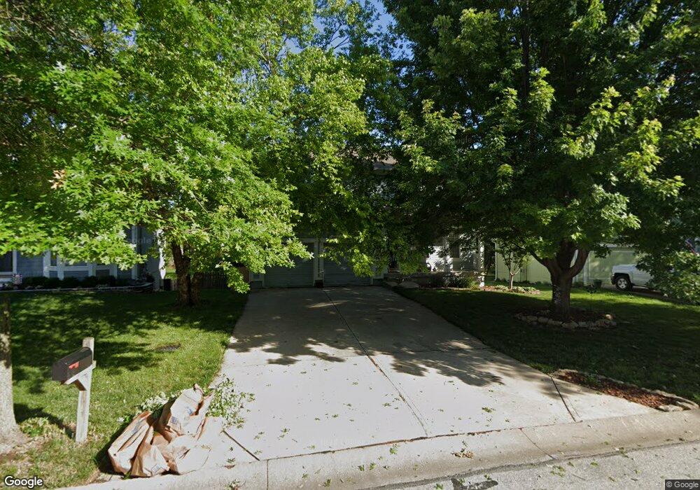
12252 S Crest Dr Olathe, KS 66061
Estimated Value: $394,000 - $407,000
3
Beds
3
Baths
1,644
Sq Ft
$245/Sq Ft
Est. Value
About This Home
This home is located at 12252 S Crest Dr, Olathe, KS 66061 and is currently estimated at $403,242, approximately $245 per square foot. 12252 S Crest Dr is a home located in Johnson County with nearby schools including Millbrooke Elementary, Summit Trail Middle School, and Olathe Northwest High School.
Ownership History
Date
Name
Owned For
Owner Type
Purchase Details
Closed on
Jul 11, 2005
Sold by
Miller Kent E and Miller Vicki L
Bought by
Miller Kent E and Miller Vicki L
Current Estimated Value
Purchase Details
Closed on
Apr 19, 2002
Sold by
Stonegate Homes Inc
Bought by
Miller Kent E and Miller Vicki L
Home Financials for this Owner
Home Financials are based on the most recent Mortgage that was taken out on this home.
Original Mortgage
$118,950
Outstanding Balance
$50,295
Interest Rate
7.09%
Estimated Equity
$352,947
Purchase Details
Closed on
Sep 9, 2001
Sold by
Stonegate Inc
Bought by
Stonegate Homes Inc
Home Financials for this Owner
Home Financials are based on the most recent Mortgage that was taken out on this home.
Original Mortgage
$133,700
Interest Rate
6.96%
Create a Home Valuation Report for This Property
The Home Valuation Report is an in-depth analysis detailing your home's value as well as a comparison with similar homes in the area
Home Values in the Area
Average Home Value in this Area
Purchase History
| Date | Buyer | Sale Price | Title Company |
|---|---|---|---|
| Miller Kent E | -- | None Available | |
| Miller Kent E | -- | Security Land Title Company | |
| Stonegate Homes Inc | -- | Security Land Title Company |
Source: Public Records
Mortgage History
| Date | Status | Borrower | Loan Amount |
|---|---|---|---|
| Open | Miller Kent E | $118,950 | |
| Previous Owner | Stonegate Homes Inc | $133,700 |
Source: Public Records
Tax History Compared to Growth
Tax History
| Year | Tax Paid | Tax Assessment Tax Assessment Total Assessment is a certain percentage of the fair market value that is determined by local assessors to be the total taxable value of land and additions on the property. | Land | Improvement |
|---|---|---|---|---|
| 2024 | $4,324 | $38,617 | $7,979 | $30,638 |
| 2023 | $4,279 | $37,398 | $6,647 | $30,751 |
| 2022 | $3,727 | $31,740 | $5,775 | $25,965 |
| 2021 | $3,731 | $30,211 | $6,369 | $23,842 |
| 2020 | $3,533 | $28,371 | $5,785 | $22,586 |
| 2019 | $3,657 | $29,153 | $5,785 | $23,368 |
| 2018 | $3,346 | $26,508 | $5,028 | $21,480 |
| 2017 | $3,169 | $24,863 | $4,567 | $20,296 |
| 2016 | $3,006 | $24,196 | $4,567 | $19,629 |
| 2015 | $2,850 | $22,966 | $4,567 | $18,399 |
| 2013 | -- | $22,368 | $5,870 | $16,498 |
Source: Public Records
Map
Nearby Homes
- 21320 W 123rd Ct
- 12421 S Parker Terrace
- 12122 S Redbud Ln
- 21510 W 121st St
- 12386 S Lincoln St
- 12036 S Clinton St
- 11957 S Monroe St
- 21794 W 123rd Terrace
- 11934 S Monroe St
- 12001 S Tallgrass Dr Unit 203
- 21205 W 125th Terrace
- 12169 S Valley Rd
- 21702 W 119th Terrace Unit 1101
- 11921 S Tallgrass Dr Unit 603
- 11921 S Tallgrass Dr Unit 602
- 11921 S Tallgrass Dr Unit 601
- 1310 N Leeview Cir
- 12525 S Lincoln St
- 12621 S Clinton Ct
- 11588 S Houston St
- 12248 S Crest Dr
- 12256 S Crest Dr
- 12244 S Crest Dr
- 12260 S Crest Dr
- 12263 S Crest Dr
- 12261 S Crest Dr
- 12240 S Crest Dr
- 12264 S Crest Dr
- 12257 S Crest Dr
- 12269 S Crest Dr
- 12091 S Troost St
- 12236 S Crest Dr
- 12179 S Troost St
- 12081 S Troost St
- 12268 S Crest Dr
- 12273 S Crest Dr
- 12183 S Troost St
- 12280 S Clinton St
- 12077 S Troost St
- 12253 S Crest Dr