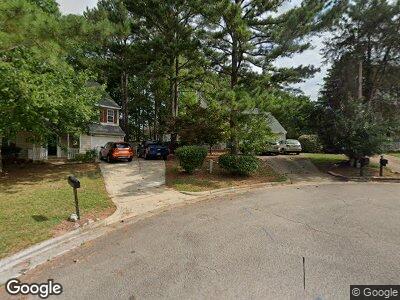
1226 Bacardi Ct Wake Forest, NC 27587
Estimated Value: $362,000 - $396,000
3
Beds
3
Baths
1,830
Sq Ft
$209/Sq Ft
Est. Value
About This Home
This home is located at 1226 Bacardi Ct, Wake Forest, NC 27587 and is currently estimated at $382,283, approximately $208 per square foot. 1226 Bacardi Ct is a home located in Wake County with nearby schools including Forest Pines Drive Elementary School, Wake Forest-Rolesville Middle School, and Heritage High School.
Ownership History
Date
Name
Owned For
Owner Type
Purchase Details
Closed on
Apr 29, 2002
Sold by
Delacruz Darius E and Delacruz Audrey L
Bought by
Saviano Mary Katherine
Current Estimated Value
Home Financials for this Owner
Home Financials are based on the most recent Mortgage that was taken out on this home.
Original Mortgage
$120,100
Interest Rate
7.07%
Create a Home Valuation Report for This Property
The Home Valuation Report is an in-depth analysis detailing your home's value as well as a comparison with similar homes in the area
Home Values in the Area
Average Home Value in this Area
Purchase History
| Date | Buyer | Sale Price | Title Company |
|---|---|---|---|
| Saviano Mary Katherine | $150,500 | -- |
Source: Public Records
Mortgage History
| Date | Status | Borrower | Loan Amount |
|---|---|---|---|
| Open | Lundquist Mary Katherine | $122,000 | |
| Closed | Lundquist Mary Katherine | $17,500 | |
| Closed | Lundquist Mary Katherine | $12,000 | |
| Closed | Saviano Mary Katherine | $144,000 | |
| Closed | Saviano Mary Katherine | $120,100 | |
| Closed | Saviano Mary Katherine | $22,500 |
Source: Public Records
Tax History Compared to Growth
Tax History
| Year | Tax Paid | Tax Assessment Tax Assessment Total Assessment is a certain percentage of the fair market value that is determined by local assessors to be the total taxable value of land and additions on the property. | Land | Improvement |
|---|---|---|---|---|
| 2024 | $3,696 | $380,855 | $100,000 | $280,855 |
| 2023 | $2,745 | $234,495 | $44,000 | $190,495 |
| 2022 | $2,633 | $234,495 | $44,000 | $190,495 |
| 2021 | $2,588 | $234,495 | $44,000 | $190,495 |
| 2020 | $2,588 | $234,495 | $44,000 | $190,495 |
| 2019 | $2,271 | $181,449 | $42,000 | $139,449 |
| 2018 | $2,151 | $181,449 | $42,000 | $139,449 |
| 2017 | $2,079 | $181,449 | $42,000 | $139,449 |
| 2016 | $2,053 | $181,449 | $42,000 | $139,449 |
| 2015 | $2,056 | $179,491 | $40,000 | $139,491 |
| 2014 | $1,991 | $179,491 | $40,000 | $139,491 |
Source: Public Records
Map
Nearby Homes
- 1210 Ventura Springs Ct
- 301 Tillamook Dr
- 262 Tillamook Dr
- 318 Tillamook Dr
- 1137 S Main St
- 1125 S Main St
- 1454 Cimarron Pkwy
- 1454 Cimarron Pkwy Unit 17
- 524 Brunello Dr
- 810 Hyperion Alley
- 806 Hyperion Alley
- 609 Callan View Ave
- 607 Callan View Ave
- 1564 Highpoint St
- 605 Callan View Ave
- 805 Hyperion Alley
- 801 Hyperion Alley
- 1170 Holding Village Way
- 604 Hyperion Alley
- 205 Forbes Rd
- 1226 Bacardi Ct
- 1222 Bacardi Ct
- 1230 Bacardi Ct
- 1225 Beringer Forest Ct
- 213 Tillamook Dr
- 1229 Beringer Forest Ct
- 217 Tillamook Dr
- 209 Tillamook Dr
- 1225 Bacardi Ct
- 1236 Bacardi Ct
- 1233 Beringer Forest Ct
- 221 Tillamook Dr
- 205 Tillamook Dr
- 1233 Bacardi Ct
- 1237 Beringer Forest Ct
- 1240 Bacardi Ct
- 201 Tillamook Dr
- 365 Tillamook Dr
- 1237 Bacardi Ct
- 1226 Beringer Forest Ct