Estimated Value: $160,000 - $250,000
4
Beds
2
Baths
1,671
Sq Ft
$117/Sq Ft
Est. Value
About This Home
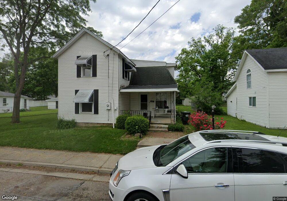
This home is located at 1226 Vornholt St, Troy, OH 45373 and is currently estimated at $195,752, approximately $117 per square foot. 1226 Vornholt St is a home located in Miami County with nearby schools including Kyle Elementary School, Van Cleve Elementary School, and Troy Junior High School.
Ownership History
Date
Name
Owned For
Owner Type
Purchase Details
Closed on
Dec 3, 2021
Sold by
Wick Randy T
Bought by
1226 Vornholt Llc
Current Estimated Value
Purchase Details
Closed on
Aug 4, 2020
Sold by
Wick Sarah J
Bought by
Wick Randy T
Purchase Details
Closed on
Jun 13, 2016
Sold by
Hoffman Dale Alan and Hoffman Belinda
Bought by
Wick Randy T and Wick Sarah J
Home Financials for this Owner
Home Financials are based on the most recent Mortgage that was taken out on this home.
Original Mortgage
$106,534
Interest Rate
4.5%
Mortgage Type
FHA
Purchase Details
Closed on
Nov 4, 2003
Sold by
Sloan Kenneth L and Sloan Lynda L
Bought by
Hoffman Dale Alan
Home Financials for this Owner
Home Financials are based on the most recent Mortgage that was taken out on this home.
Original Mortgage
$112,800
Interest Rate
6.04%
Mortgage Type
New Conventional
Purchase Details
Closed on
Aug 18, 1993
Bought by
Sloan Kenneth L
Create a Home Valuation Report for This Property
The Home Valuation Report is an in-depth analysis detailing your home's value as well as a comparison with similar homes in the area
Home Values in the Area
Average Home Value in this Area
Purchase History
| Date | Buyer | Sale Price | Title Company |
|---|---|---|---|
| 1226 Vornholt Llc | -- | None Listed On Document | |
| 1226 Vornholt Llc | -- | None Listed On Document | |
| Wick Randy T | -- | None Available | |
| Wick Randy T | $108,500 | Vantage Land Title | |
| Hoffman Dale Alan | $118,750 | -- | |
| Sloan Kenneth L | $66,000 | -- |
Source: Public Records
Mortgage History
| Date | Status | Borrower | Loan Amount |
|---|---|---|---|
| Previous Owner | Wick Randy T | $106,534 | |
| Previous Owner | Hoffman Dale Alan | $112,800 |
Source: Public Records
Tax History Compared to Growth
Tax History
| Year | Tax Paid | Tax Assessment Tax Assessment Total Assessment is a certain percentage of the fair market value that is determined by local assessors to be the total taxable value of land and additions on the property. | Land | Improvement |
|---|---|---|---|---|
| 2024 | $2,109 | $43,860 | $11,030 | $32,830 |
| 2023 | $2,109 | $43,860 | $11,030 | $32,830 |
| 2022 | $1,626 | $43,860 | $11,030 | $32,830 |
| 2021 | $1,371 | $35,070 | $8,820 | $26,250 |
| 2020 | $1,373 | $35,070 | $8,820 | $26,250 |
| 2019 | $1,384 | $35,070 | $8,820 | $26,250 |
| 2018 | $1,296 | $31,230 | $8,370 | $22,860 |
| 2017 | $1,307 | $31,230 | $8,370 | $22,860 |
| 2016 | $1,290 | $31,230 | $8,370 | $22,860 |
| 2015 | $1,397 | $32,870 | $8,820 | $24,050 |
| 2014 | $1,397 | $32,870 | $8,820 | $24,050 |
| 2013 | $1,404 | $32,870 | $8,820 | $24,050 |
Source: Public Records
Map
Nearby Homes
- 517 W Market St
- 512 Peters Ave
- 345 W Ross St
- 609 Old Newton Pike
- 385 W Ross St
- 309 W Market St
- 727 Grant St
- 804 S Walnut St
- 1463 Lantern Ln Unit 1463
- 1479 Lantern Ln Unit 1479
- 1481 Lantern Ln
- 502 Lincoln Ave
- 530 Pennsylvania Ave
- 1465 Wayne St
- 814 S Clay St
- 1002 S Market St
- 410 S Ridge Ave
- 408 S Market St
- 917 S Clay St
- 1224 Vornholt St
- 1236 Vornholt St
- 506 W Market St
- 510 W Market St
- 1240 Vornholt St
- 1229 Vornholt St
- 434 W Market St
- 1233 Vornholt St
- 516 W Market St
- 511 Peters Ave
- 511 Peters Ave
- 520 W Market St
- 428 W Market St
- 427 Peters Ave
- 513 Peters Ave
- 507 Peters Ave
- 501 Peters Ave
- 509 Peters Ave
- 505 Peters Ave
- 421 Peters Ave