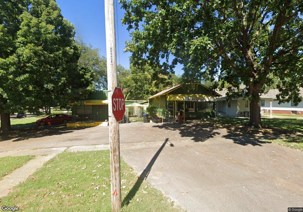
1226 W 1st Ave Topeka, KS 66606
--
Bed
4
Baths
2,086
Sq Ft
8,538
Sq Ft Lot
About This Home
This home is located at 1226 W 1st Ave, Topeka, KS 66606. 1226 W 1st Ave is a home located in Shawnee County with nearby schools including Meadows Elementary School, Robinson Middle School, and Topeka High School.
Ownership History
Date
Name
Owned For
Owner Type
Purchase Details
Closed on
Nov 30, 2023
Sold by
Glasnapp Michael John
Bought by
Johnson Cornel Nicholas
Home Financials for this Owner
Home Financials are based on the most recent Mortgage that was taken out on this home.
Original Mortgage
$50,000
Outstanding Balance
$46,465
Interest Rate
6.92%
Mortgage Type
New Conventional
Purchase Details
Closed on
Dec 18, 2014
Sold by
Levin John and Levin Joan R
Bought by
Glasnapp Michael John
Home Financials for this Owner
Home Financials are based on the most recent Mortgage that was taken out on this home.
Original Mortgage
$33,600
Interest Rate
4.01%
Mortgage Type
Future Advance Clause Open End Mortgage
Purchase Details
Closed on
Apr 18, 2011
Sold by
Oppitz Patricia A and Patricia A Oppitz Trust
Bought by
Levin John and Levin Joan R
Create a Home Valuation Report for This Property
The Home Valuation Report is an in-depth analysis detailing your home's value as well as a comparison with similar homes in the area
Home Values in the Area
Average Home Value in this Area
Purchase History
| Date | Buyer | Sale Price | Title Company |
|---|---|---|---|
| Johnson Cornel Nicholas | -- | Security 1St Title | |
| Glasnapp Michael John | -- | Capital Title Insurance Co | |
| Levin John | -- | None Available |
Source: Public Records
Mortgage History
| Date | Status | Borrower | Loan Amount |
|---|---|---|---|
| Open | Johnson Cornel Nicholas | $50,000 | |
| Previous Owner | Glasnapp Michael John | $33,600 |
Source: Public Records
Tax History Compared to Growth
Tax History
| Year | Tax Paid | Tax Assessment Tax Assessment Total Assessment is a certain percentage of the fair market value that is determined by local assessors to be the total taxable value of land and additions on the property. | Land | Improvement |
|---|---|---|---|---|
| 2025 | $1,600 | $10,923 | -- | -- |
| 2023 | $1,600 | $10,302 | $0 | $0 |
| 2022 | $1,425 | $9,379 | $0 | $0 |
| 2021 | $1,476 | $9,379 | $0 | $0 |
| 2020 | $1,458 | $9,367 | $0 | $0 |
| 2019 | $1,466 | $9,208 | $0 | $0 |
| 2018 | $1,468 | $9,208 | $0 | $0 |
| 2017 | $1,471 | $9,208 | $0 | $0 |
| 2014 | $2,013 | $12,475 | $0 | $0 |
Source: Public Records
Map
Nearby Homes
- 136 NW Quinton Ave
- 131 SW Clay St
- 1014 SW 2nd St
- 215 SW Courtland Ave
- 223 SW Fillmore St
- 306 SW Clay St
- 300 SW Greenwood Ave
- 135 SW Taylor St
- 511 SW Buchanan St
- 505 SW Clay St
- 435 SW Western Ave
- 0000 SW Elmwood Ave Unit Lots 5,6 Laurel Park
- 425 SW Taylor St
- 226 NW Knox Ave
- 634 SW Lincoln St
- 411 SW Tyler St
- 348 SW Jewell Ave
- 711 SW Buchanan St
- 731 SW Lincoln St
- 705 SW 6th Ave
- 1224 W 1st Ave
- 112 NW Quinton Ave
- 1222 W 1st Ave
- 1222 SW 1st St
- 115 NW Louise St
- 114 NW Quinton Ave
- 105 NW Louise St
- 1220 W 1st Ave
- 117 NW Louise St
- 103 NW Quinton Ave
- 118 NW Quinton Ave
- 1223 W 1st Ave
- 121 NW Louise St
- 1223 W 1st Ave
- 107 NW Quinton Ave
- 101 SW Quinton Ave
- 122 NW Quinton Ave
- 1219 W 1st Ave
- 1252 W 1st Ave
- 105 SW Quinton Ave
